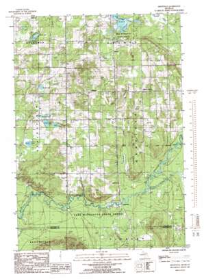
Smithville Topo Map Michigan
To zoom in, hover over the map of Smithville
USGS Topo Quad 44085e2 - 1:24,000 scale
| Topo Map Name: | Smithville |
| USGS Topo Quad ID: | 44085e2 |
| Print Size: | ca. 21 1/4" wide x 27" high |
| Southeast Coordinates: | 44.5° N latitude / 85.125° W longitude |
| Map Center Coordinates: | 44.5625° N latitude / 85.1875° W longitude |
| U.S. State: | MI |
| Filename: | o44085e2.jpg |
| Download Map JPG Image: | Smithville topo map 1:24,000 scale |
| Map Type: | Topographic |
| Topo Series: | 7.5´ |
| Map Scale: | 1:24,000 |
| Source of Map Images: | United States Geological Survey (USGS) |
| Alternate Map Versions: |
Smithville MI 1985, updated 1986 Download PDF Buy paper map Smithville MI 2011 Download PDF Buy paper map Smithville MI 2014 Download PDF Buy paper map Smithville MI 2016 Download PDF Buy paper map |
1:24,000 Topo Quads surrounding Smithville
> Back to 44085e1 at 1:100,000 scale
> Back to 44084a1 at 1:250,000 scale
> Back to U.S. Topo Maps home
Smithville topo map: Gazetteer
Smithville: Lakes
Breeds Lake elevation 336m 1102′Ingersoll Lake elevation 331m 1085′
Jones Lake elevation 333m 1092′
Perch Lake elevation 331m 1085′
Sickle Lake elevation 335m 1099′
Twentyeight Lakes elevation 335m 1099′
Woodard Lake elevation 333m 1092′
Smithville: Populated Places
Deibert elevation 340m 1115′Giddings elevation 373m 1223′
McGee elevation 348m 1141′
Millers Corners elevation 363m 1190′
Smithville elevation 308m 1010′
Taffeltown elevation 324m 1062′
Smithville: Post Offices
Comfort Post Office (historical) elevation 356m 1167′Ivan Post Office (historical) elevation 363m 1190′
Kaska Post Office (historical) elevation 342m 1122′
Smithville: Streams
Filer Creek elevation 307m 1007′Little Cannon Creek elevation 307m 1007′
Nelson Creek elevation 322m 1056′
Waterhole Creek elevation 313m 1026′
Smithville: Summits
Twentyone Hill elevation 357m 1171′Smithville digital topo map on disk
Buy this Smithville topo map showing relief, roads, GPS coordinates and other geographical features, as a high-resolution digital map file on DVD:


