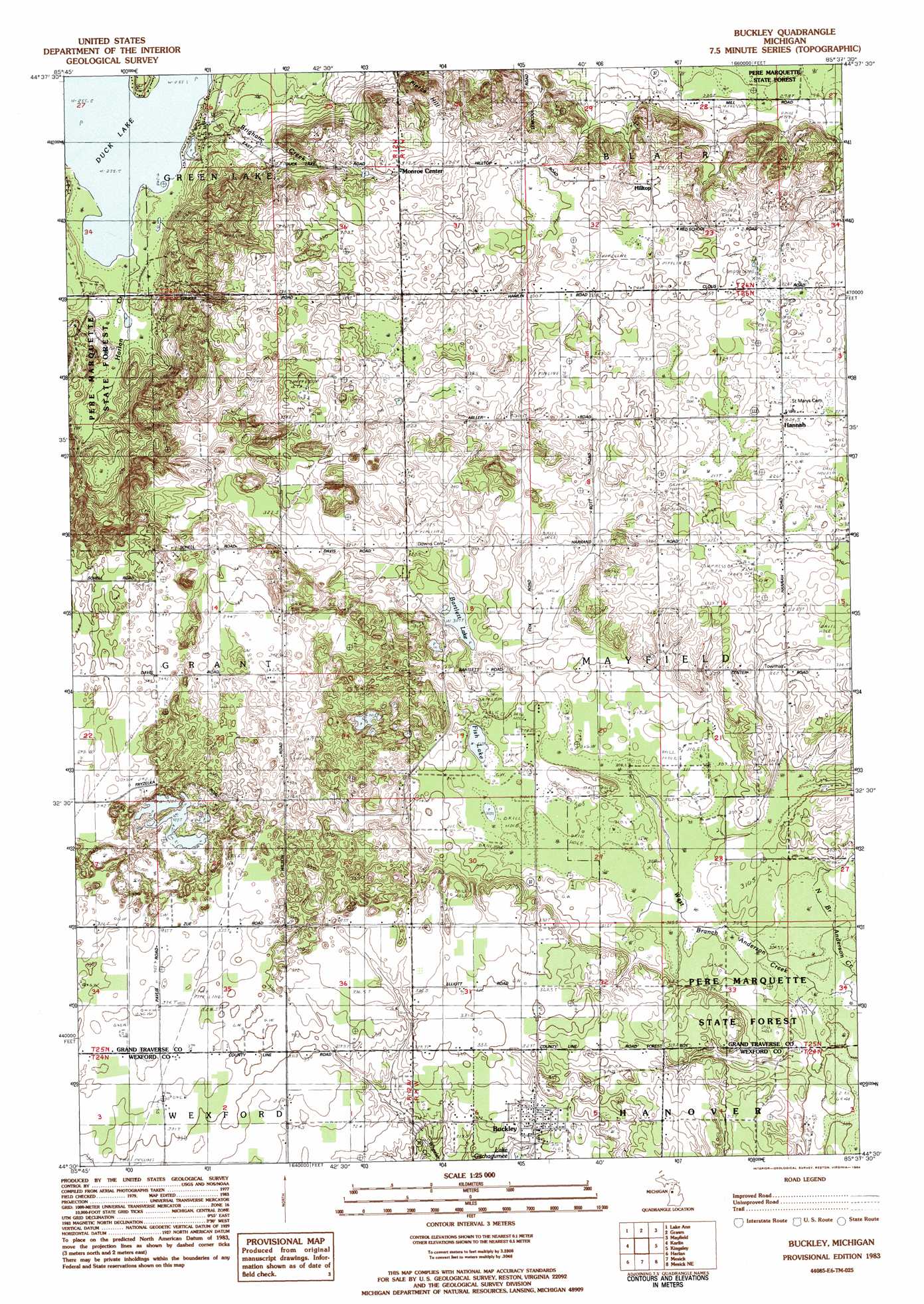
Buckley Topo Map Michigan
To zoom in, hover over the map of Buckley
USGS Topo Quad 44085e6 - 1:25,000 scale
| Topo Map Name: | Buckley |
| USGS Topo Quad ID: | 44085e6 |
| Print Size: | ca. 21 1/4" wide x 27" high |
| Southeast Coordinates: | 44.5° N latitude / 85.625° W longitude |
| Map Center Coordinates: | 44.5625° N latitude / 85.6875° W longitude |
| U.S. State: | MI |
| Filename: | l44085e6.jpg |
| Download Map JPG Image: | Buckley topo map 1:25,000 scale |
| Map Type: | Topographic |
| Topo Series: | 7.5´ |
| Map Scale: | 1:25,000 |
| Source of Map Images: | United States Geological Survey (USGS) |
| Alternate Map Versions: |
Buckley MI 1983, updated 1984 Download PDF Buy paper map |
1:24,000 Topo Quads surrounding Buckley
Burdickville |
Maple City |
Traverse City Sw |
Traverse City Se |
Williamsburg |
Platte River |
Lake Ann |
Grawn |
Mayfield |
Jacks Landing |
Thompsonville |
Karlin |
Buckley |
Kingsley |
Walton |
Copemish |
Harlan |
Mesick |
Mesick Ne |
Manton |
Marilla |
Yuma |
Harrieta |
Boon |
Cadillac North |
> Back to 44085e1 at 1:100,000 scale
> Back to 44084a1 at 1:250,000 scale
> Back to U.S. Topo Maps home
Buckley topo map: Gazetteer
Buckley: Lakes
Bartlett Lake elevation 307m 1007′Fish Lake elevation 310m 1017′
Buckley: Populated Places
Buckley elevation 320m 1049′Hannah elevation 324m 1062′
Hilltop elevation 330m 1082′
Monroe Center elevation 316m 1036′
Wexford Corner elevation 329m 1079′
Buckley: Post Offices
Bartlett Post Office (historical) elevation 318m 1043′Buckley Post Office elevation 319m 1046′
Hannah Post Office (historical) elevation 324m 1062′
Monroe Center Post Office (historical) elevation 316m 1036′
Wexford Post Office (historical) elevation 319m 1046′
Buckley: Streams
Brigham Creek elevation 257m 843′North Branch Anderson Creek elevation 302m 990′
West Branch Anderson Creek elevation 302m 990′
Buckley: Summits
Pierce Hill elevation 322m 1056′Buckley digital topo map on disk
Buy this Buckley topo map showing relief, roads, GPS coordinates and other geographical features, as a high-resolution digital map file on DVD: