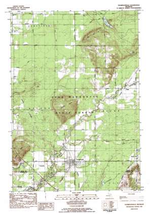
Thompsonville Topo Map Michigan
To zoom in, hover over the map of Thompsonville
USGS Topo Quad 44085e8 - 1:25,000 scale
| Topo Map Name: | Thompsonville |
| USGS Topo Quad ID: | 44085e8 |
| Print Size: | ca. 21 1/4" wide x 27" high |
| Southeast Coordinates: | 44.5° N latitude / 85.875° W longitude |
| Map Center Coordinates: | 44.5625° N latitude / 85.9375° W longitude |
| U.S. State: | MI |
| Filename: | l44085e8.jpg |
| Download Map JPG Image: | Thompsonville topo map 1:25,000 scale |
| Map Type: | Topographic |
| Topo Series: | 7.5´ |
| Map Scale: | 1:25,000 |
| Source of Map Images: | United States Geological Survey (USGS) |
| Alternate Map Versions: |
Thompsonville MI 1983, updated 1984 Download PDF Buy paper map |
1:24,000 Topo Quads surrounding Thompsonville
> Back to 44085e1 at 1:100,000 scale
> Back to 44084a1 at 1:250,000 scale
> Back to U.S. Topo Maps home
Thompsonville topo map: Gazetteer
Thompsonville: Airports
Betsie River Airstrip elevation 249m 816′Thompsonville Airport elevation 241m 790′
Thompsonville: Bridges
Black Bridge elevation 229m 751′Red Bridge elevation 229m 751′
Woirol Bridge elevation 249m 816′
Thompsonville: Lakes
Lost Lake elevation 269m 882′Turtle Lake elevation 254m 833′
Thompsonville: Parks
Michigan Legacy Art Park elevation 241m 790′Thompsonville: Populated Places
Nessen City elevation 261m 856′Thompsonville elevation 242m 793′
Wallin elevation 250m 820′
Thompsonville: Post Offices
Nessen City Post Office (historical) elevation 261m 856′Thompsonville Post Office elevation 241m 790′
Turtle Lake Post Office (historical) elevation 255m 836′
Wallin Post Office (historical) elevation 250m 820′
Thompsonville: Streams
Little Betsie River elevation 233m 764′Thompsonville: Summits
Buck Hills elevation 285m 935′North Hills elevation 299m 980′
Turtle Lake Hill elevation 308m 1010′
Thompsonville: Trails
Abendroth's Ski Trail elevation 309m 1013′Buck Ski Trail elevation 273m 895′
Canyon Ski Trail elevation 294m 964′
Cheers Ski Trail elevation 292m 958′
Cut Off Ski Trail elevation 297m 974′
Emmy Ski Trail elevation 307m 1007′
Giggles Ski Trail elevation 293m 961′
Glacier Valley Glade Area Ski Trail elevation 315m 1033′
Gorge Ski Trail elevation 295m 967′
Hoot Owl Ski Trail elevation 241m 790′
Huggy Bear Hollow Ski Trail elevation 297m 974′
Interlochen Arts Avenue Ski Trail elevation 282m 925′
Little Vincent Ski Trail elevation 315m 1033′
Loki Ski Trail elevation 299m 980′
Lower Gorge Ski Trail elevation 254m 833′
Main Street Ski Trail elevation 295m 967′
Nason's Ski Trail elevation 307m 1007′
Nastar Course Ski Trail elevation 295m 967′
Nose Dive Ski Trail elevation 289m 948′
Shelburg's Chute Ski Trail elevation 241m 790′
Short Cut Ski Trail elevation 303m 994′
Super Park Ski Trail elevation 295m 967′
Teddy's Turn Ski Trail elevation 302m 990′
Thor Chute Ski Trail elevation 281m 921′
Wipeout Ski Trail elevation 297m 974′
Thompsonville digital topo map on disk
Buy this Thompsonville topo map showing relief, roads, GPS coordinates and other geographical features, as a high-resolution digital map file on DVD:


