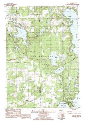
Lake Ann Topo Map Michigan
To zoom in, hover over the map of Lake Ann
USGS Topo Quad 44085f7 - 1:25,000 scale
| Topo Map Name: | Lake Ann |
| USGS Topo Quad ID: | 44085f7 |
| Print Size: | ca. 21 1/4" wide x 27" high |
| Southeast Coordinates: | 44.625° N latitude / 85.75° W longitude |
| Map Center Coordinates: | 44.6875° N latitude / 85.8125° W longitude |
| U.S. State: | MI |
| Filename: | l44085f7.jpg |
| Download Map JPG Image: | Lake Ann topo map 1:25,000 scale |
| Map Type: | Topographic |
| Topo Series: | 7.5´ |
| Map Scale: | 1:25,000 |
| Source of Map Images: | United States Geological Survey (USGS) |
| Alternate Map Versions: |
Lake Ann MI 1983, updated 1984 Download PDF Buy paper map |
1:24,000 Topo Quads surrounding Lake Ann
> Back to 44085e1 at 1:100,000 scale
> Back to 44084a1 at 1:250,000 scale
> Back to U.S. Topo Maps home
Lake Ann topo map: Gazetteer
Lake Ann: Islands
Brush Island elevation 258m 846′Lake Ann: Lakes
Bellows Lake elevation 252m 826′Bridge Lake elevation 252m 826′
Bryan Lake elevation 241m 790′
Cedar Hedge Lake elevation 252m 826′
Cedar Lake elevation 246m 807′
Fuller Lake elevation 256m 839′
Herendeene Lake elevation 256m 839′
Lake Ann elevation 241m 790′
Lake Dubonnet elevation 256m 839′
Lake View elevation 246m 807′
Lost Lake elevation 257m 843′
Lyons Lake elevation 250m 820′
Marys Lake elevation 244m 800′
Mickey Lake elevation 258m 846′
Mud Lake elevation 241m 790′
Mud Lake elevation 256m 839′
Peanut Lake elevation 242m 793′
Ransom Lake elevation 246m 807′
Round Lake elevation 252m 826′
Ruth Lake elevation 258m 846′
Sanford Lake elevation 242m 793′
Shavenaugh Lake elevation 242m 793′
Tonawanda Lake elevation 256m 839′
Tullers Lake elevation 253m 830′
Whelock Lake elevation 258m 846′
Lake Ann: Parks
Interlochen Historical Marker elevation 255m 836′Interlochen State Park elevation 260m 853′
Long Lake Township Park elevation 261m 856′
Long Lake Township Park elevation 258m 846′
Lake Ann: Populated Places
Bendon elevation 258m 846′Interlochen elevation 257m 843′
Lake Ann elevation 252m 826′
Lake Ann: Post Offices
Bendon Post Office (historical) elevation 258m 846′Inland Post Office (historical) elevation 285m 935′
Interlochen Post Office elevation 257m 843′
Lake Ann Post Office elevation 261m 856′
Melva Post Office (historical) elevation 258m 846′
Success Post Office (historical) elevation 245m 803′
Lake Ann digital topo map on disk
Buy this Lake Ann topo map showing relief, roads, GPS coordinates and other geographical features, as a high-resolution digital map file on DVD:


