Platte River Topo Map Michigan
To zoom in, hover over the map of Platte River
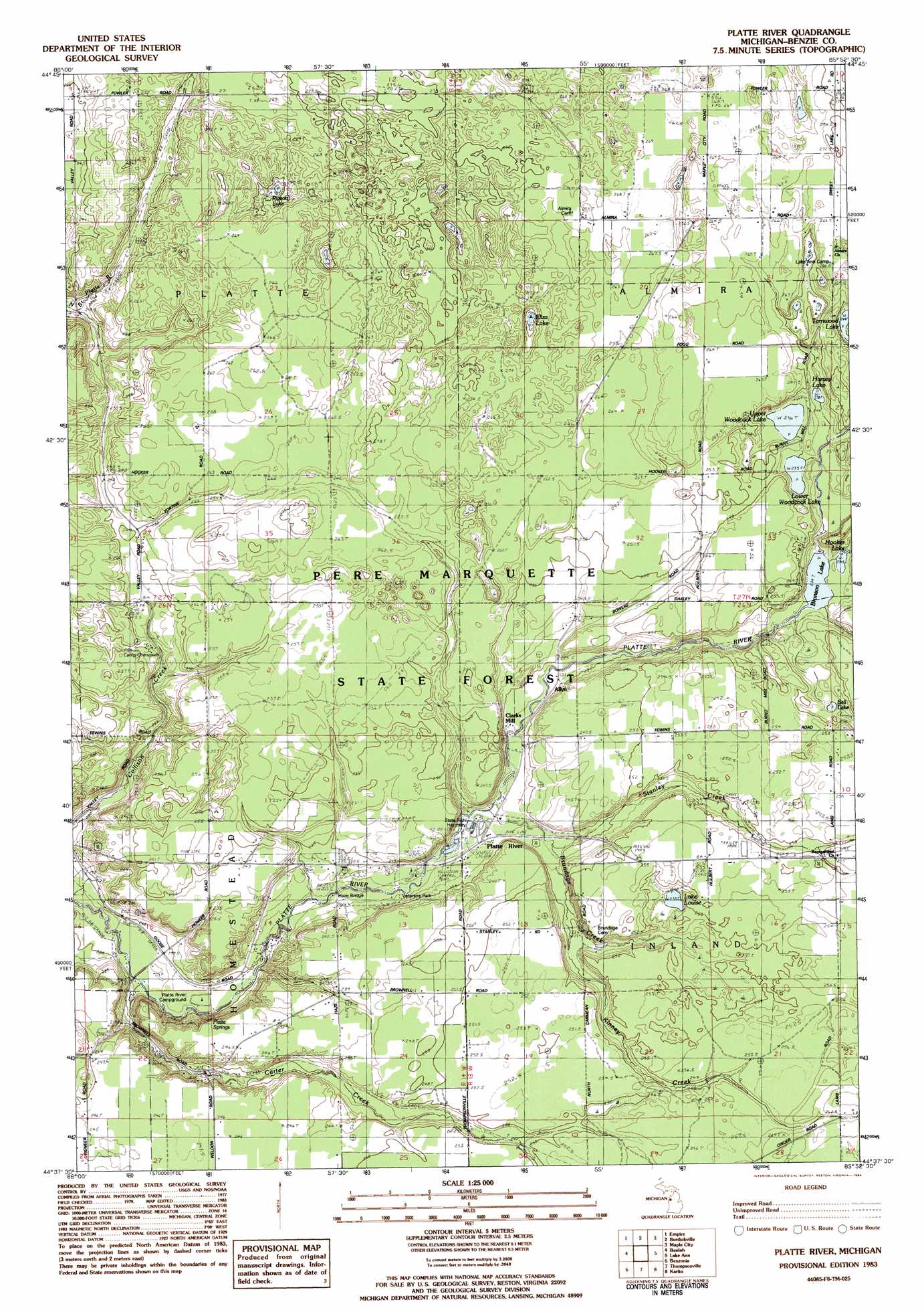
USGS Topo Quad 44085f8 - 1:25,000 scale
| Topo Map Name: | Platte River |
| USGS Topo Quad ID: | 44085f8 |
| Print Size: | ca. 21 1/4" wide x 27" high |
| Southeast Coordinates: | 44.625° N latitude / 85.875° W longitude |
| Map Center Coordinates: | 44.6875° N latitude / 85.9375° W longitude |
| U.S. State: | MI |
| Filename: | l44085f8.jpg |
| Download Map JPG Image: | Platte River topo map 1:25,000 scale |
| Map Type: | Topographic |
| Topo Series: | 7.5´ |
| Map Scale: | 1:25,000 |
| Source of Map Images: | United States Geological Survey (USGS) |
| Alternate Map Versions: |
Platte River MI 1983, updated 1984 Download PDF Buy paper map |
1:24,000 Topo Quads surrounding Platte River
Glen Haven |
Glen Arbor |
Good Harbor Bay |
Suttons Bay |
|
Empire |
Burdickville |
Maple City |
Traverse City Sw |
|
Frankfort |
Beulah |
Platte River |
Lake Ann |
Grawn |
Elberta |
Benzonia |
Thompsonville |
Karlin |
Buckley |
Bear Lake |
Pleasanton |
Copemish |
Harlan |
Mesick |
> Back to 44085e1 at 1:100,000 scale
> Back to 44084a1 at 1:250,000 scale
> Back to U.S. Topo Maps home
Platte River topo map: Gazetteer
Platte River: Bridges
Case Bridge elevation 195m 639′Haze Bridge elevation 205m 672′
Platte River: Forests
Pere Marquette State Forest elevation 257m 843′Platte River: Lakes
Bell Lake elevation 238m 780′Bronson Lake elevation 231m 757′
Eliza Lake elevation 246m 807′
Harvey Lake elevation 238m 780′
Hooker Lake elevation 231m 757′
Lake Louise elevation 236m 774′
Lower Woodcock Lake elevation 235m 770′
Pigeon Lake elevation 243m 797′
Tarnwood Lake elevation 241m 790′
Upper Woodcock Lake elevation 235m 770′
Platte River: Parks
Pacific Salmon Historical Marker elevation 214m 702′Veterans Park elevation 211m 692′
Platte River: Populated Places
Northstar Mobile Home Park elevation 252m 826′Platte River elevation 216m 708′
Platte River: Post Offices
Almira Post Office (historical) elevation 276m 905′Platte River: Springs
Platte Springs elevation 221m 725′Platte River: Streams
Brundage Creek elevation 213m 698′Carter Creek elevation 194m 636′
Kinney Creek elevation 223m 731′
Stanley Creek elevation 218m 715′
Platte River digital topo map on disk
Buy this Platte River topo map showing relief, roads, GPS coordinates and other geographical features, as a high-resolution digital map file on DVD: