Burdickville Topo Map Michigan
To zoom in, hover over the map of Burdickville
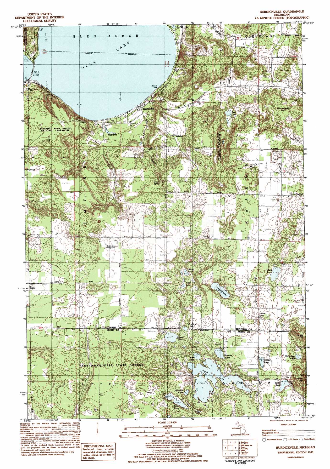
USGS Topo Quad 44085g8 - 1:25,000 scale
| Topo Map Name: | Burdickville |
| USGS Topo Quad ID: | 44085g8 |
| Print Size: | ca. 21 1/4" wide x 27" high |
| Southeast Coordinates: | 44.75° N latitude / 85.875° W longitude |
| Map Center Coordinates: | 44.8125° N latitude / 85.9375° W longitude |
| U.S. State: | MI |
| Filename: | l44085g8.jpg |
| Download Map JPG Image: | Burdickville topo map 1:25,000 scale |
| Map Type: | Topographic |
| Topo Series: | 7.5´ |
| Map Scale: | 1:25,000 |
| Source of Map Images: | United States Geological Survey (USGS) |
| Alternate Map Versions: |
Burdickville MI 1983, updated 1984 Download PDF Buy paper map |
1:24,000 Topo Quads surrounding Burdickville
South Manitou Island |
North Manitou Island |
Leland |
Gills Pier |
|
Glen Haven |
Glen Arbor |
Good Harbor Bay |
Suttons Bay |
|
Empire |
Burdickville |
Maple City |
Traverse City Sw |
|
Frankfort |
Beulah |
Platte River |
Lake Ann |
Grawn |
Elberta |
Benzonia |
Thompsonville |
Karlin |
Buckley |
> Back to 44085e1 at 1:100,000 scale
> Back to 44084a1 at 1:250,000 scale
> Back to U.S. Topo Maps home
Burdickville topo map: Gazetteer
Burdickville: Lakes
Armstrong Lake elevation 247m 810′Bow Lake elevation 205m 672′
Brooks Lake elevation 251m 823′
Brooks Lake elevation 181m 593′
Courson Lake elevation 253m 830′
Garey Lake elevation 252m 826′
Gilbert Lake elevation 235m 770′
Glen Lake elevation 181m 593′
Hartman Lake elevation 246m 807′
Holden Lake elevation 256m 839′
Horseshoe Lake elevation 252m 826′
Lime Lake elevation 146m 479′
Pearl Lake elevation 246m 807′
Polack Lake elevation 255m 836′
Sweet Lake elevation 251m 823′
Wells Lake elevation 232m 761′
Wiltz Lake elevation 251m 823′
Burdickville: Parks
Myles Kimmerly Park elevation 258m 846′Old Settlers Park Historical Marker elevation 188m 616′
Pearl Lake Natural Area elevation 251m 823′
Burdickville: Populated Places
Burdickville elevation 186m 610′Burdickville: Post Offices
Burdickville Post Office (historical) elevation 185m 606′Osborn Post Office (historical) elevation 275m 902′
Oviatt Post Office (historical) elevation 274m 898′
Burdickville: Springs
Dodge Spring elevation 265m 869′Burdickville: Summits
Varney Hill elevation 337m 1105′Warner Hill elevation 331m 1085′
Burdickville digital topo map on disk
Buy this Burdickville topo map showing relief, roads, GPS coordinates and other geographical features, as a high-resolution digital map file on DVD: