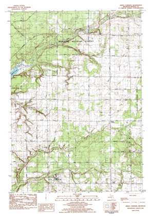
Kings Corners Topo Map Michigan
To zoom in, hover over the map of Kings Corners
USGS Topo Quad 44086a3 - 1:25,000 scale
| Topo Map Name: | Kings Corners |
| USGS Topo Quad ID: | 44086a3 |
| Print Size: | ca. 21 1/4" wide x 27" high |
| Southeast Coordinates: | 44° N latitude / 86.25° W longitude |
| Map Center Coordinates: | 44.0625° N latitude / 86.3125° W longitude |
| U.S. State: | MI |
| Filename: | l44086a3.jpg |
| Download Map JPG Image: | Kings Corners topo map 1:25,000 scale |
| Map Type: | Topographic |
| Topo Series: | 7.5´ |
| Map Scale: | 1:25,000 |
| Source of Map Images: | United States Geological Survey (USGS) |
| Alternate Map Versions: |
Kings Corners MI 1982, updated 1983 Download PDF Buy paper map |
| FStopo: | US Forest Service topo Kings Corners is available: Download FStopo PDF Download FStopo TIF |
1:24,000 Topo Quads surrounding Kings Corners
> Back to 44086a1 at 1:100,000 scale
> Back to 44086a1 at 1:250,000 scale
> Back to U.S. Topo Maps home
Kings Corners topo map: Gazetteer
Kings Corners: Populated Places
Sugar Grove elevation 208m 682′Kings Corners: Post Offices
Sugargrove Post Office (historical) elevation 208m 682′Kings Corners: Streams
Costello Creek elevation 183m 600′Davis Creek elevation 182m 597′
Freeman Creek elevation 184m 603′
North Branch Lincoln River elevation 183m 600′
Olson Drain elevation 191m 626′
South Branch Lincoln River elevation 183m 600′
Kings Corners digital topo map on disk
Buy this Kings Corners topo map showing relief, roads, GPS coordinates and other geographical features, as a high-resolution digital map file on DVD:


