Manistee Nw Topo Map Michigan
To zoom in, hover over the map of Manistee Nw
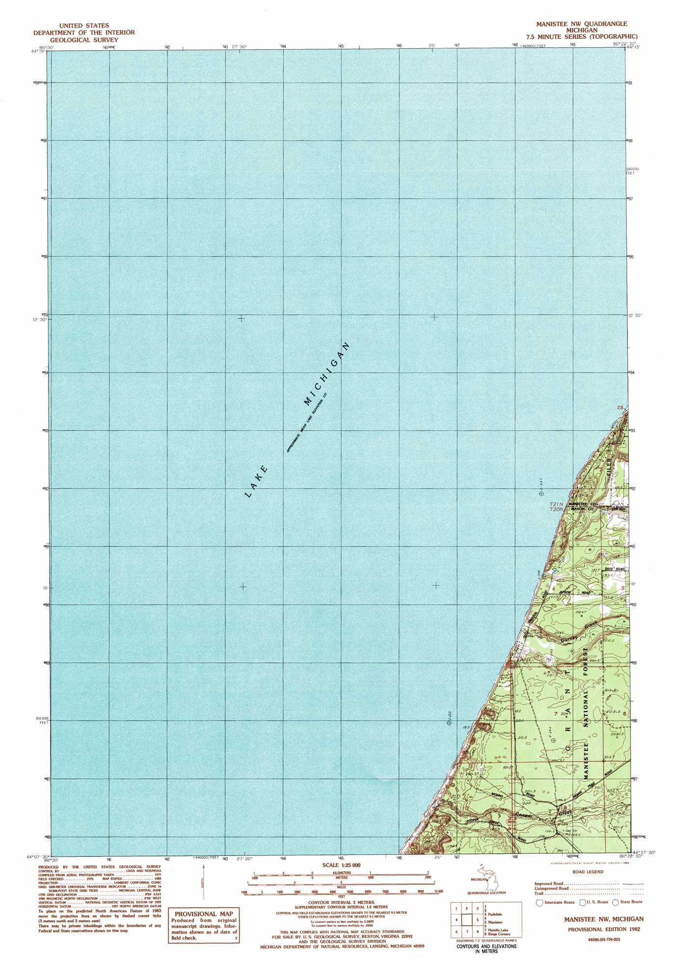
USGS Topo Quad 44086b4 - 1:25,000 scale
| Topo Map Name: | Manistee Nw |
| USGS Topo Quad ID: | 44086b4 |
| Print Size: | ca. 21 1/4" wide x 27" high |
| Southeast Coordinates: | 44.125° N latitude / 86.375° W longitude |
| Map Center Coordinates: | 44.1875° N latitude / 86.4375° W longitude |
| U.S. State: | MI |
| Filename: | l44086b4.jpg |
| Download Map JPG Image: | Manistee Nw topo map 1:25,000 scale |
| Map Type: | Topographic |
| Topo Series: | 7.5´ |
| Map Scale: | 1:25,000 |
| Source of Map Images: | United States Geological Survey (USGS) |
| Alternate Map Versions: |
Manistee NW MI 1982, updated 1984 Download PDF Buy paper map |
| FStopo: | US Forest Service topo Manistee NW is available: Download FStopo PDF Download FStopo TIF |
1:24,000 Topo Quads surrounding Manistee Nw
Bear Lake |
||||
Parkdale |
Onekama |
|||
Manistee Nw |
Manistee Ne |
Freesoil Nw |
||
Hamlin Lake |
Kings Corners |
Freesoil Sw |
||
Ludington Nw |
Ludington Ne |
Custer Nw |
> Back to 44086a1 at 1:100,000 scale
> Back to 44086a1 at 1:250,000 scale
> Back to U.S. Topo Maps home
Manistee Nw topo map: Gazetteer
Manistee Nw: Streams
Cooper Creek elevation 180m 590′Gurney Creek elevation 178m 583′
Magoon Creek elevation 177m 580′
Manistee Nw digital topo map on disk
Buy this Manistee Nw topo map showing relief, roads, GPS coordinates and other geographical features, as a high-resolution digital map file on DVD: