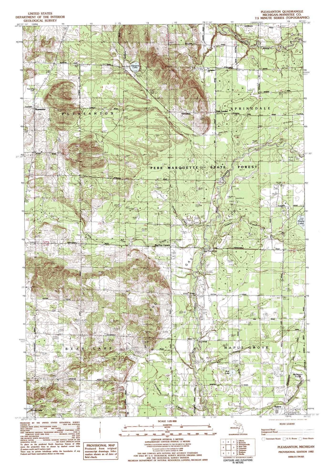
Pleasanton Topo Map Michigan
To zoom in, hover over the map of Pleasanton
USGS Topo Quad 44086d1 - 1:25,000 scale
| Topo Map Name: | Pleasanton |
| USGS Topo Quad ID: | 44086d1 |
| Print Size: | ca. 21 1/4" wide x 27" high |
| Southeast Coordinates: | 44.375° N latitude / 86° W longitude |
| Map Center Coordinates: | 44.4375° N latitude / 86.0625° W longitude |
| U.S. State: | MI |
| Filename: | l44086d1.jpg |
| Download Map JPG Image: | Pleasanton topo map 1:25,000 scale |
| Map Type: | Topographic |
| Topo Series: | 7.5´ |
| Map Scale: | 1:25,000 |
| Source of Map Images: | United States Geological Survey (USGS) |
| Alternate Map Versions: |
Pleasanton MI 1982, updated 1983 Download PDF Buy paper map Pleasanton MI 1982, updated 1983 Download PDF Buy paper map |
1:24,000 Topo Quads surrounding Pleasanton
Frankfort |
Beulah |
Platte River |
Lake Ann |
|
Elberta |
Benzonia |
Thompsonville |
Karlin |
|
Bear Lake |
Pleasanton |
Copemish |
Harlan |
|
Parkdale |
Onekama |
Brethern |
Marilla |
Yuma |
Manistee Ne |
Freesoil Nw |
Freesoil Ne |
Peacock Nw |
Peacock Ne |
> Back to 44086a1 at 1:100,000 scale
> Back to 44086a1 at 1:250,000 scale
> Back to U.S. Topo Maps home
Pleasanton topo map: Gazetteer
Pleasanton: Bridges
Bonds Bridge elevation 218m 715′Jopp Bridge elevation 218m 715′
Pleasanton: Lakes
Glovers Lake elevation 244m 800′Healy Lake elevation 232m 761′
James Lake elevation 232m 761′
Makinen Pond elevation 225m 738′
Mud Lake elevation 227m 744′
Pleasanton: Populated Places
Humphrey elevation 242m 793′Kampvilla Mobile Home Park elevation 274m 898′
Pleasanton elevation 270m 885′
Pleasanton: Post Offices
Humphrey Post Office (historical) elevation 242m 793′Pleasanton Post Office (historical) elevation 270m 885′
Pleasanton: Streams
Greens Creek elevation 222m 728′Halls Creek elevation 217m 711′
Lemon Creek elevation 221m 725′
Little Bear Creek elevation 221m 725′
Pleasanton digital topo map on disk
Buy this Pleasanton topo map showing relief, roads, GPS coordinates and other geographical features, as a high-resolution digital map file on DVD: