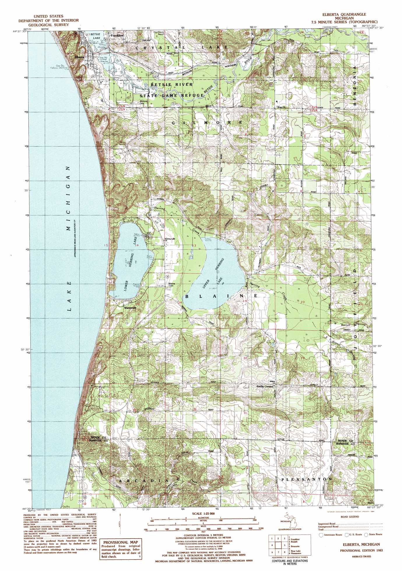
Elberta Topo Map Michigan
To zoom in, hover over the map of Elberta
USGS Topo Quad 44086e2 - 1:25,000 scale
| Topo Map Name: | Elberta |
| USGS Topo Quad ID: | 44086e2 |
| Print Size: | ca. 21 1/4" wide x 27" high |
| Southeast Coordinates: | 44.5° N latitude / 86.125° W longitude |
| Map Center Coordinates: | 44.5625° N latitude / 86.1875° W longitude |
| U.S. State: | MI |
| Filename: | l44086e2.jpg |
| Download Map JPG Image: | Elberta topo map 1:25,000 scale |
| Map Type: | Topographic |
| Topo Series: | 7.5´ |
| Map Scale: | 1:25,000 |
| Source of Map Images: | United States Geological Survey (USGS) |
| Alternate Map Versions: |
Elberta MI 1983, updated 1984 Download PDF Buy paper map |
1:24,000 Topo Quads surrounding Elberta
Empire |
Burdickville |
|||
Frankfort |
Beulah |
Platte River |
||
Elberta |
Benzonia |
Thompsonville |
||
Bear Lake |
Pleasanton |
Copemish |
||
Parkdale |
Onekama |
Brethern |
Marilla |
> Back to 44086e1 at 1:100,000 scale
> Back to 44086a1 at 1:250,000 scale
> Back to U.S. Topo Maps home
Elberta topo map: Gazetteer
Elberta: Bridges
Lewis Bridge elevation 179m 587′Elberta: Capes
Inspiration Point elevation 252m 826′Elberta: Lakes
Lower Herring Lake elevation 177m 580′Upper Herring Lake elevation 180m 590′
Elberta: Parks
Betsie River State Game Refuge elevation 178m 583′Car Ferries on Lake Michigan Historical Marker elevation 183m 600′
Elberta: Populated Places
Elberta elevation 180m 590′Watervale elevation 184m 603′
Elberta: Post Offices
Elberta Post Office elevation 180m 590′Gilmore Post Office (historical) elevation 282m 925′
Grace Post Office (historical) elevation 257m 843′
Watervale Post Office (historical) elevation 184m 603′
Elberta: Streams
Herring Creek elevation 178m 583′Herring Lake Outlet elevation 177m 580′
North Branch Herring Creek elevation 189m 620′
South Branch Herring Creek elevation 183m 600′
Elberta digital topo map on disk
Buy this Elberta topo map showing relief, roads, GPS coordinates and other geographical features, as a high-resolution digital map file on DVD: