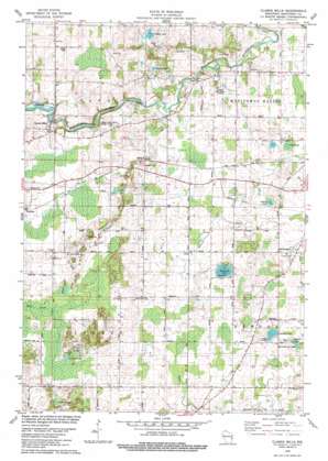
Clarks Mills Topo Map Wisconsin
To zoom in, hover over the map of Clarks Mills
USGS Topo Quad 44087a7 - 1:24,000 scale
| Topo Map Name: | Clarks Mills |
| USGS Topo Quad ID: | 44087a7 |
| Print Size: | ca. 21 1/4" wide x 27" high |
| Southeast Coordinates: | 44° N latitude / 87.75° W longitude |
| Map Center Coordinates: | 44.0625° N latitude / 87.8125° W longitude |
| U.S. State: | WI |
| Filename: | o44087a7.jpg |
| Download Map JPG Image: | Clarks Mills topo map 1:24,000 scale |
| Map Type: | Topographic |
| Topo Series: | 7.5´ |
| Map Scale: | 1:24,000 |
| Source of Map Images: | United States Geological Survey (USGS) |
| Alternate Map Versions: |
Clarks Mills WI 1978, updated 1979 Download PDF Buy paper map Clarks Mills WI 2010 Download PDF Buy paper map Clarks Mills WI 2013 Download PDF Buy paper map Clarks Mills WI 2015 Download PDF Buy paper map |
1:24,000 Topo Quads surrounding Clarks Mills
> Back to 44087a1 at 1:100,000 scale
> Back to 44086a1 at 1:250,000 scale
> Back to U.S. Topo Maps home
Clarks Mills topo map: Gazetteer
Clarks Mills: Dams
Clarks Mill Dam elevation 253m 830′Oslo Dam elevation 228m 748′
Clarks Mills: Lakes
Bergene Lake elevation 225m 738′Carstens Lake elevation 227m 744′
English Lake elevation 236m 774′
Fenske Lake elevation 254m 833′
Grosshuesch Lake elevation 224m 734′
Lutzke Lakes elevation 264m 866′
Schisel Lake elevation 233m 764′
Teek Lake elevation 222m 728′
Vetting Lake elevation 225m 738′
Waack Lake elevation 224m 734′
Clarks Mills: Parks
Lower Cato Falls County Park elevation 255m 836′Clarks Mills: Populated Places
Clarks Mills elevation 259m 849′Madsen elevation 248m 813′
Newtonburg elevation 247m 810′
Rube elevation 234m 767′
Clarks Mills: Reservoirs
Clark Mills Pond 411 elevation 253m 830′Clarks Mills digital topo map on disk
Buy this Clarks Mills topo map showing relief, roads, GPS coordinates and other geographical features, as a high-resolution digital map file on DVD:


