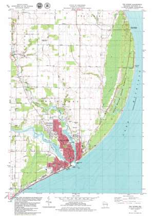
Two Rivers Topo Map Wisconsin
To zoom in, hover over the map of Two Rivers
USGS Topo Quad 44087b5 - 1:24,000 scale
| Topo Map Name: | Two Rivers |
| USGS Topo Quad ID: | 44087b5 |
| Print Size: | ca. 21 1/4" wide x 27" high |
| Southeast Coordinates: | 44.125° N latitude / 87.5° W longitude |
| Map Center Coordinates: | 44.1875° N latitude / 87.5625° W longitude |
| U.S. State: | WI |
| Filename: | o44087b5.jpg |
| Download Map JPG Image: | Two Rivers topo map 1:24,000 scale |
| Map Type: | Topographic |
| Topo Series: | 7.5´ |
| Map Scale: | 1:24,000 |
| Source of Map Images: | United States Geological Survey (USGS) |
| Alternate Map Versions: |
Two Rivers WI 1978, updated 1979 Download PDF Buy paper map Two Rivers WI 2010 Download PDF Buy paper map Two Rivers WI 2013 Download PDF Buy paper map Two Rivers WI 2015 Download PDF Buy paper map |
1:24,000 Topo Quads surrounding Two Rivers
Poland |
Stangelville |
Kewaunee |
||
Denmark |
Larrabee |
Two Creeks |
||
Whitelaw |
Mishicot |
Two Rivers |
||
Clarks Mills |
Manitowoc |
|||
Cleveland West |
Cleveland East |
> Back to 44087a1 at 1:100,000 scale
> Back to 44086a1 at 1:250,000 scale
> Back to U.S. Topo Maps home
Two Rivers topo map: Gazetteer
Two Rivers: Airports
Englebert Farms Landing Strip elevation 199m 652′Mueller Farm-Vintage Aero Airport elevation 211m 692′
Two Rivers: Capes
Rawley Point elevation 180m 590′Two Rivers: Forests
Point Beach State Forest elevation 180m 590′Rahr Memorial School Forest elevation 183m 600′
Two Rivers: Parks
Lake Shore Park elevation 179m 587′Neshotah Park elevation 180m 590′
Picnic Hill Park elevation 196m 643′
Point Beach Ridges State Natural Area elevation 180m 590′
Public Square elevation 183m 600′
Riverside Park elevation 179m 587′
Veterans Park elevation 178m 583′
Vietnam Veterans Memorial Park elevation 182m 597′
Wilderness Ridge State Natural Area elevation 180m 590′
Woodland Dunes State Natural Area elevation 182m 597′
Zander Park elevation 180m 590′
Two Rivers: Populated Places
Two Rivers elevation 184m 603′Two Rivers: Post Offices
Two Rivers Post Office elevation 183m 600′Two Rivers: Streams
East Twin River elevation 177m 580′Molash Creek elevation 177m 580′
West Twin River elevation 177m 580′
Two Rivers digital topo map on disk
Buy this Two Rivers topo map showing relief, roads, GPS coordinates and other geographical features, as a high-resolution digital map file on DVD:


