Little Sturgeon Sw Topo Map Wisconsin
To zoom in, hover over the map of Little Sturgeon Sw
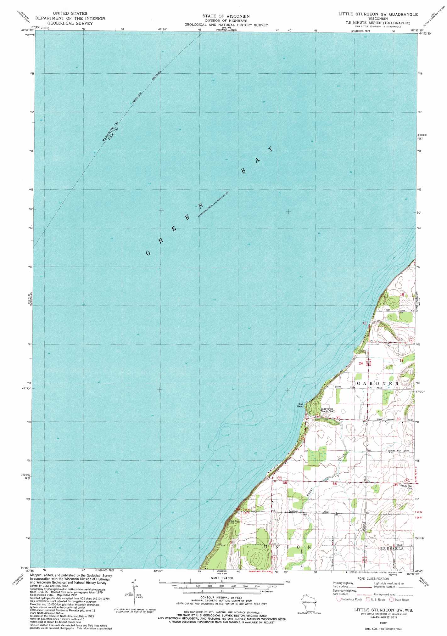
USGS Topo Quad 44087g6 - 1:24,000 scale
| Topo Map Name: | Little Sturgeon Sw |
| USGS Topo Quad ID: | 44087g6 |
| Print Size: | ca. 21 1/4" wide x 27" high |
| Southeast Coordinates: | 44.75° N latitude / 87.625° W longitude |
| Map Center Coordinates: | 44.8125° N latitude / 87.6875° W longitude |
| U.S. State: | WI |
| Filename: | o44087g6.jpg |
| Download Map JPG Image: | Little Sturgeon Sw topo map 1:24,000 scale |
| Map Type: | Topographic |
| Topo Series: | 7.5´ |
| Map Scale: | 1:24,000 |
| Source of Map Images: | United States Geological Survey (USGS) |
| Alternate Map Versions: |
Little Sturgeon SW WI 1982, updated 1983 Download PDF Buy paper map Little Sturgeon SW WI 2010 Download PDF Buy paper map Little Sturgeon SW WI 2013 Download PDF Buy paper map Little Sturgeon SW WI 2015 Download PDF Buy paper map |
1:24,000 Topo Quads surrounding Little Sturgeon Sw
Porterfiled Sw |
Harmony |
Marinette West |
Marinette East |
Green Island |
Oconto West |
Oconto East |
Peshtigo Harbor |
Idlewild |
|
Pensaukee |
Oconto Se |
Little Sturgeon Sw |
Little Sturgeon |
Sturgeon Bay West |
Little Tail Point |
Dyckesville |
Namur |
Brussels |
Forestville |
Green Bay East |
New Franken |
Luxemburg |
Casco |
Algoma |
> Back to 44087e1 at 1:100,000 scale
> Back to 44086a1 at 1:250,000 scale
> Back to U.S. Topo Maps home
Little Sturgeon Sw topo map: Gazetteer
Little Sturgeon Sw: Parks
Sugar Creek County Park elevation 183m 600′Little Sturgeon Sw: Streams
Sugar Creek elevation 178m 583′Little Sturgeon Sw digital topo map on disk
Buy this Little Sturgeon Sw topo map showing relief, roads, GPS coordinates and other geographical features, as a high-resolution digital map file on DVD: