Jacksonport Topo Map Wisconsin
To zoom in, hover over the map of Jacksonport
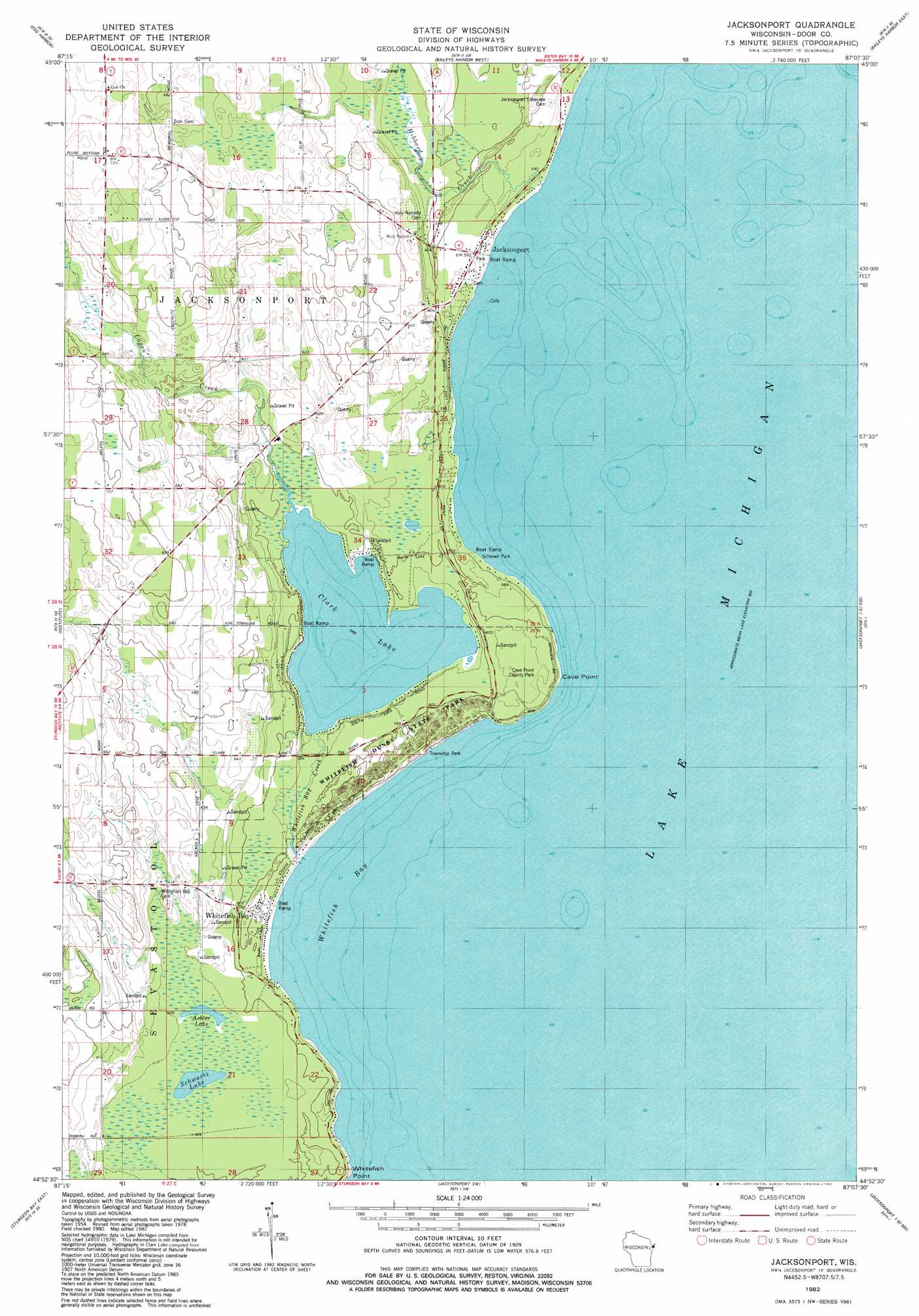
USGS Topo Quad 44087h2 - 1:24,000 scale
| Topo Map Name: | Jacksonport |
| USGS Topo Quad ID: | 44087h2 |
| Print Size: | ca. 21 1/4" wide x 27" high |
| Southeast Coordinates: | 44.875° N latitude / 87.125° W longitude |
| Map Center Coordinates: | 44.9375° N latitude / 87.1875° W longitude |
| U.S. State: | WI |
| Filename: | o44087h2.jpg |
| Download Map JPG Image: | Jacksonport topo map 1:24,000 scale |
| Map Type: | Topographic |
| Topo Series: | 7.5´ |
| Map Scale: | 1:24,000 |
| Source of Map Images: | United States Geological Survey (USGS) |
| Alternate Map Versions: |
Jacksonport WI 1982, updated 1982 Download PDF Buy paper map Jacksonport WI 2010 Download PDF Buy paper map Jacksonport WI 2013 Download PDF Buy paper map Jacksonport WI 2015 Download PDF Buy paper map |
1:24,000 Topo Quads surrounding Jacksonport
Chambers Island Nw |
Chambers Island |
Ephraim |
Sister Bay |
Spider Island |
Green Island |
Egg Harbor |
Baileys Harbor West |
Baileys Harbor East |
|
Idlewild |
Institute |
Jacksonport |
||
Sturgeon Bay West |
Sturgeon Bay East |
Jacksonport Sw |
||
Forestville |
Algoma Ne |
> Back to 44087e1 at 1:100,000 scale
> Back to 44086a1 at 1:250,000 scale
> Back to U.S. Topo Maps home
Jacksonport topo map: Gazetteer
Jacksonport: Bays
Whitefish Bay elevation 177m 580′Jacksonport: Capes
Cave Point elevation 184m 603′Whitefish Point elevation 181m 593′
Jacksonport: Lakes
Arbter Lake elevation 184m 603′Clark Lake elevation 179m 587′
Schwartz Lake elevation 184m 603′
Jacksonport: Parks
Cave Point County Park elevation 185m 606′Schauer Park elevation 178m 583′
Sevastopol Township Park elevation 182m 597′
Whitefish Dunes State Natural Area elevation 184m 603′
Jacksonport: Populated Places
Jacksonport elevation 180m 590′Whitefish Bay elevation 181m 593′
Jacksonport: Streams
Hibbard Creek elevation 178m 583′Logan Creek elevation 179m 587′
Whitefish Bay Creek elevation 177m 580′
Jacksonport digital topo map on disk
Buy this Jacksonport topo map showing relief, roads, GPS coordinates and other geographical features, as a high-resolution digital map file on DVD: