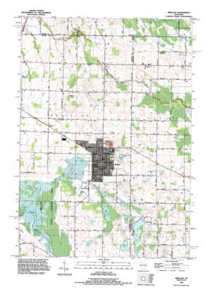
Brillion Topo Map Wisconsin
To zoom in, hover over the map of Brillion
USGS Topo Quad 44088b1 - 1:24,000 scale
| Topo Map Name: | Brillion |
| USGS Topo Quad ID: | 44088b1 |
| Print Size: | ca. 21 1/4" wide x 27" high |
| Southeast Coordinates: | 44.125° N latitude / 88° W longitude |
| Map Center Coordinates: | 44.1875° N latitude / 88.0625° W longitude |
| U.S. State: | WI |
| Filename: | o44088b1.jpg |
| Download Map JPG Image: | Brillion topo map 1:24,000 scale |
| Map Type: | Topographic |
| Topo Series: | 7.5´ |
| Map Scale: | 1:24,000 |
| Source of Map Images: | United States Geological Survey (USGS) |
| Alternate Map Versions: |
Brillion WI 1974, updated 1977 Download PDF Buy paper map Brillion WI 1992, updated 1996 Download PDF Buy paper map Brillion WI 2010 Download PDF Buy paper map Brillion WI 2013 Download PDF Buy paper map Brillion WI 2016 Download PDF Buy paper map |
1:24,000 Topo Quads surrounding Brillion
> Back to 44088a1 at 1:100,000 scale
> Back to 44088a1 at 1:250,000 scale
> Back to U.S. Topo Maps home
Brillion topo map: Gazetteer
Brillion: Lakes
Becker Lake elevation 251m 823′Boot Lake elevation 254m 833′
Grass Lake elevation 245m 803′
Long Lake elevation 254m 833′
Round Lake elevation 254m 833′
Brillion: Parks
Brillion State Wildlife Area elevation 244m 800′Brillion: Populated Places
Brillion elevation 253m 830′Brillion: Post Offices
Brillion Post Office elevation 253m 830′Brillion: Streams
Black Creek elevation 247m 810′Spring Creek elevation 243m 797′
Brillion digital topo map on disk
Buy this Brillion topo map showing relief, roads, GPS coordinates and other geographical features, as a high-resolution digital map file on DVD:


