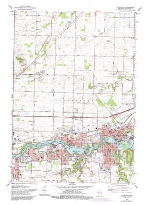
Kaukauna Topo Map Wisconsin
To zoom in, hover over the map of Kaukauna
USGS Topo Quad 44088c3 - 1:24,000 scale
| Topo Map Name: | Kaukauna |
| USGS Topo Quad ID: | 44088c3 |
| Print Size: | ca. 21 1/4" wide x 27" high |
| Southeast Coordinates: | 44.25° N latitude / 88.25° W longitude |
| Map Center Coordinates: | 44.3125° N latitude / 88.3125° W longitude |
| U.S. State: | WI |
| Filename: | o44088c3.jpg |
| Download Map JPG Image: | Kaukauna topo map 1:24,000 scale |
| Map Type: | Topographic |
| Topo Series: | 7.5´ |
| Map Scale: | 1:24,000 |
| Source of Map Images: | United States Geological Survey (USGS) |
| Alternate Map Versions: |
Kaukauna WI 1974, updated 1978 Download PDF Buy paper map Kaukauna WI 1974, updated 1984 Download PDF Buy paper map Kaukauna WI 1992, updated 1996 Download PDF Buy paper map Kaukauna WI 2010 Download PDF Buy paper map Kaukauna WI 2013 Download PDF Buy paper map Kaukauna WI 2016 Download PDF Buy paper map |
1:24,000 Topo Quads surrounding Kaukauna
> Back to 44088a1 at 1:100,000 scale
> Back to 44088a1 at 1:250,000 scale
> Back to U.S. Topo Maps home
Kaukauna topo map: Gazetteer
Kaukauna: Airports
Kaukauna Community Hospital Heliport elevation 216m 708′Kaukauna: Capes
Fox Point elevation 216m 708′Kaukauna: Crossings
Interchange 144 elevation 230m 754′Interchange 145 elevation 225m 738′
Interchange 146 elevation 221m 725′
Interchange 148 elevation 216m 708′
Kaukauna: Dams
Cedars Lock elevation 212m 695′Combined Locks Dam elevation 205m 672′
Kaukauna 1856c112 Dam elevation 199m 652′
Kimberly Laws1848 Dam elevation 210m 688′
Little Chute 1856c112 Dam elevation 206m 675′
Lower Kaukauna 2-Wp-381 Dam elevation 187m 613′
Kaukauna: Islands
Little Chute Islands elevation 211m 692′Kaukauna: Parks
Blaese Park elevation 222m 728′Central Park elevation 199m 652′
Doyle Park elevation 208m 682′
Grignon Park elevation 197m 646′
Heesakker Park elevation 212m 695′
Horseshoe Park elevation 200m 656′
La Follette Park elevation 217m 711′
Legion Park elevation 223m 731′
Lindberg Park elevation 217m 711′
Riverside Park elevation 208m 682′
Roosevelt Park elevation 220m 721′
Schaefer Park elevation 232m 761′
Sunset Point Park elevation 215m 705′
Thousand Island State Conservancy Area elevation 214m 702′
Van Zeeland Park elevation 221m 725′
Verhagen Park elevation 224m 734′
White City Park elevation 203m 666′
Kaukauna: Populated Places
Apple Creek elevation 238m 780′Combined Locks elevation 221m 725′
Kaukauna elevation 200m 656′
Kimberly elevation 223m 731′
Little Chute elevation 223m 731′
Kaukauna: Post Offices
Combined Locks Post Office elevation 220m 721′Kaukauna Post Office elevation 199m 652′
Kimberly Post Office elevation 222m 728′
Little Chute Post Office elevation 223m 731′
Kaukauna: Reservoirs
6201 Reservoir elevation 210m 688′6223 Reservoir elevation 205m 672′
6224 Reservoir elevation 199m 652′
6229 Reservoir elevation 187m 613′
6263 Reservoir elevation 206m 675′
Kaukauna: Streams
Garners Creek elevation 199m 652′Kankapot Creek elevation 187m 613′
Kaukauna digital topo map on disk
Buy this Kaukauna topo map showing relief, roads, GPS coordinates and other geographical features, as a high-resolution digital map file on DVD:


