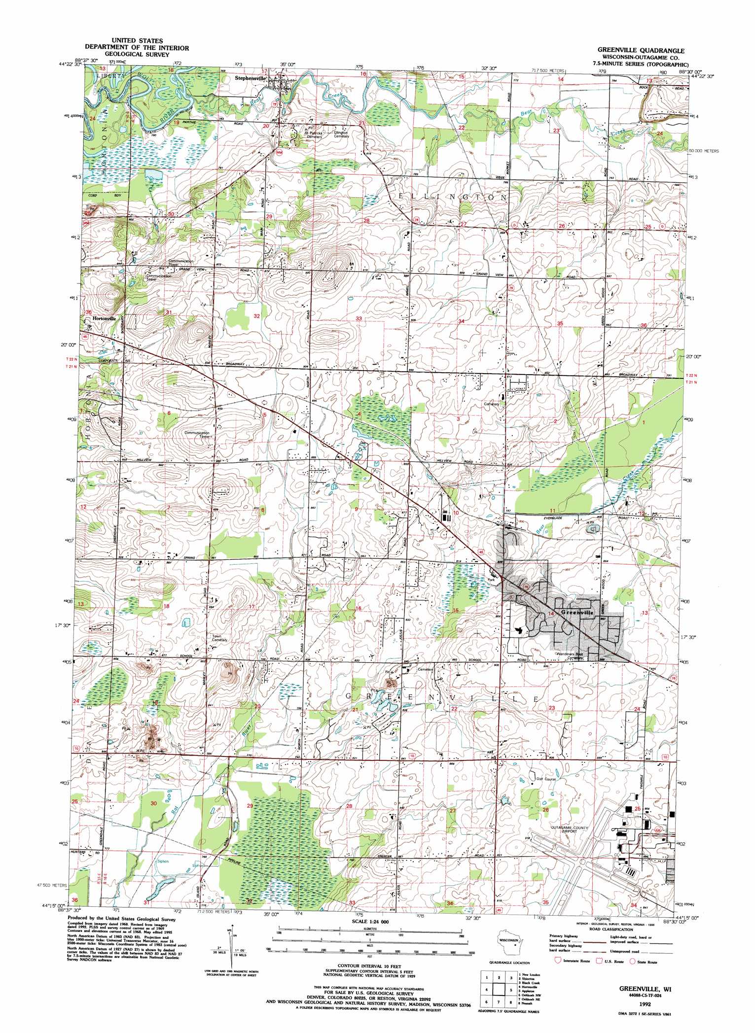
Greenville Topo Map Wisconsin
To zoom in, hover over the map of Greenville
USGS Topo Quad 44088c5 - 1:24,000 scale
| Topo Map Name: | Greenville |
| USGS Topo Quad ID: | 44088c5 |
| Print Size: | ca. 21 1/4" wide x 27" high |
| Southeast Coordinates: | 44.25° N latitude / 88.5° W longitude |
| Map Center Coordinates: | 44.3125° N latitude / 88.5625° W longitude |
| U.S. State: | WI |
| Filename: | o44088c5.jpg |
| Download Map JPG Image: | Greenville topo map 1:24,000 scale |
| Map Type: | Topographic |
| Topo Series: | 7.5´ |
| Map Scale: | 1:24,000 |
| Source of Map Images: | United States Geological Survey (USGS) |
| Alternate Map Versions: |
Greenville WI 1969, updated 1972 Download PDF Buy paper map Greenville WI 1969, updated 1976 Download PDF Buy paper map Greenville WI 1992, updated 1996 Download PDF Buy paper map Greenville WI 2010 Download PDF Buy paper map Greenville WI 2013 Download PDF Buy paper map Greenville WI 2016 Download PDF Buy paper map |
1:24,000 Topo Quads surrounding Greenville
Clintonville South |
Bear Creek |
Leeman |
Nichols |
Seymour |
Northport |
New London |
Shiocton |
Black Creek |
Freedom |
Readfield |
Hortonville |
Greenville |
Appleton |
Kaukauna |
Lake Poygan |
Oshkosh Nw |
Oshkosh Ne |
Neenah |
Sherwood |
Eureka |
Omro |
Oshkosh |
Indian Point |
Stockbridge |
> Back to 44088a1 at 1:100,000 scale
> Back to 44088a1 at 1:250,000 scale
> Back to U.S. Topo Maps home
Greenville topo map: Gazetteer
Greenville: Airports
Outagamie County Airport elevation 268m 879′Greenville: Populated Places
Greenville elevation 248m 813′Stephensville elevation 245m 803′
Greenville: Streams
Bear Creek elevation 230m 754′Greenville digital topo map on disk
Buy this Greenville topo map showing relief, roads, GPS coordinates and other geographical features, as a high-resolution digital map file on DVD: