Suamico Topo Map Wisconsin
To zoom in, hover over the map of Suamico
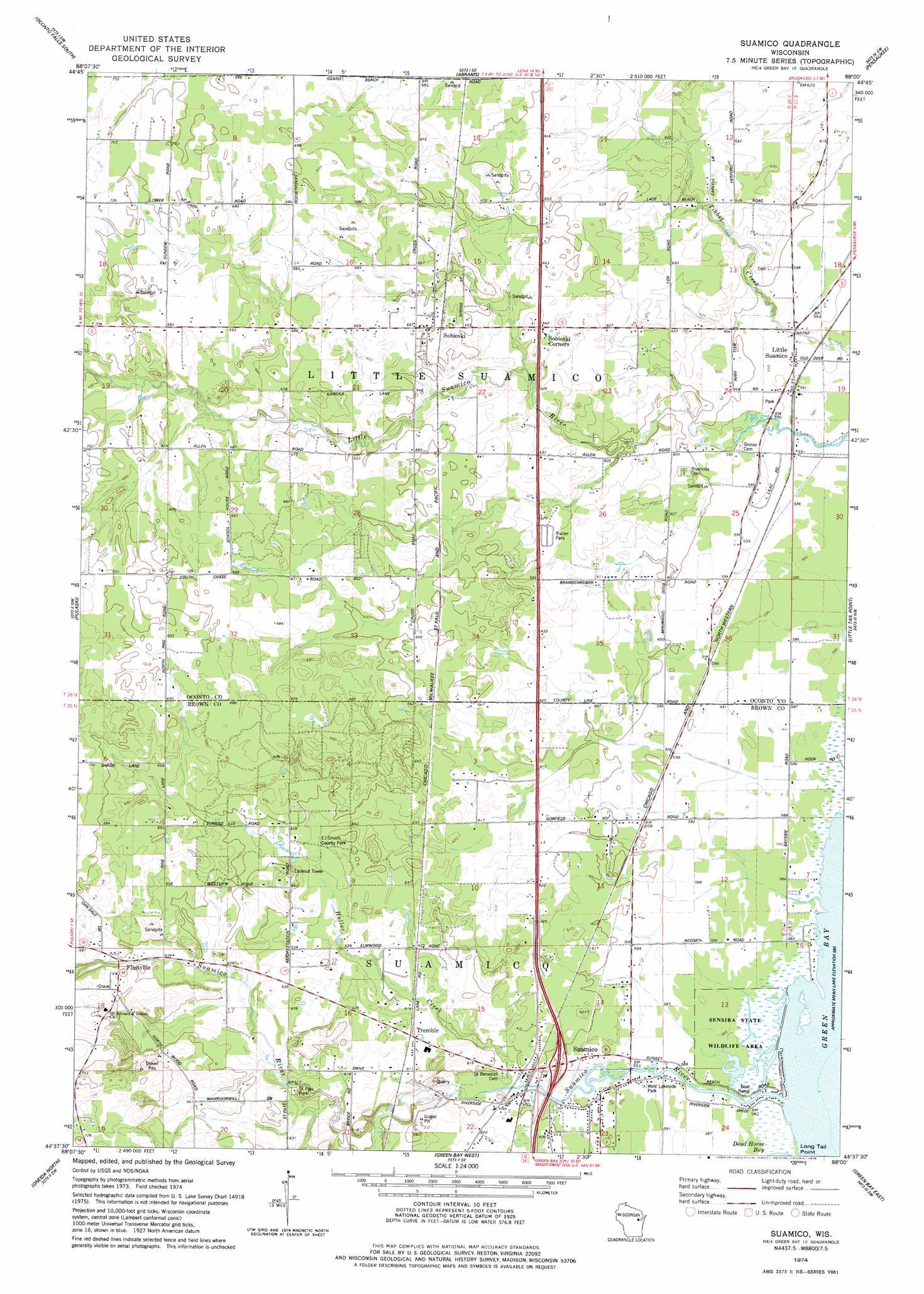
USGS Topo Quad 44088f1 - 1:24,000 scale
| Topo Map Name: | Suamico |
| USGS Topo Quad ID: | 44088f1 |
| Print Size: | ca. 21 1/4" wide x 27" high |
| Southeast Coordinates: | 44.625° N latitude / 88° W longitude |
| Map Center Coordinates: | 44.6875° N latitude / 88.0625° W longitude |
| U.S. State: | WI |
| Filename: | o44088f1.jpg |
| Download Map JPG Image: | Suamico topo map 1:24,000 scale |
| Map Type: | Topographic |
| Topo Series: | 7.5´ |
| Map Scale: | 1:24,000 |
| Source of Map Images: | United States Geological Survey (USGS) |
| Alternate Map Versions: |
Suamico WI 1974, updated 1978 Download PDF Buy paper map Suamico WI 2010 Download PDF Buy paper map Suamico WI 2013 Download PDF Buy paper map Suamico WI 2016 Download PDF Buy paper map |
1:24,000 Topo Quads surrounding Suamico
Gillett |
Oconto Falls North |
Lena |
Oconto West |
Oconto East |
Krakow |
Oconto Falls South |
Abrams |
Pensaukee |
Oconto Se |
Zachow |
Pulaski |
Suamico |
Little Tail Point |
Dyckesville |
Seymour |
Oneida North |
Green Bay West |
Green Bay East |
New Franken |
Freedom |
Oneida South |
De Pere |
Bellevue |
Poland |
> Back to 44088e1 at 1:100,000 scale
> Back to 44088a1 at 1:250,000 scale
> Back to U.S. Topo Maps home
Suamico topo map: Gazetteer
Suamico: Parks
EJ Smith County Park elevation 195m 639′Saint Pats Park elevation 188m 616′
Sensiba State Wildlife Area elevation 178m 583′
West Lakeside Park elevation 180m 590′
Suamico: Populated Places
Flintville elevation 198m 649′Little Suamico elevation 180m 590′
Sobieski elevation 201m 659′
Sobieski Corners elevation 195m 639′
Suamico elevation 180m 590′
Tremble elevation 190m 623′
Suamico: Streams
Haller Creek elevation 180m 590′Suamico River elevation 177m 580′
Suamico digital topo map on disk
Buy this Suamico topo map showing relief, roads, GPS coordinates and other geographical features, as a high-resolution digital map file on DVD: