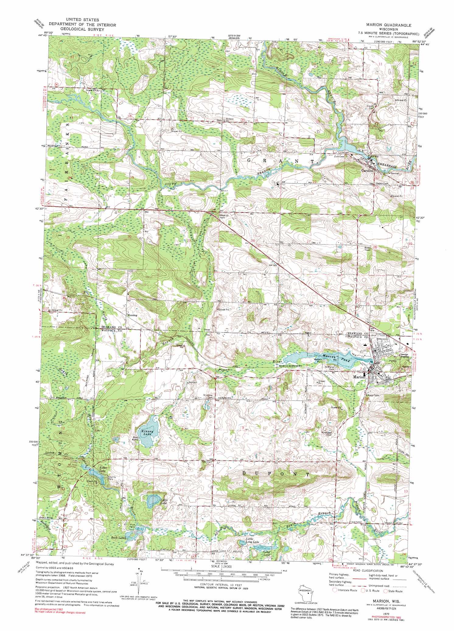
Marion Topo Map Wisconsin
To zoom in, hover over the map of Marion
USGS Topo Quad 44088f8 - 1:24,000 scale
| Topo Map Name: | Marion |
| USGS Topo Quad ID: | 44088f8 |
| Print Size: | ca. 21 1/4" wide x 27" high |
| Southeast Coordinates: | 44.625° N latitude / 88.875° W longitude |
| Map Center Coordinates: | 44.6875° N latitude / 88.9375° W longitude |
| U.S. State: | WI |
| Filename: | o44088f8.jpg |
| Download Map JPG Image: | Marion topo map 1:24,000 scale |
| Map Type: | Topographic |
| Topo Series: | 7.5´ |
| Map Scale: | 1:24,000 |
| Source of Map Images: | United States Geological Survey (USGS) |
| Alternate Map Versions: |
Marion WI 1970, updated 1973 Download PDF Buy paper map Marion WI 1970, updated 1991 Download PDF Buy paper map Marion WI 2010 Download PDF Buy paper map Marion WI 2013 Download PDF Buy paper map Marion WI 2016 Download PDF Buy paper map |
1:24,000 Topo Quads surrounding Marion
Birnamwood |
Regina |
Burney Lake |
Neopit |
Keshena |
Wittenberg |
Shepley |
Bowler |
Gresham |
Thornton |
Tigerton Nw |
Tigerton |
Marion |
Clintonville North |
Embarrass |
Iola |
Big Falls |
Symco |
Clintonville South |
Bear Creek |
Scandinavia |
Ogdensburg |
Manawa |
Northport |
New London |
> Back to 44088e1 at 1:100,000 scale
> Back to 44088a1 at 1:250,000 scale
> Back to U.S. Topo Maps home
Marion topo map: Gazetteer
Marion: Dams
Caroline 1885c282 Dam elevation 278m 912′Keller C5602.6 Dam elevation 270m 885′
Marion 2WP732 Dam elevation 259m 849′
Marion: Lakes
Buck Lakes elevation 264m 866′Little Lake elevation 267m 875′
Little Long Lake elevation 258m 846′
Long Lake elevation 258m 846′
Marion: Mines
Leuthold Granite Quarry elevation 274m 898′Marion: Parks
Wallace Park elevation 260m 853′Marion: Populated Places
Caroline elevation 281m 921′Granite City (historical) elevation 274m 898′
Hunting elevation 284m 931′
Marion elevation 259m 849′
Marion: Reservoirs
Caroline Pond 247 elevation 278m 912′Keller Lake elevation 270m 885′
Keller Lake 16.5 elevation 265m 869′
Kinney Lake elevation 273m 895′
Marion Pond elevation 259m 849′
Marion Pond 30 elevation 259m 849′
Marion: Streams
Geskey Creek elevation 271m 889′Middle Branch Embarrass River elevation 273m 895′
South Branch Embarrass River elevation 273m 895′
Marion digital topo map on disk
Buy this Marion topo map showing relief, roads, GPS coordinates and other geographical features, as a high-resolution digital map file on DVD: