Gresham Topo Map Wisconsin
To zoom in, hover over the map of Gresham
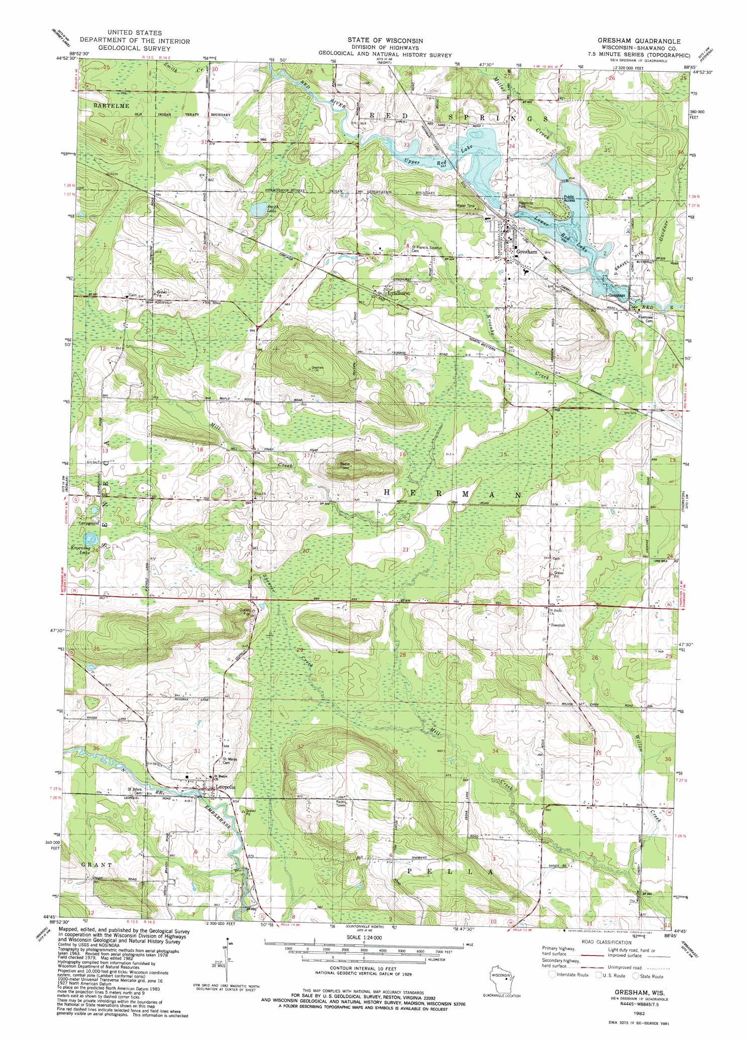
USGS Topo Quad 44088g7 - 1:24,000 scale
| Topo Map Name: | Gresham |
| USGS Topo Quad ID: | 44088g7 |
| Print Size: | ca. 21 1/4" wide x 27" high |
| Southeast Coordinates: | 44.75° N latitude / 88.75° W longitude |
| Map Center Coordinates: | 44.8125° N latitude / 88.8125° W longitude |
| U.S. State: | WI |
| Filename: | o44088g7.jpg |
| Download Map JPG Image: | Gresham topo map 1:24,000 scale |
| Map Type: | Topographic |
| Topo Series: | 7.5´ |
| Map Scale: | 1:24,000 |
| Source of Map Images: | United States Geological Survey (USGS) |
| Alternate Map Versions: |
Gresham WI 1982, updated 1982 Download PDF Buy paper map Gresham WI 2010 Download PDF Buy paper map Gresham WI 2013 Download PDF Buy paper map Gresham WI 2016 Download PDF Buy paper map |
1:24,000 Topo Quads surrounding Gresham
Mattoon |
Zoar |
Perote Lake |
Markton |
Fredenberg Lake |
Regina |
Burney Lake |
Neopit |
Keshena |
Legend Lake |
Shepley |
Bowler |
Gresham |
Thornton |
Shawano |
Tigerton |
Marion |
Clintonville North |
Embarrass |
Lunds |
Big Falls |
Symco |
Clintonville South |
Bear Creek |
Leeman |
> Back to 44088e1 at 1:100,000 scale
> Back to 44088a1 at 1:250,000 scale
> Back to U.S. Topo Maps home
Gresham topo map: Gazetteer
Gresham: Dams
Gresham 2WP 1540 Dam elevation 284m 931′Gresham: Lakes
Kroening Lake elevation 289m 948′Lower Red Lake elevation 274m 898′
Smith Lake elevation 289m 948′
Upper Red Lake elevation 284m 931′
Gresham: Parks
Jung Hemlock-Beech Forest State Natural Area elevation 285m 935′Riverside Park elevation 281m 921′
Gresham: Populated Places
Gresham elevation 283m 928′Leopolis elevation 275m 902′
Lyndhurst elevation 290m 951′
Gresham: Reservoirs
Gresham Pond 147 elevation 284m 931′Gresham: Streams
Gardner Creek elevation 266m 872′Miller Creek elevation 274m 898′
Spencer Creek elevation 262m 859′
Gresham digital topo map on disk
Buy this Gresham topo map showing relief, roads, GPS coordinates and other geographical features, as a high-resolution digital map file on DVD: