Wild Rose Topo Map Wisconsin
To zoom in, hover over the map of Wild Rose
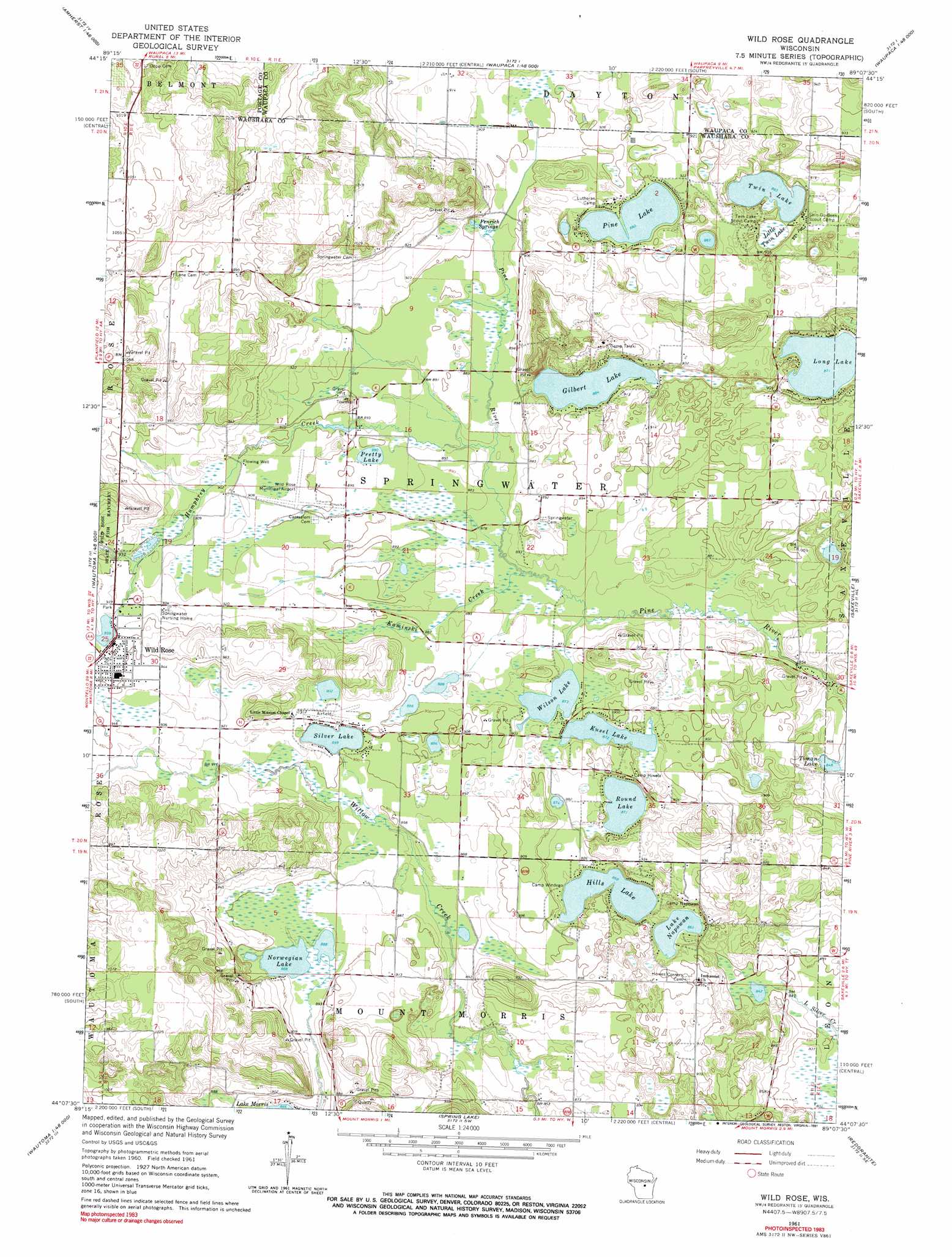
USGS Topo Quad 44089b2 - 1:24,000 scale
| Topo Map Name: | Wild Rose |
| USGS Topo Quad ID: | 44089b2 |
| Print Size: | ca. 21 1/4" wide x 27" high |
| Southeast Coordinates: | 44.125° N latitude / 89.125° W longitude |
| Map Center Coordinates: | 44.1875° N latitude / 89.1875° W longitude |
| U.S. State: | WI |
| Filename: | o44089b2.jpg |
| Download Map JPG Image: | Wild Rose topo map 1:24,000 scale |
| Map Type: | Topographic |
| Topo Series: | 7.5´ |
| Map Scale: | 1:24,000 |
| Source of Map Images: | United States Geological Survey (USGS) |
| Alternate Map Versions: |
Wild Rose WI 1961, updated 1966 Download PDF Buy paper map Wild Rose WI 1961, updated 1991 Download PDF Buy paper map Wild Rose WI 2010 Download PDF Buy paper map Wild Rose WI 2013 Download PDF Buy paper map Wild Rose WI 2015 Download PDF Buy paper map |
1:24,000 Topo Quads surrounding Wild Rose
Arnott |
Amherst |
Scandinavia |
Ogdensburg |
Manawa |
Almond |
Blaine |
King |
Waupaca |
Weyauwega |
Plainfield |
Wautoma Ne |
Wild Rose |
Saxeville |
Poy Sippi |
Richford |
Wautoma |
Spring Lake |
Redgranite |
Auroraville |
Westfield East |
Germania |
Neshkoro |
Fairburn |
Berlin |
> Back to 44089a1 at 1:100,000 scale
> Back to 44088a1 at 1:250,000 scale
> Back to U.S. Topo Maps home
Wild Rose topo map: Gazetteer
Wild Rose: Airports
Wild Rose Idlewild Airport elevation 275m 902′Wild Rose: Dams
Wild Rose WP117 Dam elevation 286m 938′Wild Rose: Lakes
Bonneville Lake elevation 271m 889′Gilbert Lake elevation 269m 882′
Hills Lake elevation 265m 869′
Kusel Lake elevation 266m 872′
Lake Napowan elevation 262m 859′
Long Lake elevation 265m 869′
Norwegian Lake elevation 271m 889′
Pine Lake elevation 271m 889′
Pretty Lake elevation 273m 895′
Round Lake elevation 265m 869′
Silver Lake elevation 274m 898′
Timan Lake elevation 258m 846′
Twin Lake elevation 269m 882′
Wild Rose Pond elevation 286m 938′
Wilson Lake elevation 266m 872′
Wild Rose: Parks
Karner Blue Meadow State Natural Area elevation 271m 889′Wild Rose: Populated Places
Wild Rose elevation 290m 951′Wild Rose: Reservoirs
Wild Rose Millpond 53 elevation 286m 938′Wild Rose: Springs
Fenrich Springs elevation 271m 889′Wild Rose: Streams
Davies Creek elevation 268m 879′Humphrey Creek elevation 267m 875′
Kaminski Creek elevation 265m 869′
Wild Rose: Swamps
Little Twin Lake elevation 269m 882′Wild Rose digital topo map on disk
Buy this Wild Rose topo map showing relief, roads, GPS coordinates and other geographical features, as a high-resolution digital map file on DVD: