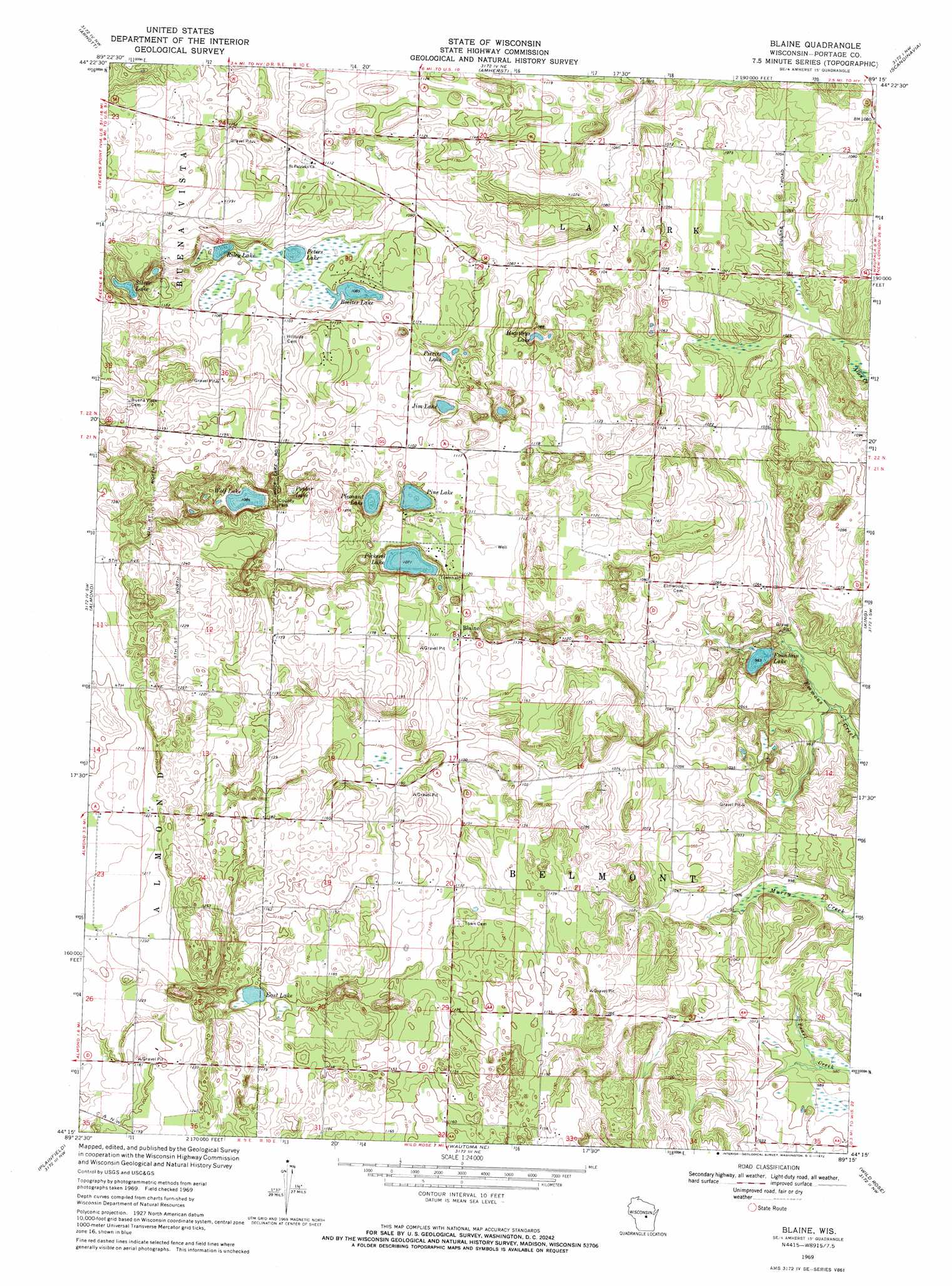
Blaine Topo Map Wisconsin
To zoom in, hover over the map of Blaine
USGS Topo Quad 44089c3 - 1:24,000 scale
| Topo Map Name: | Blaine |
| USGS Topo Quad ID: | 44089c3 |
| Print Size: | ca. 21 1/4" wide x 27" high |
| Southeast Coordinates: | 44.25° N latitude / 89.25° W longitude |
| Map Center Coordinates: | 44.3125° N latitude / 89.3125° W longitude |
| U.S. State: | WI |
| Filename: | o44089c3.jpg |
| Download Map JPG Image: | Blaine topo map 1:24,000 scale |
| Map Type: | Topographic |
| Topo Series: | 7.5´ |
| Map Scale: | 1:24,000 |
| Source of Map Images: | United States Geological Survey (USGS) |
| Alternate Map Versions: |
Blaine WI 1969, updated 1972 Download PDF Buy paper map Blaine WI 2010 Download PDF Buy paper map Blaine WI 2013 Download PDF Buy paper map Blaine WI 2015 Download PDF Buy paper map |
1:24,000 Topo Quads surrounding Blaine
Stevens Point |
Polonia |
New Hope |
Iola |
Big Falls |
Whiting |
Arnott |
Amherst |
Scandinavia |
Ogdensburg |
Bancroft |
Almond |
Blaine |
King |
Waupaca |
Hancock |
Plainfield |
Wautoma Ne |
Wild Rose |
Saxeville |
Coloma |
Richford |
Wautoma |
Spring Lake |
Redgranite |
> Back to 44089a1 at 1:100,000 scale
> Back to 44088a1 at 1:250,000 scale
> Back to U.S. Topo Maps home
Blaine topo map: Gazetteer
Blaine: Dams
Fountain Lake Dam elevation 299m 980′Blaine: Lakes
Boelter Lake elevation 330m 1082′East Lake elevation 345m 1131′
Fountain Lake elevation 299m 980′
Huntleys Lake elevation 322m 1056′
Jim Lake elevation 328m 1076′
Peters Lake elevation 330m 1082′
Pickerel Lake elevation 326m 1069′
Pierces Lake elevation 325m 1066′
Pine Lake elevation 330m 1082′
Pleasant Lake elevation 326m 1069′
Poplar Lake elevation 331m 1085′
Riley Lake elevation 332m 1089′
Silver Lake elevation 333m 1092′
Wolf Lake elevation 330m 1082′
Blaine: Parks
Pickerel Lake State Natural Area elevation 345m 1131′Blaine: Populated Places
Blaine elevation 342m 1122′Blaine: Reservoirs
Fountain Lake 1 elevation 299m 980′Blaine digital topo map on disk
Buy this Blaine topo map showing relief, roads, GPS coordinates and other geographical features, as a high-resolution digital map file on DVD: