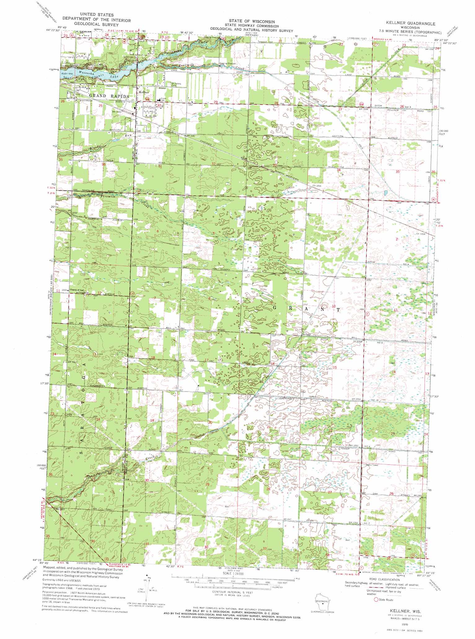
Kellner Topo Map Wisconsin
To zoom in, hover over the map of Kellner
USGS Topo Quad 44089c6 - 1:24,000 scale
| Topo Map Name: | Kellner |
| USGS Topo Quad ID: | 44089c6 |
| Print Size: | ca. 21 1/4" wide x 27" high |
| Southeast Coordinates: | 44.25° N latitude / 89.625° W longitude |
| Map Center Coordinates: | 44.3125° N latitude / 89.6875° W longitude |
| U.S. State: | WI |
| Filename: | o44089c6.jpg |
| Download Map JPG Image: | Kellner topo map 1:24,000 scale |
| Map Type: | Topographic |
| Topo Series: | 7.5´ |
| Map Scale: | 1:24,000 |
| Source of Map Images: | United States Geological Survey (USGS) |
| Alternate Map Versions: |
Kellner WI 1970, updated 1972 Download PDF Buy paper map Kellner WI 2010 Download PDF Buy paper map Kellner WI 2013 Download PDF Buy paper map Kellner WI 2015 Download PDF Buy paper map |
1:24,000 Topo Quads surrounding Kellner
Sherry |
Junction City |
Rocky Run |
Stevens Point |
Polonia |
Vesper |
Wisconsin Rapids North |
Meehan |
Whiting |
Arnott |
Nekoosa |
Wisconsin Rapids South |
Kellner |
Bancroft |
Almond |
Arkdale Nw |
Arkdale Ne |
Coloma Nw |
Hancock |
Plainfield |
Arkdale |
Roche A Cri |
Coloma Sw |
Coloma |
Richford |
> Back to 44089a1 at 1:100,000 scale
> Back to 44088a1 at 1:250,000 scale
> Back to U.S. Topo Maps home
Kellner topo map: Gazetteer
Kellner: Canals
Lateral Number Two elevation 319m 1046′Kellner: Dams
Portage County Number 35 Dam elevation 317m 1040′Kellner: Parks
Buena Vista Prairie Chicken Meadow State Natural Area elevation 322m 1056′Buena Vista Quarry Prairie State Natural Area elevation 323m 1059′
South Wood County Park elevation 312m 1023′
Kellner: Populated Places
Kellner elevation 317m 1040′Kellner: Reservoirs
46 Reservoir elevation 317m 1040′Kellner: Streams
Buena Vista Creek elevation 309m 1013′North Branch Tenmile Creek elevation 317m 1040′
South Branch Tenmile Creek elevation 317m 1040′
Kellner digital topo map on disk
Buy this Kellner topo map showing relief, roads, GPS coordinates and other geographical features, as a high-resolution digital map file on DVD: