Sherry Topo Map Wisconsin
To zoom in, hover over the map of Sherry
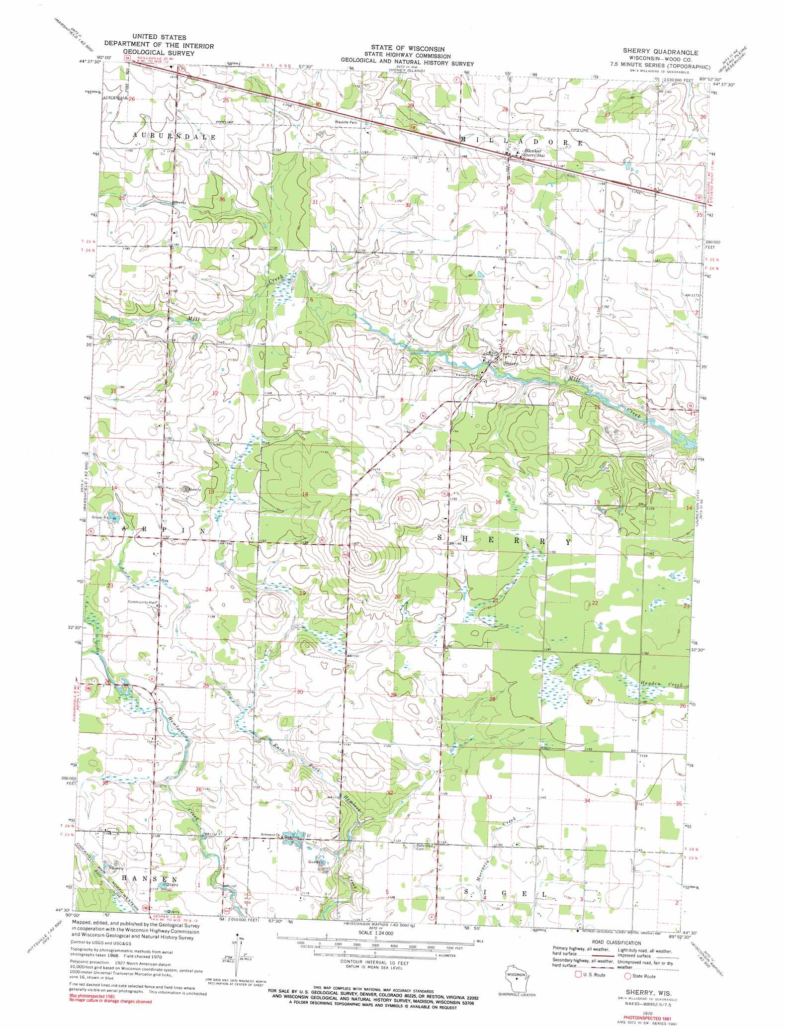
USGS Topo Quad 44089e8 - 1:24,000 scale
| Topo Map Name: | Sherry |
| USGS Topo Quad ID: | 44089e8 |
| Print Size: | ca. 21 1/4" wide x 27" high |
| Southeast Coordinates: | 44.5° N latitude / 89.875° W longitude |
| Map Center Coordinates: | 44.5625° N latitude / 89.9375° W longitude |
| U.S. State: | WI |
| Filename: | o44089e8.jpg |
| Download Map JPG Image: | Sherry topo map 1:24,000 scale |
| Map Type: | Topographic |
| Topo Series: | 7.5´ |
| Map Scale: | 1:24,000 |
| Source of Map Images: | United States Geological Survey (USGS) |
| Alternate Map Versions: |
Sherry WI 1970, updated 1972 Download PDF Buy paper map Sherry WI 1970, updated 1990 Download PDF Buy paper map Sherry WI 2010 Download PDF Buy paper map Sherry WI 2013 Download PDF Buy paper map Sherry WI 2015 Download PDF Buy paper map |
1:24,000 Topo Quads surrounding Sherry
Little Rose |
Stratford |
Marathon Sw |
Halder |
Mosinee |
Arpin |
Hewitt |
Honey Island |
Big Eau Pleine Reservoir |
Dancy |
Lake Manakiki |
Marshfield |
Sherry |
Junction City |
Rocky Run |
Pittsville |
Lake Dexter |
Vesper |
Wisconsin Rapids North |
Meehan |
Quail Point Flowage |
Babcock |
Nekoosa |
Wisconsin Rapids South |
Kellner |
> Back to 44089e1 at 1:100,000 scale
> Back to 44088a1 at 1:250,000 scale
> Back to U.S. Topo Maps home
Sherry topo map: Gazetteer
Sherry: Populated Places
Blenker elevation 360m 1181′Sherry elevation 350m 1148′
Sherry: Streams
North Fork Hemlock Creek elevation 341m 1118′Sherry digital topo map on disk
Buy this Sherry topo map showing relief, roads, GPS coordinates and other geographical features, as a high-resolution digital map file on DVD: