Mission Lake Topo Map Wisconsin
To zoom in, hover over the map of Mission Lake
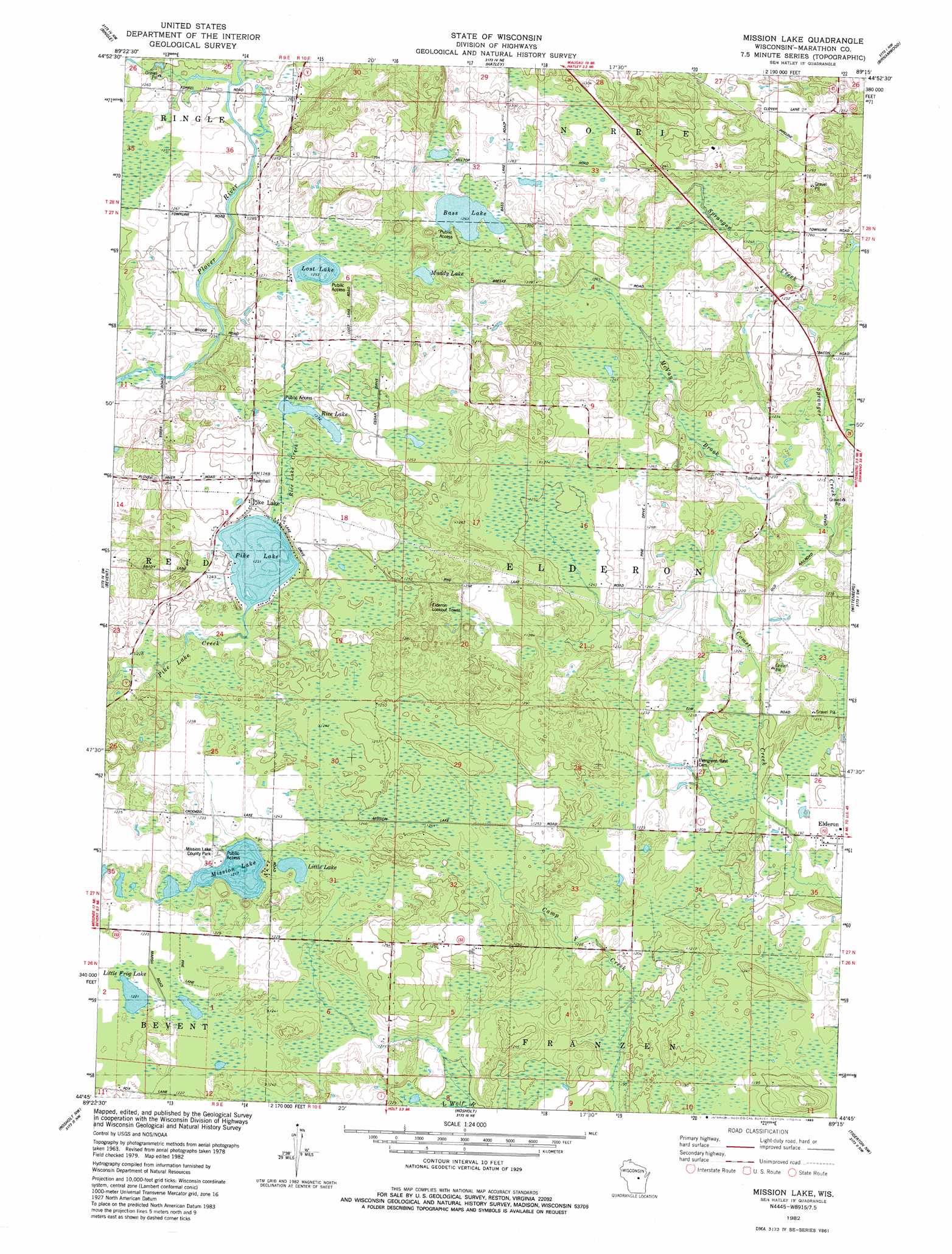
USGS Topo Quad 44089g3 - 1:24,000 scale
| Topo Map Name: | Mission Lake |
| USGS Topo Quad ID: | 44089g3 |
| Print Size: | ca. 21 1/4" wide x 27" high |
| Southeast Coordinates: | 44.75° N latitude / 89.25° W longitude |
| Map Center Coordinates: | 44.8125° N latitude / 89.3125° W longitude |
| U.S. State: | WI |
| Filename: | o44089g3.jpg |
| Download Map JPG Image: | Mission Lake topo map 1:24,000 scale |
| Map Type: | Topographic |
| Topo Series: | 7.5´ |
| Map Scale: | 1:24,000 |
| Source of Map Images: | United States Geological Survey (USGS) |
| Alternate Map Versions: |
Mission Lake WI 1982, updated 1983 Download PDF Buy paper map Mission Lake WI 2010 Download PDF Buy paper map Mission Lake WI 2013 Download PDF Buy paper map Mission Lake WI 2015 Download PDF Buy paper map |
1:24,000 Topo Quads surrounding Mission Lake
Nutterville |
Kalinke |
Hogarty |
Aniwa |
Mattoon |
Wausau East |
Ringle |
Hatley |
Birnamwood |
Regina |
Peplin |
Bevent |
Mission Lake |
Wittenberg |
Shepley |
Dewey Marsh |
Rosholt Nw |
Rosholt |
Tigerton Nw |
Tigerton |
Stevens Point |
Polonia |
New Hope |
Iola |
Big Falls |
> Back to 44089e1 at 1:100,000 scale
> Back to 44088a1 at 1:250,000 scale
> Back to U.S. Topo Maps home
Mission Lake topo map: Gazetteer
Mission Lake: Lakes
Bass Lake elevation 386m 1266′Little Frog Lake elevation 372m 1220′
Little Lake elevation 376m 1233′
Lost Lake elevation 382m 1253′
Mission Lake elevation 372m 1220′
Muddy Lake elevation 385m 1263′
Pike Lake elevation 375m 1230′
Rice Lake elevation 375m 1230′
Mission Lake: Parks
Mission Lake County Park elevation 375m 1230′Mission Lake: Populated Places
Ingersoll elevation 384m 1259′Pike Lake elevation 382m 1253′
Mission Lake: Streams
McVay Brook elevation 366m 1200′Rice Lake Creek elevation 375m 1230′
Mission Lake digital topo map on disk
Buy this Mission Lake topo map showing relief, roads, GPS coordinates and other geographical features, as a high-resolution digital map file on DVD: