Cataract Topo Map Wisconsin
To zoom in, hover over the map of Cataract
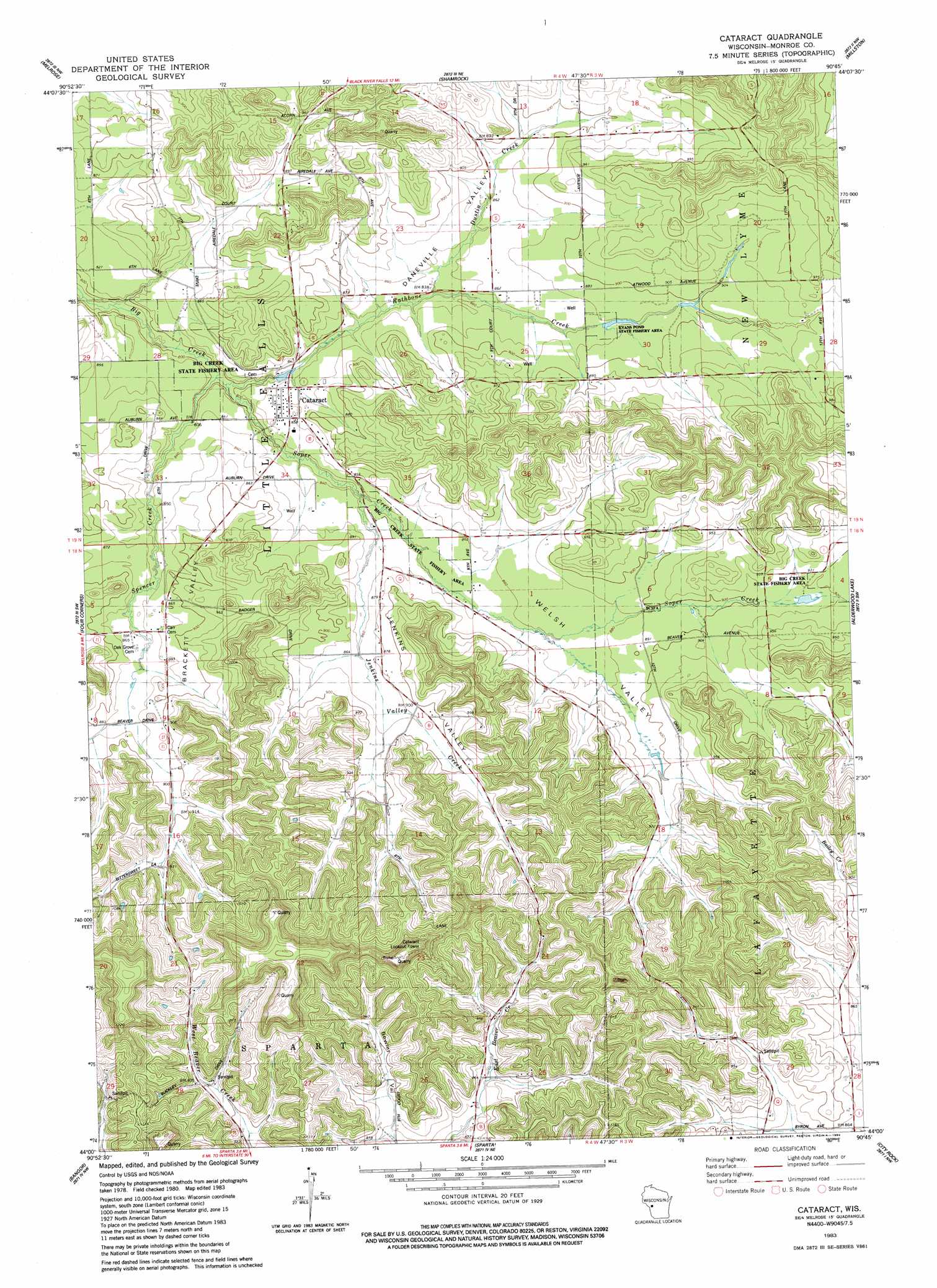
USGS Topo Quad 44090a7 - 1:24,000 scale
| Topo Map Name: | Cataract |
| USGS Topo Quad ID: | 44090a7 |
| Print Size: | ca. 21 1/4" wide x 27" high |
| Southeast Coordinates: | 44° N latitude / 90.75° W longitude |
| Map Center Coordinates: | 44.0625° N latitude / 90.8125° W longitude |
| U.S. State: | WI |
| Filename: | o44090a7.jpg |
| Download Map JPG Image: | Cataract topo map 1:24,000 scale |
| Map Type: | Topographic |
| Topo Series: | 7.5´ |
| Map Scale: | 1:24,000 |
| Source of Map Images: | United States Geological Survey (USGS) |
| Alternate Map Versions: |
Cataract WI 1983, updated 1984 Download PDF Buy paper map Cataract WI 2010 Download PDF Buy paper map Cataract WI 2013 Download PDF Buy paper map Cataract WI 2015 Download PDF Buy paper map |
1:24,000 Topo Quads surrounding Cataract
Taylor |
Stenulson Coulee |
Black River Falls |
Hatfield Sw |
Hatfield Se |
North Bend Ne |
Melrose |
Shamrock |
Millston |
Warrens West |
North Bend |
Four Corners |
Cataract |
Alderwood Lake |
Tunnel City |
West Salem |
Bangor |
Sparta |
City Rock |
Tomah |
Saint Joseph |
Middle Ridge |
Melvina |
Saint Marys |
Wilton |
> Back to 44090a1 at 1:100,000 scale
> Back to 44090a1 at 1:250,000 scale
> Back to U.S. Topo Maps home
Cataract topo map: Gazetteer
Cataract: Parks
Big Creek State Fishery Area elevation 244m 800′Evans Pond State Fishery Area elevation 264m 866′
Cataract: Populated Places
Cataract elevation 259m 849′Cataract: Streams
Dustin Creek elevation 257m 843′Jenkins Valley Creek elevation 250m 820′
Rathbone Creek elevation 244m 800′
Soper Creek elevation 244m 800′
Spencer Creek elevation 244m 800′
Cataract: Valleys
Brackett Valley elevation 244m 800′Daneville Valley elevation 244m 800′
Jenkins Valley elevation 256m 839′
Welsh Valley elevation 244m 800′
Cataract digital topo map on disk
Buy this Cataract topo map showing relief, roads, GPS coordinates and other geographical features, as a high-resolution digital map file on DVD: