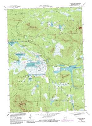
Hatfield Se Topo Map Wisconsin
To zoom in, hover over the map of Hatfield Se
USGS Topo Quad 44090c5 - 1:24,000 scale
| Topo Map Name: | Hatfield Se |
| USGS Topo Quad ID: | 44090c5 |
| Print Size: | ca. 21 1/4" wide x 27" high |
| Southeast Coordinates: | 44.25° N latitude / 90.5° W longitude |
| Map Center Coordinates: | 44.3125° N latitude / 90.5625° W longitude |
| U.S. State: | WI |
| Filename: | o44090c5.jpg |
| Download Map JPG Image: | Hatfield Se topo map 1:24,000 scale |
| Map Type: | Topographic |
| Topo Series: | 7.5´ |
| Map Scale: | 1:24,000 |
| Source of Map Images: | United States Geological Survey (USGS) |
| Alternate Map Versions: |
Hatfield SE WI 1970, updated 1972 Download PDF Buy paper map Hatfield SE WI 1970, updated 1985 Download PDF Buy paper map Hatfield SE WI 2010 Download PDF Buy paper map Hatfield SE WI 2013 Download PDF Buy paper map Hatfield SE WI 2015 Download PDF Buy paper map |
1:24,000 Topo Quads surrounding Hatfield Se
> Back to 44090a1 at 1:100,000 scale
> Back to 44090a1 at 1:250,000 scale
> Back to U.S. Topo Maps home
Hatfield Se topo map: Gazetteer
Hatfield Se: Dams
Normington E7395 Dam elevation 297m 974′Potter 2WP695 Dam elevation 294m 964′
Resettlement Administration 12 Dam elevation 287m 941′
Resettlement Administration 15 Dam elevation 283m 928′
Resettlement Administration 2 Dam elevation 287m 941′
Resettlement Administration 4 Dam elevation 292m 958′
Resettlement Administration 5 Dam elevation 294m 964′
Resettlement Administration 6 Dam elevation 297m 974′
Resettlement Administration 8 Dam elevation 281m 921′
Resettlement Administration 8 East Dam elevation 281m 921′
Resettlement Administration 9 Dam elevation 287m 941′
Hatfield Se: Populated Places
Speck Oaks elevation 290m 951′Hatfield Se: Reservoirs
Battle Point Flowage elevation 288m 944′Battle Point Flowage 2 elevation 287m 941′
Black Duck Flowage elevation 292m 958′
Hawkins Lake elevation 304m 997′
Little Thunder Flowage elevation 281m 921′
Mallard Flowage elevation 294m 964′
Mallard Flowage 1 elevation 294m 964′
Partridge Crop Flowage elevation 284m 931′
Potter Flowage elevation 294m 964′
Potter Flowage 58 elevation 294m 964′
Range Line Flowage elevation 284m 931′
Rangeline Flowage 8 elevation 287m 941′
Schwartz Pool elevation 281m 921′
Seventeen Flowage elevation 287m 941′
Seventeen Reservoir elevation 287m 941′
Tanner Flowage elevation 298m 977′
Tanner Flowage 5 elevation 297m 974′
Town Line Flowage elevation 281m 921′
Townline Reservoir elevation 281m 921′
Townline Reservoir elevation 281m 921′
Weber Flowage elevation 292m 958′
Weber Flowage U elevation 292m 958′
White Tail Flowage elevation 284m 931′
Whitetail Flowage 12 elevation 283m 928′
Hatfield Se: Ridges
Crawford Hills elevation 326m 1069′Hatfield Se: Streams
Crawford Creek elevation 280m 918′Hawkins Creek elevation 294m 964′
McKenna Creek elevation 294m 964′
Town Line Creek elevation 285m 935′
Hatfield Se: Summits
Campground Hill elevation 322m 1056′Circle Hill elevation 318m 1043′
Saddle Mound elevation 421m 1381′
Wangreen Hill elevation 330m 1082′
Wildcat Mound elevation 402m 1318′
Hatfield Se: Swamps
City Marsh elevation 283m 928′Dresher Marsh elevation 297m 974′
Hay Marsh elevation 297m 974′
Johnson Marsh elevation 300m 984′
Martin Marsh elevation 290m 951′
Purrleburg Marsh elevation 295m 967′
Ring Marsh elevation 299m 980′
Speck Marsh elevation 290m 951′
Hatfield Se digital topo map on disk
Buy this Hatfield Se topo map showing relief, roads, GPS coordinates and other geographical features, as a high-resolution digital map file on DVD:


