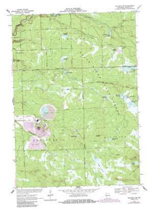
Hatfield Sw Topo Map Wisconsin
To zoom in, hover over the map of Hatfield Sw
USGS Topo Quad 44090c6 - 1:24,000 scale
| Topo Map Name: | Hatfield Sw |
| USGS Topo Quad ID: | 44090c6 |
| Print Size: | ca. 21 1/4" wide x 27" high |
| Southeast Coordinates: | 44.25° N latitude / 90.625° W longitude |
| Map Center Coordinates: | 44.3125° N latitude / 90.6875° W longitude |
| U.S. State: | WI |
| Filename: | o44090c6.jpg |
| Download Map JPG Image: | Hatfield Sw topo map 1:24,000 scale |
| Map Type: | Topographic |
| Topo Series: | 7.5´ |
| Map Scale: | 1:24,000 |
| Source of Map Images: | United States Geological Survey (USGS) |
| Alternate Map Versions: |
Hatfield SW WI 1970, updated 1972 Download PDF Buy paper map Hatfield SW WI 1970, updated 1983 Download PDF Buy paper map Hatfield SW WI 1970, updated 1985 Download PDF Buy paper map Hatfield SW WI 2010 Download PDF Buy paper map Hatfield SW WI 2013 Download PDF Buy paper map Hatfield SW WI 2015 Download PDF Buy paper map |
1:24,000 Topo Quads surrounding Hatfield Sw
> Back to 44090a1 at 1:100,000 scale
> Back to 44090a1 at 1:250,000 scale
> Back to U.S. Topo Maps home
Hatfield Sw topo map: Gazetteer
Hatfield Sw: Dams
Resettlement Administration 20 Dam elevation 281m 921′Resettlement Administration 21 Dam elevation 282m 925′
Resettlement Administration 29 2WP398 Dam elevation 273m 895′
Hatfield Sw: Forests
Black River State Forest elevation 287m 941′Hatfield Sw: Lakes
Oxbow Pond elevation 262m 859′Wildcat Flowage elevation 297m 974′
Hatfield Sw: Mines
Jackson County Iron Mine elevation 296m 971′Hatfield Sw: Parks
Bauer-Brockway Barrens State Natural Area elevation 265m 869′Black River Camp Picnic Area elevation 273m 895′
Hatfield Sw: Reservoirs
Big Bear Flowage elevation 286m 938′Dry Land Flowage elevation 275m 902′
Funmaker Flowage elevation 276m 905′
Little Bear Flowage elevation 282m 925′
Little Bear Flowage 3 elevation 282m 925′
Lower Wilson Marsh Flowage elevation 287m 941′
Squaw Mound Flowage elevation 281m 921′
Squaw Mound Flowage 4 elevation 281m 921′
Staffon Flowage elevation 279m 915′
Teal Flowage elevation 273m 895′
Teal Flowage 7 elevation 273m 895′
Wilson Marsh Flowage elevation 287m 941′
Hatfield Sw: Streams
Trowe Drain elevation 268m 879′White Creek elevation 272m 892′
Hatfield Sw: Summits
Iron Mound elevation 294m 964′Squaw Mound elevation 302m 990′
Hatfield Sw: Swamps
Trowe Marsh elevation 283m 928′Hatfield Sw digital topo map on disk
Buy this Hatfield Sw topo map showing relief, roads, GPS coordinates and other geographical features, as a high-resolution digital map file on DVD:


