Granton Topo Map Wisconsin
To zoom in, hover over the map of Granton
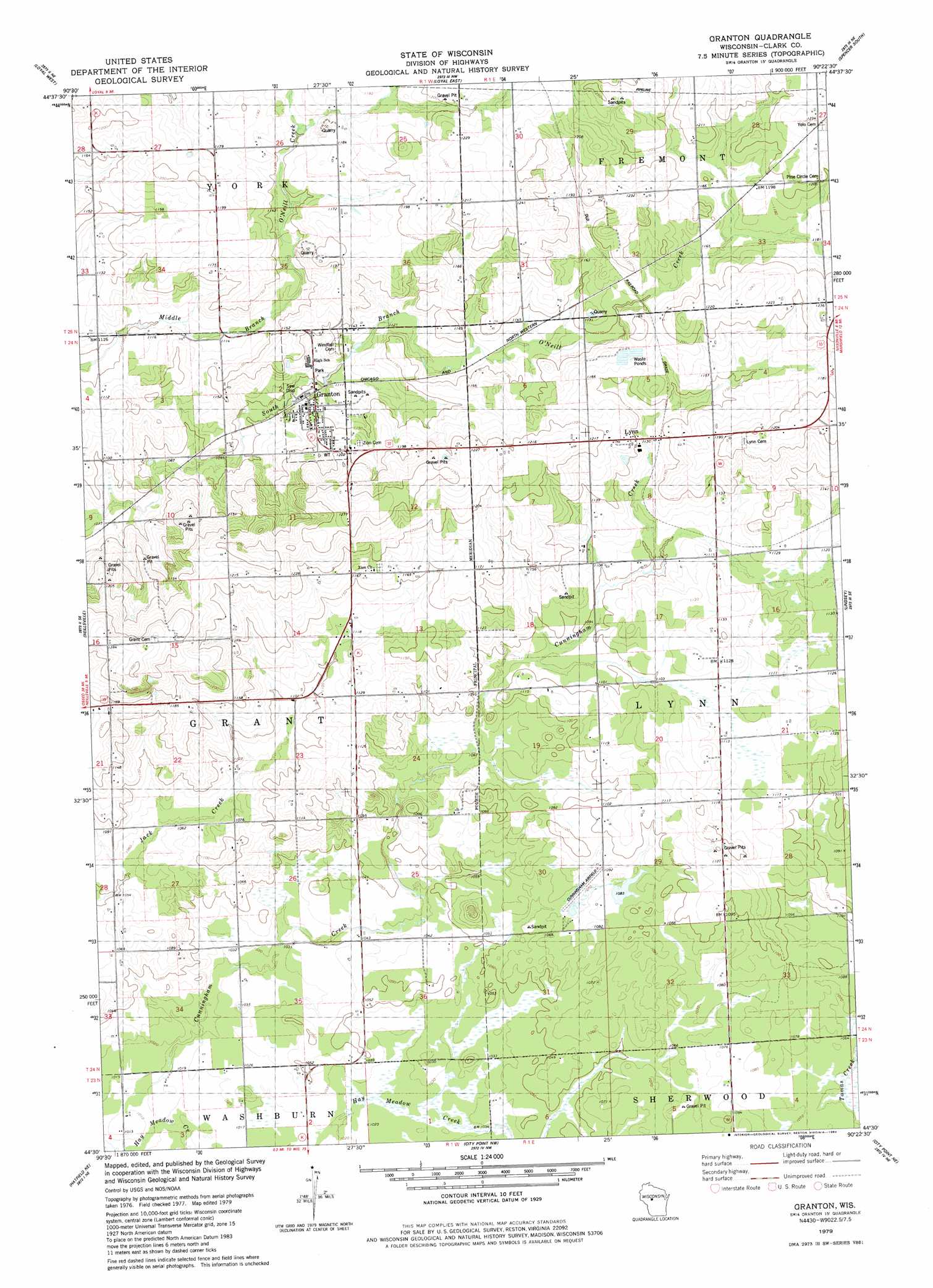
USGS Topo Quad 44090e4 - 1:24,000 scale
| Topo Map Name: | Granton |
| USGS Topo Quad ID: | 44090e4 |
| Print Size: | ca. 21 1/4" wide x 27" high |
| Southeast Coordinates: | 44.5° N latitude / 90.375° W longitude |
| Map Center Coordinates: | 44.5625° N latitude / 90.4375° W longitude |
| U.S. State: | WI |
| Filename: | o44090e4.jpg |
| Download Map JPG Image: | Granton topo map 1:24,000 scale |
| Map Type: | Topographic |
| Topo Series: | 7.5´ |
| Map Scale: | 1:24,000 |
| Source of Map Images: | United States Geological Survey (USGS) |
| Alternate Map Versions: |
Granton WI 1979, updated 1980 Download PDF Buy paper map Granton WI 2010 Download PDF Buy paper map Granton WI 2013 Download PDF Buy paper map Granton WI 2015 Download PDF Buy paper map |
1:24,000 Topo Quads surrounding Granton
Mead Lake East |
Greenwood |
Riplinger |
Spencer North |
Little Rose |
Willard |
Loyal West |
Loyal East |
Spencer South |
Arpin |
Columbia |
Neillsville |
Granton |
Lindsey |
Lake Manakiki |
Hatfield |
Hatfield Ne |
City Point Nw |
City Point Ne |
Pittsville |
Hatfield Sw |
Hatfield Se |
Spaulding |
City Point |
Quail Point Flowage |
> Back to 44090e1 at 1:100,000 scale
> Back to 44090a1 at 1:250,000 scale
> Back to U.S. Topo Maps home
Granton topo map: Gazetteer
Granton: Airports
Cunningham Airport elevation 328m 1076′Granton: Dams
Loretta Smith H1097 Dam elevation 326m 1069′Granton: Populated Places
Granton elevation 341m 1118′Kurth (historical) elevation 329m 1079′
Lynn elevation 357m 1171′
Granton: Reservoirs
0.8 Reservoir elevation 326m 1069′Granton digital topo map on disk
Buy this Granton topo map showing relief, roads, GPS coordinates and other geographical features, as a high-resolution digital map file on DVD: