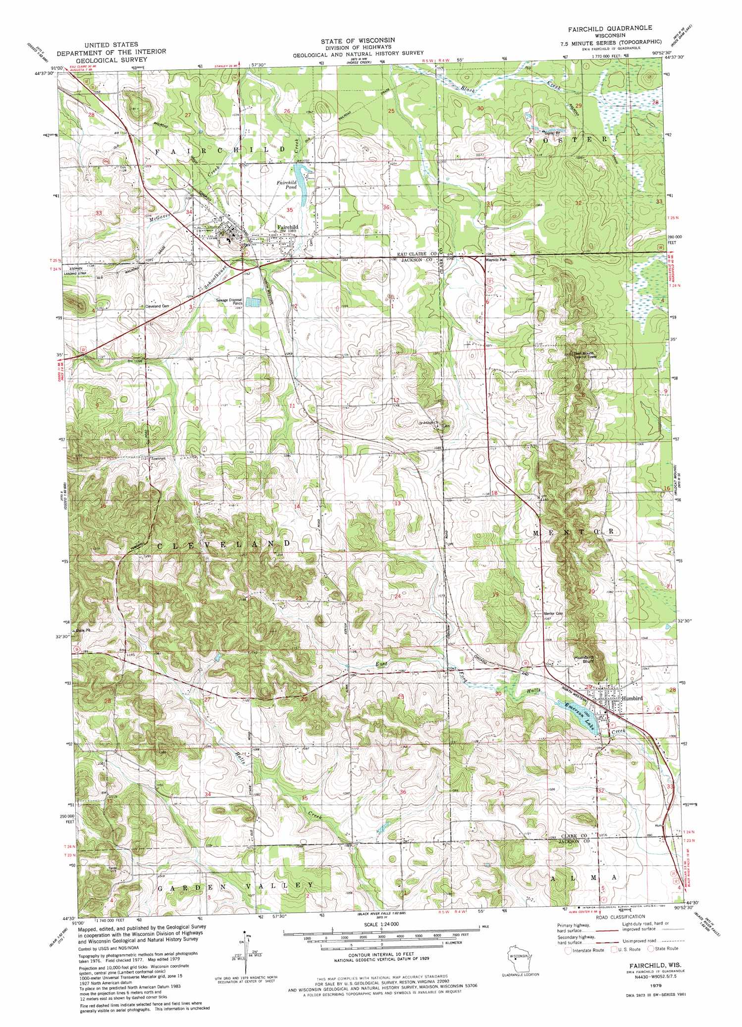
Fairchild Topo Map Wisconsin
To zoom in, hover over the map of Fairchild
USGS Topo Quad 44090e8 - 1:24,000 scale
| Topo Map Name: | Fairchild |
| USGS Topo Quad ID: | 44090e8 |
| Print Size: | ca. 21 1/4" wide x 27" high |
| Southeast Coordinates: | 44.5° N latitude / 90.875° W longitude |
| Map Center Coordinates: | 44.5625° N latitude / 90.9375° W longitude |
| U.S. State: | WI |
| Filename: | o44090e8.jpg |
| Download Map JPG Image: | Fairchild topo map 1:24,000 scale |
| Map Type: | Topographic |
| Topo Series: | 7.5´ |
| Map Scale: | 1:24,000 |
| Source of Map Images: | United States Geological Survey (USGS) |
| Alternate Map Versions: |
Fairchild WI 1979, updated 1980 Download PDF Buy paper map Fairchild WI 2010 Download PDF Buy paper map Fairchild WI 2013 Download PDF Buy paper map Fairchild WI 2015 Download PDF Buy paper map |
1:24,000 Topo Quads surrounding Fairchild
Lake Eau Claire West |
Lake Eau Claire East |
Simes Creek |
Mead Lake West |
Mead Lake East |
Augusta West |
Augusta East |
Horse Creek |
Rock Dam Lake |
Willard |
Osseo |
Price |
Fairchild |
Wildcat Mound |
Columbia |
Pigeon Falls |
Hixton |
Alma Center |
Merrillan |
Hatfield |
Blair |
Taylor |
Stenulson Coulee |
Black River Falls |
Hatfield Sw |
> Back to 44090e1 at 1:100,000 scale
> Back to 44090a1 at 1:250,000 scale
> Back to U.S. Topo Maps home
Fairchild topo map: Gazetteer
Fairchild: Cliffs
Humbird Bluff elevation 378m 1240′Fairchild: Dams
Fairchild C4772 Dam elevation 316m 1036′Humbird Dam elevation 307m 1007′
Fairchild: Populated Places
Fairchild elevation 328m 1076′Humbird elevation 312m 1023′
Fairchild: Reservoirs
Emerson Lake elevation 305m 1000′Emerson Lake 10 elevation 307m 1007′
Fairchild Pond elevation 316m 1036′
Fairchild Pond 12 elevation 316m 1036′
Fairchild: Streams
McGaver Creek elevation 314m 1030′Fairchild digital topo map on disk
Buy this Fairchild topo map showing relief, roads, GPS coordinates and other geographical features, as a high-resolution digital map file on DVD: