Riplinger Topo Map Wisconsin
To zoom in, hover over the map of Riplinger
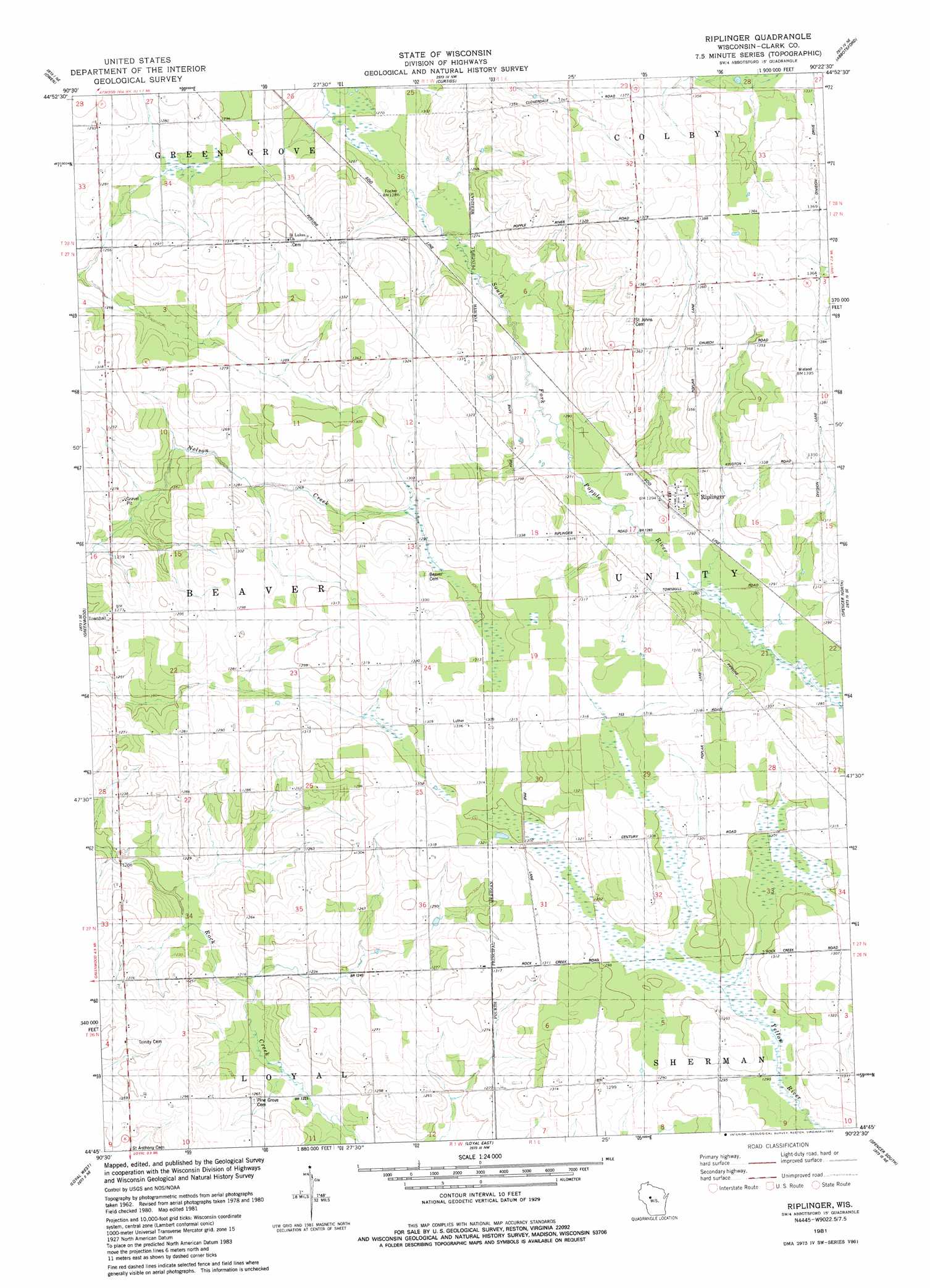
USGS Topo Quad 44090g4 - 1:24,000 scale
| Topo Map Name: | Riplinger |
| USGS Topo Quad ID: | 44090g4 |
| Print Size: | ca. 21 1/4" wide x 27" high |
| Southeast Coordinates: | 44.75° N latitude / 90.375° W longitude |
| Map Center Coordinates: | 44.8125° N latitude / 90.4375° W longitude |
| U.S. State: | WI |
| Filename: | o44090g4.jpg |
| Download Map JPG Image: | Riplinger topo map 1:24,000 scale |
| Map Type: | Topographic |
| Topo Series: | 7.5´ |
| Map Scale: | 1:24,000 |
| Source of Map Images: | United States Geological Survey (USGS) |
| Alternate Map Versions: |
Riplinger WI 1981, updated 1982 Download PDF Buy paper map Riplinger WI 2010 Download PDF Buy paper map Riplinger WI 2013 Download PDF Buy paper map Riplinger WI 2015 Download PDF Buy paper map |
1:24,000 Topo Quads surrounding Riplinger
Lublin |
Lublin Se |
Medford Sw |
Stetsonville |
Corinth |
Lombard |
Owen |
Curtiss |
Abbotsford |
Milan |
Mead Lake East |
Greenwood |
Riplinger |
Spencer North |
Little Rose |
Willard |
Loyal West |
Loyal East |
Spencer South |
Arpin |
Columbia |
Neillsville |
Granton |
Lindsey |
Lake Manakiki |
> Back to 44090e1 at 1:100,000 scale
> Back to 44090a1 at 1:250,000 scale
> Back to U.S. Topo Maps home
Riplinger topo map: Gazetteer
Riplinger: Populated Places
Riplinger elevation 396m 1299′Riplinger: Streams
East Fork Popple River elevation 385m 1263′Riplinger digital topo map on disk
Buy this Riplinger topo map showing relief, roads, GPS coordinates and other geographical features, as a high-resolution digital map file on DVD: