Greenwood Topo Map Wisconsin
To zoom in, hover over the map of Greenwood
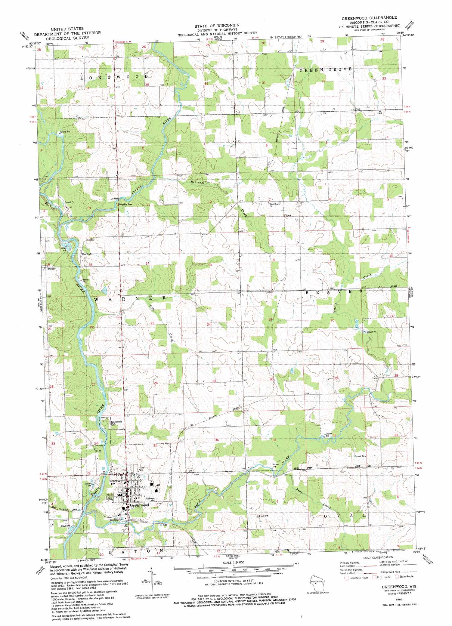
USGS Topo Quad 44090g5 - 1:24,000 scale
| Topo Map Name: | Greenwood |
| USGS Topo Quad ID: | 44090g5 |
| Print Size: | ca. 21 1/4" wide x 27" high |
| Southeast Coordinates: | 44.75° N latitude / 90.5° W longitude |
| Map Center Coordinates: | 44.8125° N latitude / 90.5625° W longitude |
| U.S. State: | WI |
| Filename: | o44090g5.jpg |
| Download Map JPG Image: | Greenwood topo map 1:24,000 scale |
| Map Type: | Topographic |
| Topo Series: | 7.5´ |
| Map Scale: | 1:24,000 |
| Source of Map Images: | United States Geological Survey (USGS) |
| Alternate Map Versions: |
Greenwood WI 1982, updated 1982 Download PDF Buy paper map Greenwood WI 2010 Download PDF Buy paper map Greenwood WI 2013 Download PDF Buy paper map Greenwood WI 2015 Download PDF Buy paper map |
1:24,000 Topo Quads surrounding Greenwood
Bellinger |
Lublin |
Lublin Se |
Medford Sw |
Stetsonville |
Thorp |
Lombard |
Owen |
Curtiss |
Abbotsford |
Mead Lake West |
Mead Lake East |
Greenwood |
Riplinger |
Spencer North |
Rock Dam Lake |
Willard |
Loyal West |
Loyal East |
Spencer South |
Wildcat Mound |
Columbia |
Neillsville |
Granton |
Lindsey |
> Back to 44090e1 at 1:100,000 scale
> Back to 44090a1 at 1:250,000 scale
> Back to U.S. Topo Maps home
Greenwood topo map: Gazetteer
Greenwood: Airports
Town Line Airport elevation 389m 1276′Greenwood: Parks
Greenwood Park elevation 337m 1105′Greenwood: Populated Places
Greenwood elevation 360m 1181′Hemlock elevation 359m 1177′
Greenwood: Streams
Bear Creek elevation 354m 1161′Behringer Creek elevation 354m 1161′
Gile Creek elevation 344m 1128′
Nelson Creek elevation 363m 1190′
Popple River elevation 347m 1138′
Rock Creek elevation 334m 1095′
Greenwood digital topo map on disk
Buy this Greenwood topo map showing relief, roads, GPS coordinates and other geographical features, as a high-resolution digital map file on DVD: