Simes Creek Topo Map Wisconsin
To zoom in, hover over the map of Simes Creek
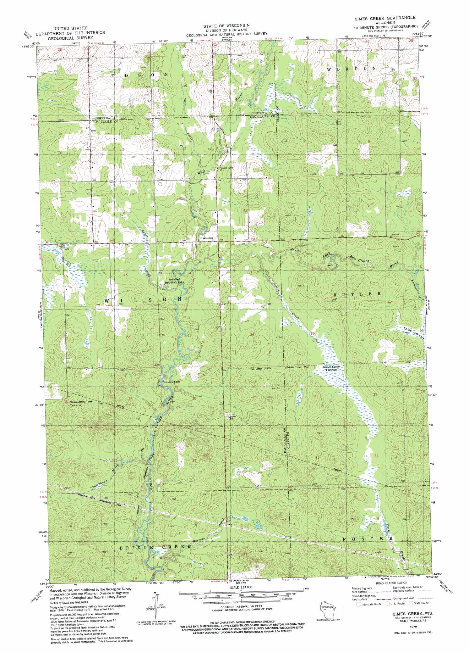
USGS Topo Quad 44090g8 - 1:24,000 scale
| Topo Map Name: | Simes Creek |
| USGS Topo Quad ID: | 44090g8 |
| Print Size: | ca. 21 1/4" wide x 27" high |
| Southeast Coordinates: | 44.75° N latitude / 90.875° W longitude |
| Map Center Coordinates: | 44.8125° N latitude / 90.9375° W longitude |
| U.S. State: | WI |
| Filename: | o44090g8.jpg |
| Download Map JPG Image: | Simes Creek topo map 1:24,000 scale |
| Map Type: | Topographic |
| Topo Series: | 7.5´ |
| Map Scale: | 1:24,000 |
| Source of Map Images: | United States Geological Survey (USGS) |
| Alternate Map Versions: |
Simes Creek WI 1979, updated 1980 Download PDF Buy paper map Simes Creek WI 2010 Download PDF Buy paper map Simes Creek WI 2013 Download PDF Buy paper map Simes Creek WI 2015 Download PDF Buy paper map |
1:24,000 Topo Quads surrounding Simes Creek
Crescent |
Colburn |
Huron |
Bellinger |
Lublin |
Cadott |
Boyd |
Stanley |
Thorp |
Lombard |
Lake Eau Claire West |
Lake Eau Claire East |
Simes Creek |
Mead Lake West |
Mead Lake East |
Augusta West |
Augusta East |
Horse Creek |
Rock Dam Lake |
Willard |
Osseo |
Price |
Fairchild |
Wildcat Mound |
Columbia |
> Back to 44090e1 at 1:100,000 scale
> Back to 44090a1 at 1:250,000 scale
> Back to U.S. Topo Maps home
Simes Creek topo map: Gazetteer
Simes Creek: Falls
Hamilton Falls elevation 295m 967′Simes Creek: Parks
Township Memorial Park elevation 300m 984′Simes Creek: Reservoirs
Simes Creek Flowage elevation 309m 1013′Simes Creek: Streams
Beeman Creek elevation 290m 951′Loper Creek elevation 299m 980′
Robinson Creek elevation 308m 1010′
Shambaugh Creek elevation 291m 954′
Simes Creek elevation 302m 990′
Swim Creek elevation 304m 997′
Wolf River elevation 299m 980′
Simes Creek: Trails
Hamilton Falls Snowmobile Trail elevation 313m 1026′Simes Creek digital topo map on disk
Buy this Simes Creek topo map showing relief, roads, GPS coordinates and other geographical features, as a high-resolution digital map file on DVD: