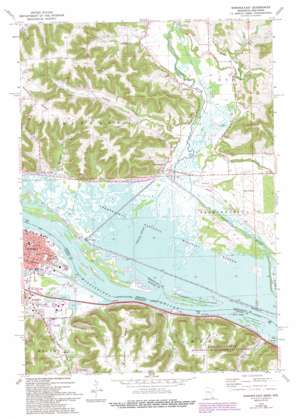
Winona East Topo Map Wisconsin
To zoom in, hover over the map of Winona East
USGS Topo Quad 44091a5 - 1:24,000 scale
| Topo Map Name: | Winona East |
| USGS Topo Quad ID: | 44091a5 |
| Print Size: | ca. 21 1/4" wide x 27" high |
| Southeast Coordinates: | 44° N latitude / 91.5° W longitude |
| Map Center Coordinates: | 44.0625° N latitude / 91.5625° W longitude |
| U.S. States: | WI, MN |
| Filename: | o44091a5.jpg |
| Download Map JPG Image: | Winona East topo map 1:24,000 scale |
| Map Type: | Topographic |
| Topo Series: | 7.5´ |
| Map Scale: | 1:24,000 |
| Source of Map Images: | United States Geological Survey (USGS) |
| Alternate Map Versions: |
Winona East MN 1972, updated 1975 Download PDF Buy paper map Winona East MN 1972, updated 1991 Download PDF Buy paper map Winona East MN 1972, updated 1993 Download PDF Buy paper map Winona East MN 2011 Download PDF Buy paper map Winona East MN 2013 Download PDF Buy paper map Winona East MN 2016 Download PDF Buy paper map |
1:24,000 Topo Quads surrounding Winona East
> Back to 44091a1 at 1:100,000 scale
> Back to 44090a1 at 1:250,000 scale
> Back to U.S. Topo Maps home
Winona East topo map: Gazetteer
Winona East: Airports
Community Memorial Hospital Heliport elevation 199m 652′Winona East: Dams
Pleasant Valley Site Number 12 Dam elevation 205m 672′Winona East: Parks
Gabryck Park elevation 202m 662′Sobieski Park elevation 202m 662′
Trempealeau National Wildlife Refuge elevation 204m 669′
Winona East: Populated Places
Bluff Siding elevation 208m 682′East Winona elevation 200m 656′
Homer elevation 213m 698′
Marshland elevation 208m 682′
Morningside Terrace elevation 222m 728′
Pine Creek (historical) elevation 200m 656′
Sugarloaf elevation 215m 705′
West Prairie elevation 219m 718′
Winona East: Post Offices
Homer Post Office (historical) elevation 213m 698′Winona East: Streams
Homer Creek elevation 197m 646′Pine Creek elevation 200m 656′
Pleasant Valley Creek elevation 197m 646′
Tamarack Creek elevation 200m 656′
Winona East: Valleys
Chicken Valley elevation 207m 679′Decker Valley elevation 197m 646′
East Burns Valley elevation 203m 666′
Homer Valley elevation 197m 646′
Pine Creek Valley elevation 206m 675′
Piper Valley elevation 207m 679′
Platt Valley elevation 214m 702′
Pleasant Valley elevation 202m 662′
Winona East digital topo map on disk
Buy this Winona East topo map showing relief, roads, GPS coordinates and other geographical features, as a high-resolution digital map file on DVD:


