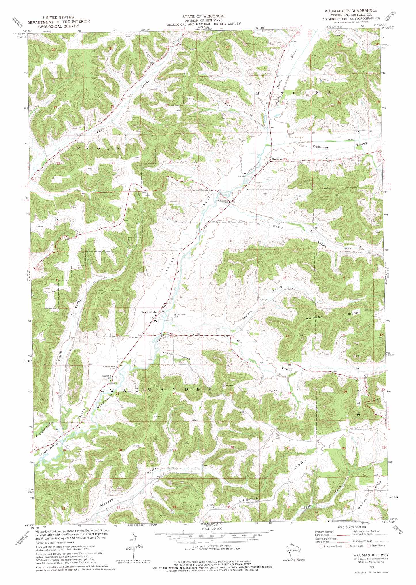
Waumandee Topo Map Wisconsin
To zoom in, hover over the map of Waumandee
USGS Topo Quad 44091c6 - 1:24,000 scale
| Topo Map Name: | Waumandee |
| USGS Topo Quad ID: | 44091c6 |
| Print Size: | ca. 21 1/4" wide x 27" high |
| Southeast Coordinates: | 44.25° N latitude / 91.625° W longitude |
| Map Center Coordinates: | 44.3125° N latitude / 91.6875° W longitude |
| U.S. State: | WI |
| Filename: | o44091c6.jpg |
| Download Map JPG Image: | Waumandee topo map 1:24,000 scale |
| Map Type: | Topographic |
| Topo Series: | 7.5´ |
| Map Scale: | 1:24,000 |
| Source of Map Images: | United States Geological Survey (USGS) |
| Alternate Map Versions: |
Waumandee WI 1973, updated 1975 Download PDF Buy paper map Waumandee WI 2010 Download PDF Buy paper map Waumandee WI 2013 Download PDF Buy paper map Waumandee WI 2015 Download PDF Buy paper map |
1:24,000 Topo Quads surrounding Waumandee
Durand South |
Tarrant |
Mondovi |
Rossman Creek |
Strum |
Urne |
Modena |
Gilmanton |
Lookout |
Elk Creek |
Alma |
Cream |
Waumandee |
Swinns Valley |
Independence |
Weaver |
Cochrane |
Fountain City |
Dodge |
Tamarack |
Altura |
Rollingstone |
Winona West |
Winona East |
Trempealeau |
> Back to 44091a1 at 1:100,000 scale
> Back to 44090a1 at 1:250,000 scale
> Back to U.S. Topo Maps home
Waumandee topo map: Gazetteer
Waumandee: Parks
Harmonia Park elevation 232m 761′Waumandee: Populated Places
Montana elevation 248m 813′Waumandee elevation 234m 767′
Waumandee: Streams
Little Waumandee Creek elevation 217m 711′Waumandee: Valleys
Buell Valley elevation 242m 793′Danuser Valley elevation 242m 793′
Florin Valley elevation 232m 761′
Garden Valley elevation 234m 767′
Hesch Valley elevation 241m 790′
Hunt Valley elevation 241m 790′
Irish Valley elevation 236m 774′
Knecht Valley elevation 226m 741′
Waters Valley elevation 236m 774′
Waumandee digital topo map on disk
Buy this Waumandee topo map showing relief, roads, GPS coordinates and other geographical features, as a high-resolution digital map file on DVD: