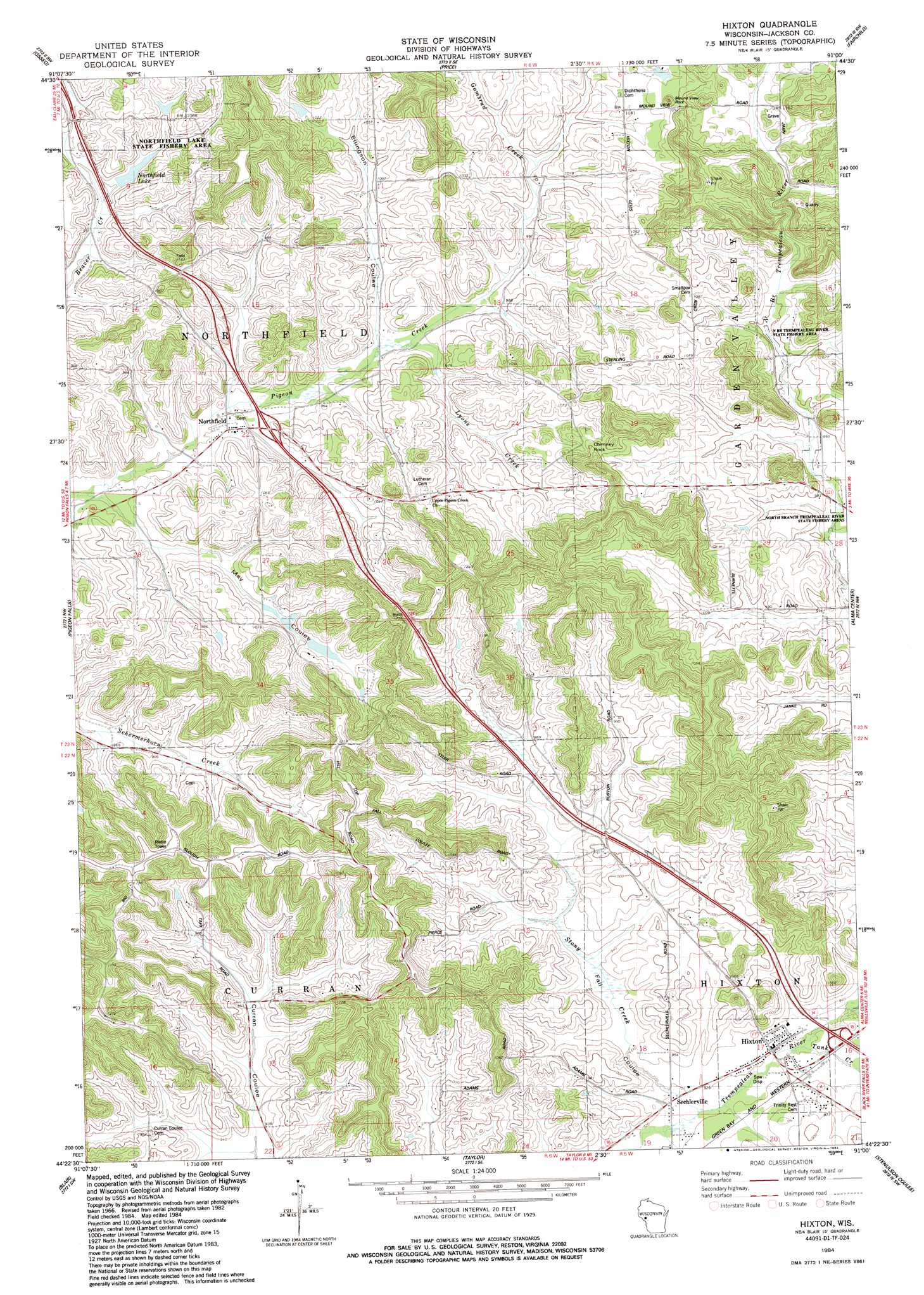
Hixton Topo Map Wisconsin
To zoom in, hover over the map of Hixton
USGS Topo Quad 44091d1 - 1:24,000 scale
| Topo Map Name: | Hixton |
| USGS Topo Quad ID: | 44091d1 |
| Print Size: | ca. 21 1/4" wide x 27" high |
| Southeast Coordinates: | 44.375° N latitude / 91° W longitude |
| Map Center Coordinates: | 44.4375° N latitude / 91.0625° W longitude |
| U.S. State: | WI |
| Filename: | o44091d1.jpg |
| Download Map JPG Image: | Hixton topo map 1:24,000 scale |
| Map Type: | Topographic |
| Topo Series: | 7.5´ |
| Map Scale: | 1:24,000 |
| Source of Map Images: | United States Geological Survey (USGS) |
| Alternate Map Versions: |
Hixton WI 1984, updated 1984 Download PDF Buy paper map Hixton WI 2010 Download PDF Buy paper map Hixton WI 2013 Download PDF Buy paper map Hixton WI 2015 Download PDF Buy paper map |
1:24,000 Topo Quads surrounding Hixton
Brackett |
Augusta West |
Augusta East |
Horse Creek |
Rock Dam Lake |
Strum Se |
Osseo |
Price |
Fairchild |
Wildcat Mound |
Pleasantville |
Pigeon Falls |
Hixton |
Alma Center |
Merrillan |
Whitehall |
Blair |
Taylor |
Stenulson Coulee |
Black River Falls |
Ettrick |
Hegg |
North Bend Ne |
Melrose |
Shamrock |
> Back to 44091a1 at 1:100,000 scale
> Back to 44090a1 at 1:250,000 scale
> Back to U.S. Topo Maps home
Hixton topo map: Gazetteer
Hixton: Dams
Beaver Creek Dam elevation 293m 961′Marantha Discipleship Center H1240 Dam elevation 331m 1085′
Hixton: Populated Places
Hixton elevation 281m 921′Northfield elevation 290m 951′
Hixton: Reservoirs
Northfield Lake elevation 296m 971′Northfield Lake 1 elevation 293m 961′
Hixton: Streams
Gomsrud Creek elevation 297m 974′Holmes Creek elevation 279m 915′
Lyons Creek elevation 291m 954′
Sands Creek elevation 280m 918′
Stony Creek elevation 279m 915′
Tank Creek elevation 280m 918′
Hixton: Summits
Chimney Rock elevation 338m 1108′Mound View Rock elevation 340m 1115′
Hixton: Valleys
Ellingson Coulee elevation 291m 954′Fall Coulee elevation 280m 918′
May Coulee elevation 286m 938′
West Curran Coulee elevation 281m 921′
Hixton digital topo map on disk
Buy this Hixton topo map showing relief, roads, GPS coordinates and other geographical features, as a high-resolution digital map file on DVD: