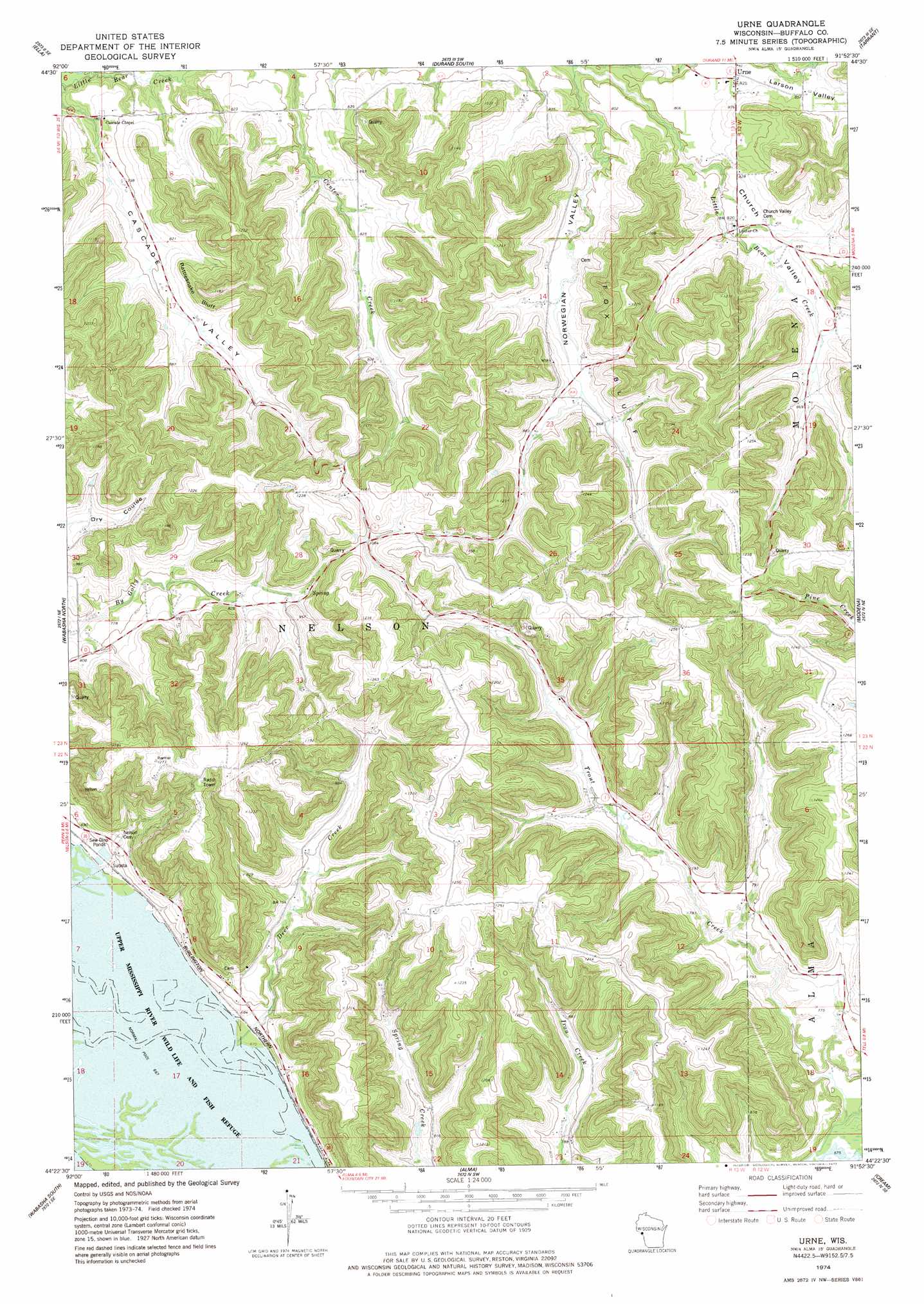
Urne Topo Map Wisconsin
To zoom in, hover over the map of Urne
USGS Topo Quad 44091d8 - 1:24,000 scale
| Topo Map Name: | Urne |
| USGS Topo Quad ID: | 44091d8 |
| Print Size: | ca. 21 1/4" wide x 27" high |
| Southeast Coordinates: | 44.375° N latitude / 91.875° W longitude |
| Map Center Coordinates: | 44.4375° N latitude / 91.9375° W longitude |
| U.S. State: | WI |
| Filename: | o44091d8.jpg |
| Download Map JPG Image: | Urne topo map 1:24,000 scale |
| Map Type: | Topographic |
| Topo Series: | 7.5´ |
| Map Scale: | 1:24,000 |
| Source of Map Images: | United States Geological Survey (USGS) |
| Alternate Map Versions: |
Urne WI 1974, updated 1977 Download PDF Buy paper map Urne WI 2010 Download PDF Buy paper map Urne WI 2013 Download PDF Buy paper map Urne WI 2015 Download PDF Buy paper map |
1:24,000 Topo Quads surrounding Urne
Plum City |
Arkansaw |
Durand North |
Meridean |
Rock Falls |
Nerike Hill |
Ella |
Durand South |
Tarrant |
Mondovi |
Pepin |
Wabasha North |
Urne |
Modena |
Gilmanton |
Theilman |
Wabasha South |
Alma |
Cream |
Waumandee |
Plainview |
Beaver |
Weaver |
Cochrane |
Fountain City |
> Back to 44091a1 at 1:100,000 scale
> Back to 44090a1 at 1:250,000 scale
> Back to U.S. Topo Maps home
Urne topo map: Gazetteer
Urne: Cliffs
Fox Bluff elevation 312m 1023′Rattlesnake Bluff elevation 286m 938′
Urne: Dams
South Nelson 1 D6519.1 Dam elevation 233m 764′Urne: Populated Places
Urne elevation 251m 823′Urne: Reservoirs
1.8 Reservoir elevation 233m 764′Urne: Streams
Deer Creek elevation 203m 666′North Branch Little Bear Creek elevation 234m 767′
Urne: Valleys
Cascade Valley elevation 226m 741′Church Valley elevation 248m 813′
Larson Valley elevation 254m 833′
Norwegian Valley elevation 237m 777′
Urne digital topo map on disk
Buy this Urne topo map showing relief, roads, GPS coordinates and other geographical features, as a high-resolution digital map file on DVD: