Cleghorn Topo Map Wisconsin
To zoom in, hover over the map of Cleghorn
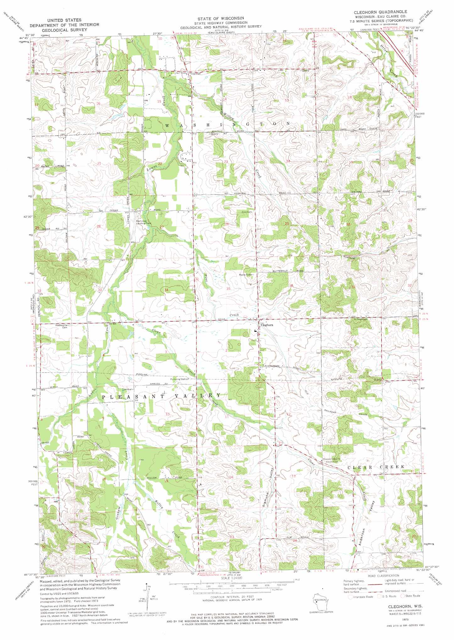
USGS Topo Quad 44091f4 - 1:24,000 scale
| Topo Map Name: | Cleghorn |
| USGS Topo Quad ID: | 44091f4 |
| Print Size: | ca. 21 1/4" wide x 27" high |
| Southeast Coordinates: | 44.625° N latitude / 91.375° W longitude |
| Map Center Coordinates: | 44.6875° N latitude / 91.4375° W longitude |
| U.S. State: | WI |
| Filename: | o44091f4.jpg |
| Download Map JPG Image: | Cleghorn topo map 1:24,000 scale |
| Map Type: | Topographic |
| Topo Series: | 7.5´ |
| Map Scale: | 1:24,000 |
| Source of Map Images: | United States Geological Survey (USGS) |
| Alternate Map Versions: |
Cleghorn WI 1973, updated 1975 Download PDF Buy paper map Cleghorn WI 2010 Download PDF Buy paper map Cleghorn WI 2013 Download PDF Buy paper map Cleghorn WI 2015 Download PDF Buy paper map |
1:24,000 Topo Quads surrounding Cleghorn
Colfax South |
Albertville |
Chippewa Falls |
Lake Wissota |
Cadott |
Elk Creek Lake |
Eau Claire West |
Eau Claire East |
Fall Creek |
Lake Eau Claire West |
Rock Falls |
Mondovi Ne |
Cleghorn |
Brackett |
Augusta West |
Mondovi |
Rossman Creek |
Strum |
Strum Se |
Osseo |
Gilmanton |
Lookout |
Elk Creek |
Pleasantville |
Pigeon Falls |
> Back to 44091e1 at 1:100,000 scale
> Back to 44090a1 at 1:250,000 scale
> Back to U.S. Topo Maps home
Cleghorn topo map: Gazetteer
Cleghorn: Airports
Carlson Airport elevation 277m 908′Mertinkes Airport elevation 275m 902′
Cleghorn: Populated Places
Cleghorn elevation 293m 961′Cleghorn: Streams
Clear Creek elevation 280m 918′Graham Creek elevation 286m 938′
Kelley Creek elevation 291m 954′
Pine Creek elevation 274m 898′
Schoolhouse Creek elevation 298m 977′
Willow Creek elevation 261m 856′
Cleghorn: Valleys
Anderson Valley elevation 298m 977′Sigmund Valley elevation 298m 977′
Cleghorn digital topo map on disk
Buy this Cleghorn topo map showing relief, roads, GPS coordinates and other geographical features, as a high-resolution digital map file on DVD: