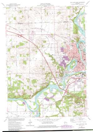
Eau Claire West Topo Map Wisconsin
To zoom in, hover over the map of Eau Claire West
USGS Topo Quad 44091g5 - 1:24,000 scale
| Topo Map Name: | Eau Claire West |
| USGS Topo Quad ID: | 44091g5 |
| Print Size: | ca. 21 1/4" wide x 27" high |
| Southeast Coordinates: | 44.75° N latitude / 91.5° W longitude |
| Map Center Coordinates: | 44.8125° N latitude / 91.5625° W longitude |
| U.S. State: | WI |
| Filename: | o44091g5.jpg |
| Download Map JPG Image: | Eau Claire West topo map 1:24,000 scale |
| Map Type: | Topographic |
| Topo Series: | 7.5´ |
| Map Scale: | 1:24,000 |
| Source of Map Images: | United States Geological Survey (USGS) |
| Alternate Map Versions: |
Eau Claire West WI 1972, updated 1975 Download PDF Buy paper map Eau Claire West WI 1972, updated 1983 Download PDF Buy paper map Eau Claire West WI 2010 Download PDF Buy paper map Eau Claire West WI 2013 Download PDF Buy paper map Eau Claire West WI 2015 Download PDF Buy paper map |
1:24,000 Topo Quads surrounding Eau Claire West
> Back to 44091e1 at 1:100,000 scale
> Back to 44090a1 at 1:250,000 scale
> Back to U.S. Topo Maps home
Eau Claire West topo map: Gazetteer
Eau Claire West: Airports
Luther Hospital Heliport elevation 242m 793′Eau Claire West: Beaches
Half Moon Beach elevation 235m 770′Eau Claire West: Dams
Dells 1907C35 Dam elevation 237m 777′Dells Dam elevation 233m 764′
Half Moon Lake H 364 Dam elevation 233m 764′
Eau Claire West: Lakes
Cooley Lake elevation 230m 754′Halfmoon Lake elevation 233m 764′
Eau Claire West: Parks
Cameron Park Playground elevation 267m 875′Carson Park elevation 248m 813′
Gypsy Park elevation 270m 885′
Halfmoon Park elevation 241m 790′
Hobart Playground elevation 241m 790′
Kaiser Field elevation 236m 774′
Kessler Field elevation 246m 807′
Mount Simon Park elevation 248m 813′
Newall Playground elevation 237m 777′
Randall Park elevation 241m 790′
Randall Playground elevation 238m 780′
Rod and Gun Park elevation 243m 797′
Roosevelt Playground elevation 268m 879′
Sherman Creek Park elevation 259m 849′
Eau Claire West: Populated Places
Berghs Mobile Home Park elevation 273m 895′Lufkin elevation 237m 777′
Oak Ridge Village Mobile Home Park elevation 238m 780′
Pine Edge Mobile Home Park elevation 245m 803′
Shawtown elevation 240m 787′
Truax elevation 273m 895′
Union elevation 277m 908′
Eau Claire West: Post Offices
Eau Claire Post Office elevation 239m 784′Eau Claire West: Reservoirs
Big Dells Pond 5752 elevation 237m 777′Dells Pond elevation 240m 787′
Half Moon Lake 2.54 elevation 233m 764′
Eau Claire West: Springs
Silver Spring elevation 250m 820′Eau Claire West: Streams
Eau Claire River elevation 232m 761′Little Niagara Creek elevation 236m 774′
Lowes Creek elevation 229m 751′
Sherman Creek elevation 229m 751′
Taylor Creek elevation 231m 757′
Eau Claire West: Summits
Mount Simon elevation 289m 948′Mount Washington elevation 305m 1000′
Eau Claire West digital topo map on disk
Buy this Eau Claire West topo map showing relief, roads, GPS coordinates and other geographical features, as a high-resolution digital map file on DVD:


