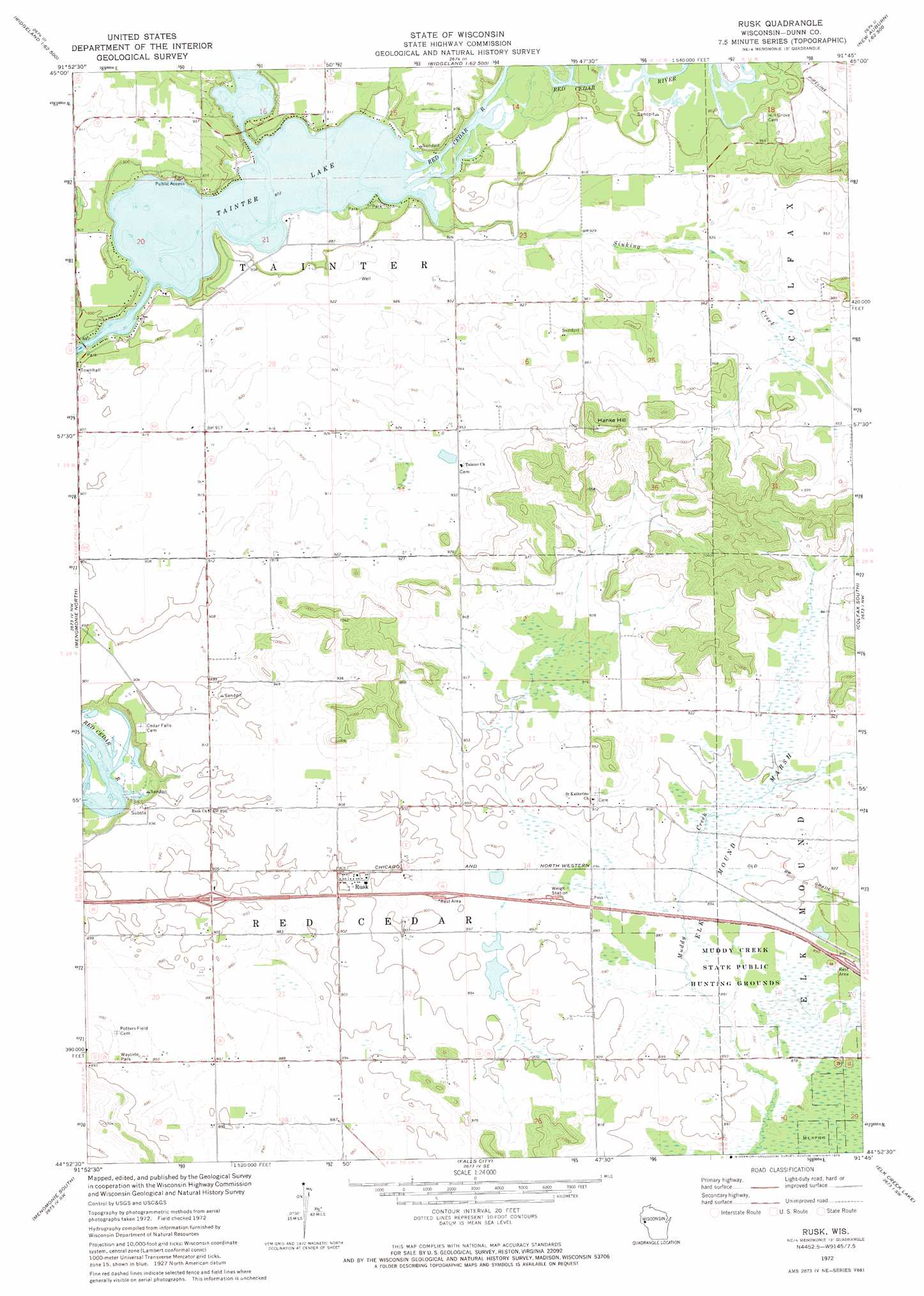
Rusk Topo Map Wisconsin
To zoom in, hover over the map of Rusk
USGS Topo Quad 44091h7 - 1:24,000 scale
| Topo Map Name: | Rusk |
| USGS Topo Quad ID: | 44091h7 |
| Print Size: | ca. 21 1/4" wide x 27" high |
| Southeast Coordinates: | 44.875° N latitude / 91.75° W longitude |
| Map Center Coordinates: | 44.9375° N latitude / 91.8125° W longitude |
| U.S. State: | WI |
| Filename: | o44091h7.jpg |
| Download Map JPG Image: | Rusk topo map 1:24,000 scale |
| Map Type: | Topographic |
| Topo Series: | 7.5´ |
| Map Scale: | 1:24,000 |
| Source of Map Images: | United States Geological Survey (USGS) |
| Alternate Map Versions: |
Rusk WI 1972, updated 1975 Download PDF Buy paper map Rusk WI 2010 Download PDF Buy paper map Rusk WI 2013 Download PDF Buy paper map Rusk WI 2015 Download PDF Buy paper map |
1:24,000 Topo Quads surrounding Rusk
Connorsville |
Ridgeland |
Ridgeland Ne |
Sand Creek |
New Auburn |
Boyceville |
Wheeler |
Norton |
Colfax North |
Como Creek |
Knapp |
Menomonie North |
Rusk |
Colfax South |
Albertville |
Weston |
Menomonie South |
Falls City |
Elk Creek Lake |
Eau Claire West |
Arkansaw |
Durand North |
Meridean |
Rock Falls |
Mondovi Ne |
> Back to 44091e1 at 1:100,000 scale
> Back to 44090a1 at 1:250,000 scale
> Back to U.S. Topo Maps home
Rusk topo map: Gazetteer
Rusk: Airports
Score Field elevation 270m 885′Rusk: Areas
Sherbourne Prairie elevation 275m 902′Rusk: Parks
Muddy Creek State Public Hunting Grounds elevation 267m 875′Rusk: Populated Places
Rusk elevation 274m 898′Tainter Lake elevation 266m 872′
Rusk: Post Offices
Rusk Post Office (historical) elevation 274m 898′Rusk: Streams
Sinking Creek elevation 281m 921′Rusk: Summits
Hanke Hill elevation 341m 1118′Rusk: Swamps
Elk Mound Marsh elevation 274m 898′Rusk digital topo map on disk
Buy this Rusk topo map showing relief, roads, GPS coordinates and other geographical features, as a high-resolution digital map file on DVD: