Chester Topo Map Minnesota
To zoom in, hover over the map of Chester
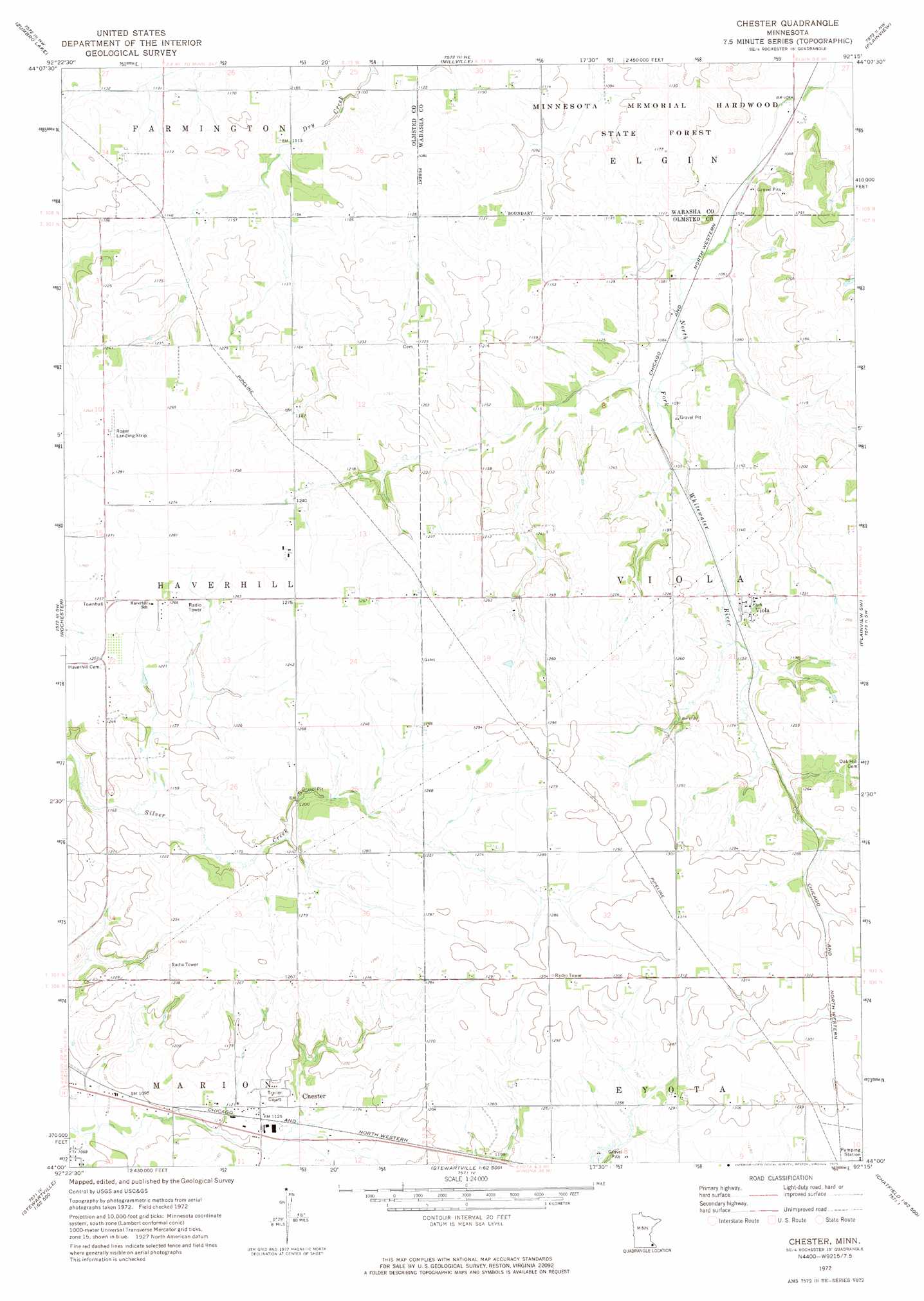
USGS Topo Quad 44092a3 - 1:24,000 scale
| Topo Map Name: | Chester |
| USGS Topo Quad ID: | 44092a3 |
| Print Size: | ca. 21 1/4" wide x 27" high |
| Southeast Coordinates: | 44° N latitude / 92.25° W longitude |
| Map Center Coordinates: | 44.0625° N latitude / 92.3125° W longitude |
| U.S. State: | MN |
| Filename: | o44092a3.jpg |
| Download Map JPG Image: | Chester topo map 1:24,000 scale |
| Map Type: | Topographic |
| Topo Series: | 7.5´ |
| Map Scale: | 1:24,000 |
| Source of Map Images: | United States Geological Survey (USGS) |
| Alternate Map Versions: |
Chester MN 1972, updated 1975 Download PDF Buy paper map Chester MN 2010 Download PDF Buy paper map Chester MN 2013 Download PDF Buy paper map Chester MN 2016 Download PDF Buy paper map |
1:24,000 Topo Quads surrounding Chester
Mazeppa |
Zumbro Falls |
West Albany |
Theilman |
Wabasha South |
Oronoco |
Zumbro Lake |
Millville |
Plainview |
Beaver |
Douglas |
Rochester |
Chester |
Plainview Sw |
Elba |
Salem Corners |
Simpson |
Marion |
Eyota |
Saint Charles |
High Forest |
Stewartville |
Washington |
Chatfield |
Pilot Mound |
> Back to 44092a1 at 1:100,000 scale
> Back to 44092a1 at 1:250,000 scale
> Back to U.S. Topo Maps home
Chester topo map: Gazetteer
Chester: Airports
Rogers Landing Field elevation 389m 1276′Chester: Dams
Dresser Valley Watershed Dam elevation 382m 1253′Chester: Populated Places
Chester elevation 346m 1135′Viola elevation 353m 1158′
Chester: Post Offices
Chester Post Office (historical) elevation 346m 1135′Viola Post Office elevation 353m 1158′
Chester digital topo map on disk
Buy this Chester topo map showing relief, roads, GPS coordinates and other geographical features, as a high-resolution digital map file on DVD: