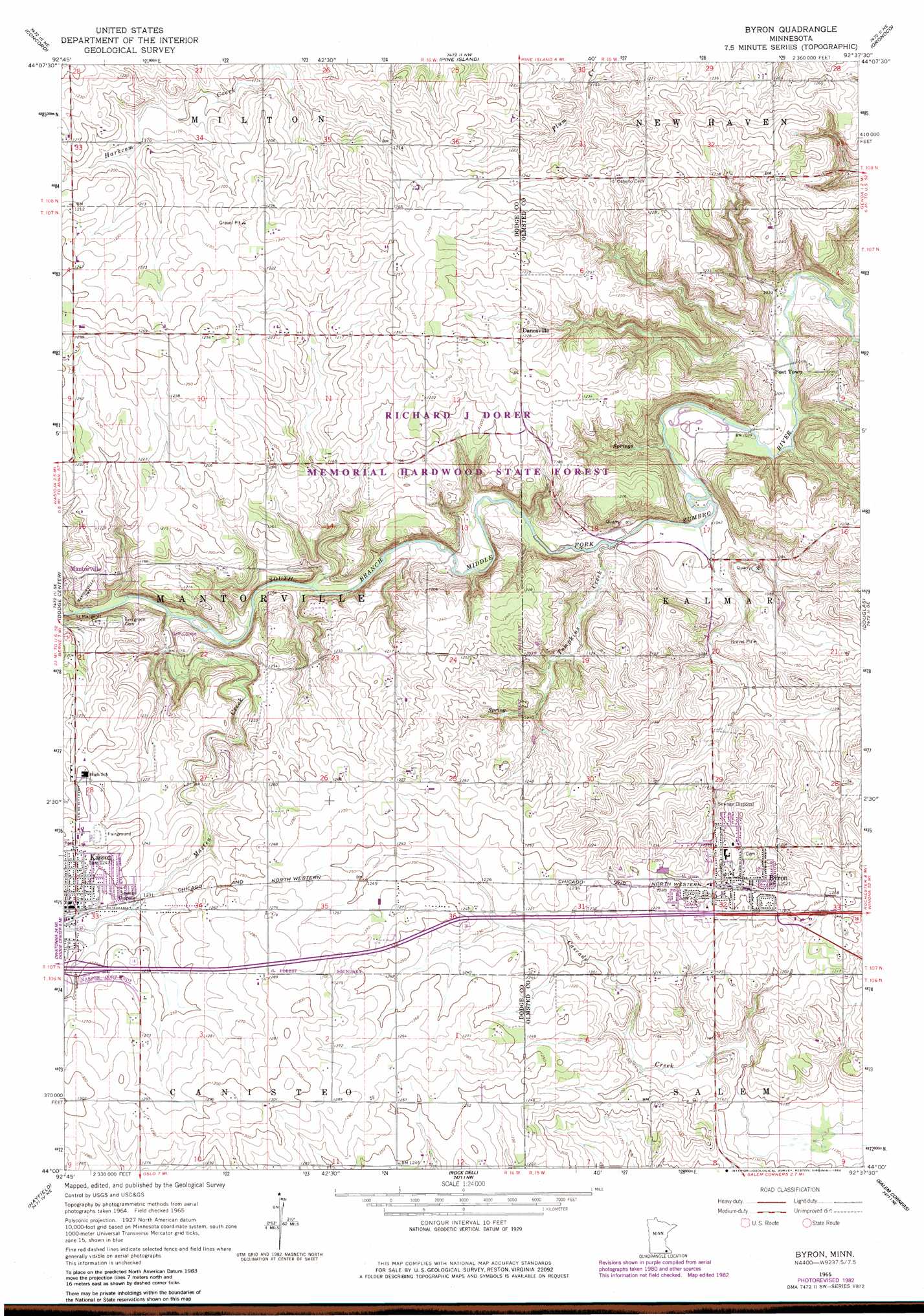
Byron Topo Map Minnesota
To zoom in, hover over the map of Byron
USGS Topo Quad 44092a6 - 1:24,000 scale
| Topo Map Name: | Byron |
| USGS Topo Quad ID: | 44092a6 |
| Print Size: | ca. 21 1/4" wide x 27" high |
| Southeast Coordinates: | 44° N latitude / 92.625° W longitude |
| Map Center Coordinates: | 44.0625° N latitude / 92.6875° W longitude |
| U.S. State: | MN |
| Filename: | o44092a6.jpg |
| Download Map JPG Image: | Byron topo map 1:24,000 scale |
| Map Type: | Topographic |
| Topo Series: | 7.5´ |
| Map Scale: | 1:24,000 |
| Source of Map Images: | United States Geological Survey (USGS) |
| Alternate Map Versions: |
Byron MN 1965, updated 1967 Download PDF Buy paper map Byron MN 1965, updated 1983 Download PDF Buy paper map Byron MN 2010 Download PDF Buy paper map Byron MN 2013 Download PDF Buy paper map Byron MN 2016 Download PDF Buy paper map |
1:24,000 Topo Quads surrounding Byron
Kenyon |
Wanamingo |
Zumbrota |
Mazeppa |
Zumbro Falls |
West Concord |
Concord |
Pine Island |
Oronoco |
Zumbro Lake |
Claremont |
Dodge Center |
Byron |
Douglas |
Rochester |
Hayfield Nw |
Hayfield |
Rock Dell |
Salem Corners |
Simpson |
Waltham |
Sargeant |
High Forest Sw |
High Forest |
Stewartville |
> Back to 44092a1 at 1:100,000 scale
> Back to 44092a1 at 1:250,000 scale
> Back to U.S. Topo Maps home
Byron topo map: Gazetteer
Byron: Parks
Oxbow Park elevation 317m 1040′Byron: Populated Places
Byron elevation 383m 1256′Danesville elevation 374m 1227′
Post Town elevation 315m 1033′
Byron: Post Offices
Byron Post Office elevation 382m 1253′Kasson Post Office elevation 381m 1250′
Byron: Streams
Masten Creek elevation 336m 1102′Tompkins Creek elevation 318m 1043′
Byron digital topo map on disk
Buy this Byron topo map showing relief, roads, GPS coordinates and other geographical features, as a high-resolution digital map file on DVD: