West Albany Topo Map Minnesota
To zoom in, hover over the map of West Albany
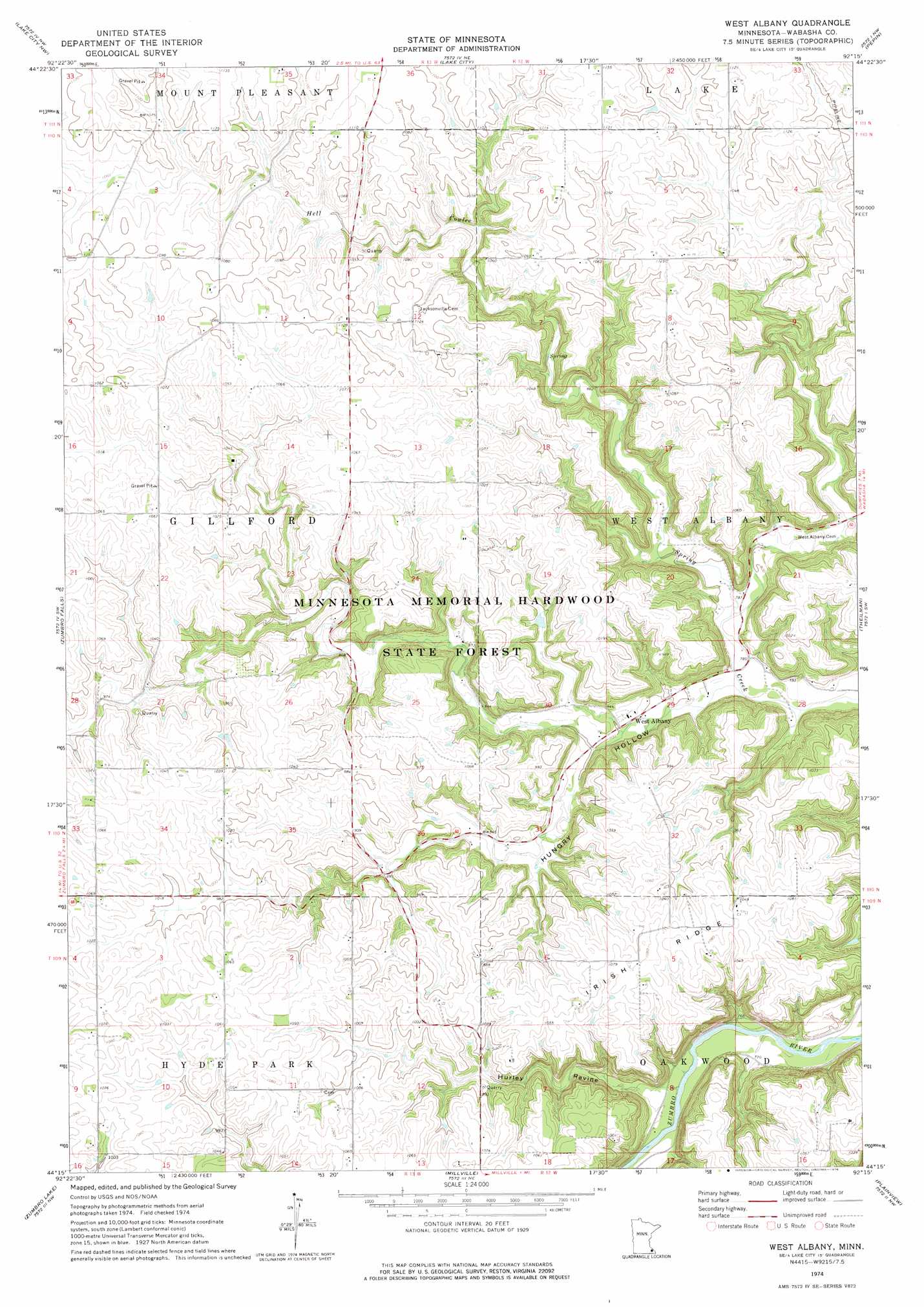
USGS Topo Quad 44092c3 - 1:24,000 scale
| Topo Map Name: | West Albany |
| USGS Topo Quad ID: | 44092c3 |
| Print Size: | ca. 21 1/4" wide x 27" high |
| Southeast Coordinates: | 44.25° N latitude / 92.25° W longitude |
| Map Center Coordinates: | 44.3125° N latitude / 92.3125° W longitude |
| U.S. State: | MN |
| Filename: | o44092c3.jpg |
| Download Map JPG Image: | West Albany topo map 1:24,000 scale |
| Map Type: | Topographic |
| Topo Series: | 7.5´ |
| Map Scale: | 1:24,000 |
| Source of Map Images: | United States Geological Survey (USGS) |
| Alternate Map Versions: |
West Albany MN 1974, updated 1976 Download PDF Buy paper map West Albany MN 2010 Download PDF Buy paper map West Albany MN 2013 Download PDF Buy paper map West Albany MN 2016 Download PDF Buy paper map |
1:24,000 Topo Quads surrounding West Albany
Red Wing |
Bay City |
Maiden Rock |
Nerike Hill |
Ella |
Goodhue East |
Lake City Nw |
Lake City |
Pepin |
Wabasha North |
Mazeppa |
Zumbro Falls |
West Albany |
Theilman |
Wabasha South |
Oronoco |
Zumbro Lake |
Millville |
Plainview |
Beaver |
Douglas |
Rochester |
Chester |
Plainview Sw |
Elba |
> Back to 44092a1 at 1:100,000 scale
> Back to 44092a1 at 1:250,000 scale
> Back to U.S. Topo Maps home
West Albany topo map: Gazetteer
West Albany: Dams
L Myers Dam elevation 271m 889′West Albany: Populated Places
West Albany elevation 249m 816′West Albany: Post Offices
West Albany Post Office (historical) elevation 250m 820′West Albany: Ridges
Irish Ridge elevation 330m 1082′West Albany: Valleys
Hell Coulee elevation 291m 954′Hungry Hollow elevation 234m 767′
Hurley Ravine elevation 229m 751′
West Albany digital topo map on disk
Buy this West Albany topo map showing relief, roads, GPS coordinates and other geographical features, as a high-resolution digital map file on DVD: