Kenyon Topo Map Minnesota
To zoom in, hover over the map of Kenyon
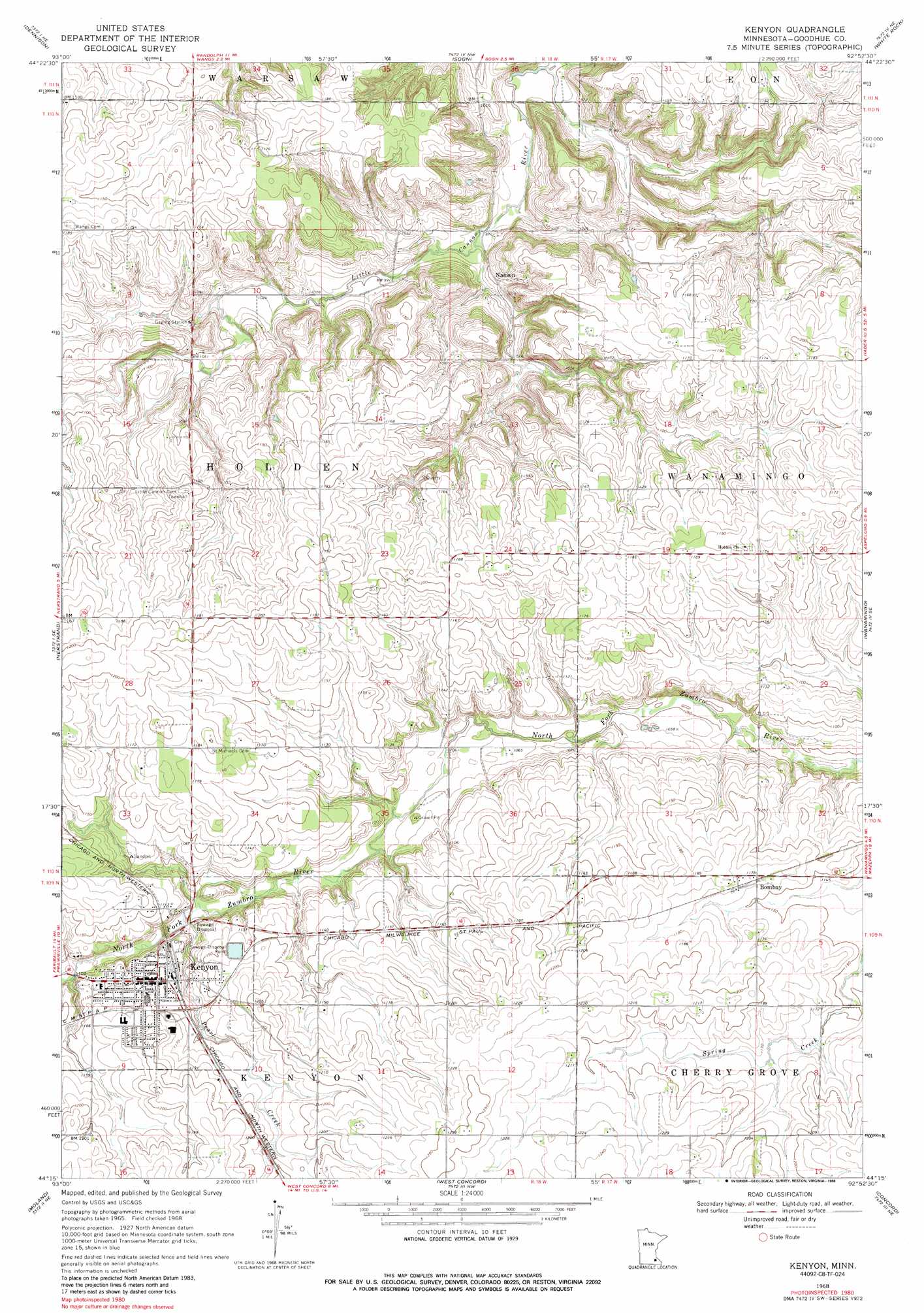
USGS Topo Quad 44092c8 - 1:24,000 scale
| Topo Map Name: | Kenyon |
| USGS Topo Quad ID: | 44092c8 |
| Print Size: | ca. 21 1/4" wide x 27" high |
| Southeast Coordinates: | 44.25° N latitude / 92.875° W longitude |
| Map Center Coordinates: | 44.3125° N latitude / 92.9375° W longitude |
| U.S. State: | MN |
| Filename: | o44092c8.jpg |
| Download Map JPG Image: | Kenyon topo map 1:24,000 scale |
| Map Type: | Topographic |
| Topo Series: | 7.5´ |
| Map Scale: | 1:24,000 |
| Source of Map Images: | United States Geological Survey (USGS) |
| Alternate Map Versions: |
Kenyon MN 1968, updated 1970 Download PDF Buy paper map Kenyon MN 1968, updated 1988 Download PDF Buy paper map Kenyon MN 2010 Download PDF Buy paper map Kenyon MN 2013 Download PDF Buy paper map Kenyon MN 2016 Download PDF Buy paper map |
1:24,000 Topo Quads surrounding Kenyon
Castle Rock |
Randolph |
Cannon Falls |
Miesville |
Welch |
Northfield |
Dennison |
Sogn |
White Rock |
Goodhue West |
Cannon City |
Nerstrand |
Kenyon |
Wanamingo |
Zumbrota |
Medford East |
Moland |
West Concord |
Concord |
Pine Island |
Owatonna |
Owatonna Se |
Claremont |
Dodge Center |
Byron |
> Back to 44092a1 at 1:100,000 scale
> Back to 44092a1 at 1:250,000 scale
> Back to U.S. Topo Maps home
Kenyon topo map: Gazetteer
Kenyon: Airports
Kenyon Heliport elevation 351m 1151′Kenyon: Populated Places
Bombay elevation 357m 1171′Kenyon elevation 352m 1154′
Nansen elevation 306m 1003′
Kenyon: Post Offices
Kenyon Post Office elevation 352m 1154′Nansen Post Office (historical) elevation 307m 1007′
Kenyon: Streams
Pearl Creek elevation 329m 1079′Kenyon digital topo map on disk
Buy this Kenyon topo map showing relief, roads, GPS coordinates and other geographical features, as a high-resolution digital map file on DVD: