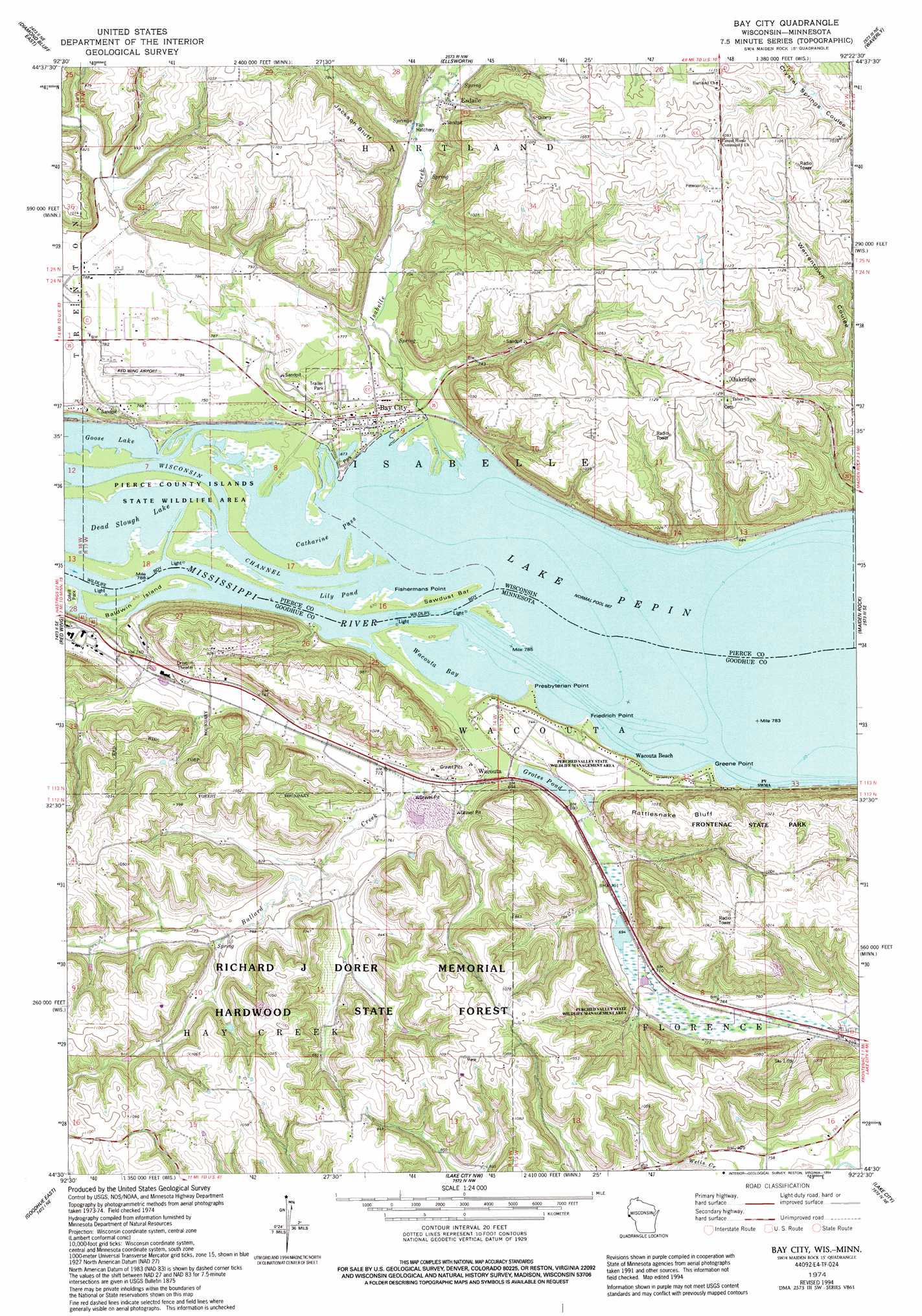
Bay City Topo Map Minnesota
To zoom in, hover over the map of Bay City
USGS Topo Quad 44092e4 - 1:24,000 scale
| Topo Map Name: | Bay City |
| USGS Topo Quad ID: | 44092e4 |
| Print Size: | ca. 21 1/4" wide x 27" high |
| Southeast Coordinates: | 44.5° N latitude / 92.375° W longitude |
| Map Center Coordinates: | 44.5625° N latitude / 92.4375° W longitude |
| U.S. States: | MN, WI |
| Filename: | o44092e4.jpg |
| Download Map JPG Image: | Bay City topo map 1:24,000 scale |
| Map Type: | Topographic |
| Topo Series: | 7.5´ |
| Map Scale: | 1:24,000 |
| Source of Map Images: | United States Geological Survey (USGS) |
| Alternate Map Versions: |
Bay City WI 1974, updated 1978 Download PDF Buy paper map Bay City WI 1974, updated 1994 Download PDF Buy paper map Bay City WI 2010 Download PDF Buy paper map Bay City WI 2013 Download PDF Buy paper map Bay City WI 2015 Download PDF Buy paper map |
1:24,000 Topo Quads surrounding Bay City
River Falls West |
River Falls East |
Martell |
El Paso |
Spring Valley |
Diamond Bluff West |
Diamond Bluff East |
Ellsworth |
Waverly |
Plum City |
Welch |
Red Wing |
Bay City |
Maiden Rock |
Nerike Hill |
Goodhue West |
Goodhue East |
Lake City Nw |
Lake City |
Pepin |
Zumbrota |
Mazeppa |
Zumbro Falls |
West Albany |
Theilman |
> Back to 44092e1 at 1:100,000 scale
> Back to 44092a1 at 1:250,000 scale
> Back to U.S. Topo Maps home
Bay City topo map: Gazetteer
Bay City: Airports
Red Wing Municipal Airport elevation 238m 780′Bay City: Bars
Sawdust Bar elevation 204m 669′Bay City: Bays
Goose Lake elevation 204m 669′Lily Pond elevation 204m 669′
Wacouta Bay elevation 204m 669′
Bay City: Capes
Fishermans Point elevation 204m 669′Friedrich Point elevation 206m 675′
Greene Point elevation 207m 679′
Bay City: Channels
Catharine Pass elevation 204m 669′Bay City: Cliffs
Jackson Bluff elevation 261m 856′Rattlesnake Bluff elevation 315m 1033′
Bay City: Dams
Henry Henricks Dam elevation 249m 816′Bay City: Forests
Richard J Dorer Memorial Hardwood State Forest elevation 307m 1007′Bay City: Islands
Baldwin Island elevation 204m 669′Bay City: Lakes
Dead Slough Lake elevation 204m 669′Grotes Pond elevation 208m 682′
Bay City: Parks
Hedin Island Park elevation 205m 672′Minnesota State Training School Entrance Walls elevation 228m 748′
Bay City: Populated Places
Bay City elevation 210m 688′Esdaile elevation 227m 744′
Oak Hill Mobile Home Park elevation 227m 744′
Oakridge elevation 339m 1112′
Wacouta elevation 218m 715′
Wacouta Beach elevation 225m 738′
Bay City: Streams
Bullard Creek elevation 204m 669′Isabelle Creek elevation 204m 669′
Bay City digital topo map on disk
Buy this Bay City topo map showing relief, roads, GPS coordinates and other geographical features, as a high-resolution digital map file on DVD: