Plum City Topo Map Wisconsin
To zoom in, hover over the map of Plum City
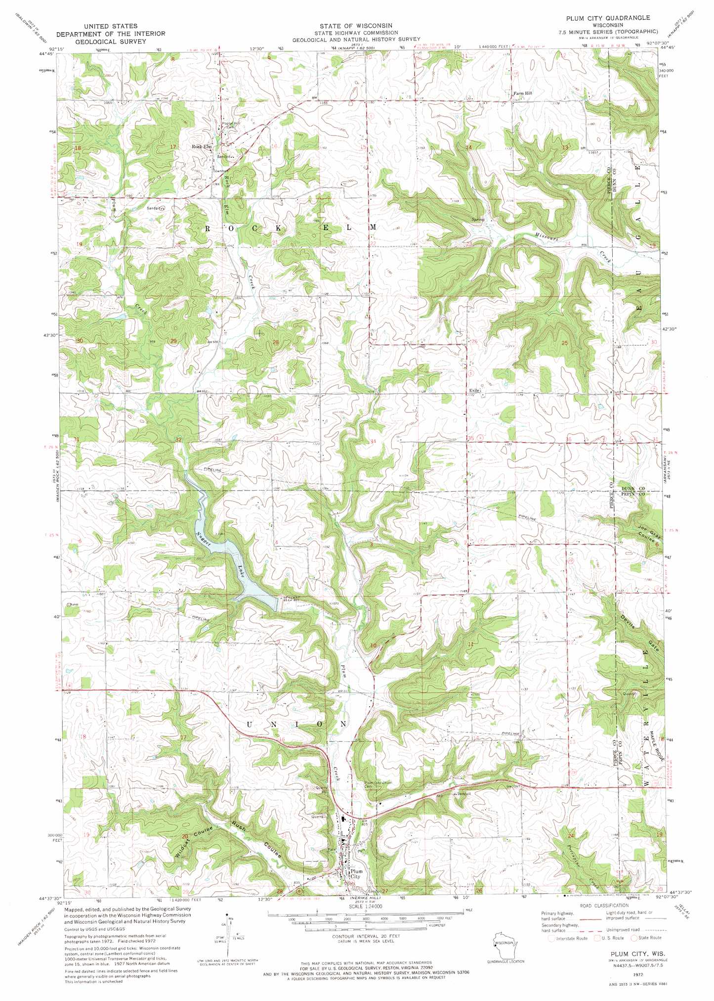
USGS Topo Quad 44092f2 - 1:24,000 scale
| Topo Map Name: | Plum City |
| USGS Topo Quad ID: | 44092f2 |
| Print Size: | ca. 21 1/4" wide x 27" high |
| Southeast Coordinates: | 44.625° N latitude / 92.125° W longitude |
| Map Center Coordinates: | 44.6875° N latitude / 92.1875° W longitude |
| U.S. State: | WI |
| Filename: | o44092f2.jpg |
| Download Map JPG Image: | Plum City topo map 1:24,000 scale |
| Map Type: | Topographic |
| Topo Series: | 7.5´ |
| Map Scale: | 1:24,000 |
| Source of Map Images: | United States Geological Survey (USGS) |
| Alternate Map Versions: |
Plum City WI 1972, updated 1975 Download PDF Buy paper map Plum City WI 2010 Download PDF Buy paper map Plum City WI 2013 Download PDF Buy paper map Plum City WI 2015 Download PDF Buy paper map |
1:24,000 Topo Quads surrounding Plum City
Baldwin West |
Baldwin East |
Wilson |
Knapp |
Menomonie North |
Martell |
El Paso |
Spring Valley |
Weston |
Menomonie South |
Ellsworth |
Waverly |
Plum City |
Arkansaw |
Durand North |
Bay City |
Maiden Rock |
Nerike Hill |
Ella |
Durand South |
Lake City Nw |
Lake City |
Pepin |
Wabasha North |
Urne |
> Back to 44092e1 at 1:100,000 scale
> Back to 44092a1 at 1:250,000 scale
> Back to U.S. Topo Maps home
Plum City topo map: Gazetteer
Plum City: Dams
Gilles G 9016 Dam elevation 341m 1118′Plum Creek 2 E4499 Dam elevation 271m 889′
Plum Creek 3 E4499 Dam elevation 282m 925′
Plum City: Parks
Plum Creek Woods State Natural Area elevation 283m 928′Plum City: Populated Places
Exile elevation 356m 1167′Plum City elevation 249m 816′
Plum City Trailer Court elevation 253m 830′
Rock Elm elevation 327m 1072′
Plum City: Reservoirs
0.46 Reservoir elevation 341m 1118′2 Reservoir elevation 282m 925′
Nugget Lake elevation 272m 892′
Nugget Lake 18 elevation 271m 889′
Plum City: Streams
Rock Elm Creek elevation 280m 918′Plum City: Valleys
Rush Coulee elevation 251m 823′Wildcat Coulee elevation 271m 889′
Plum City digital topo map on disk
Buy this Plum City topo map showing relief, roads, GPS coordinates and other geographical features, as a high-resolution digital map file on DVD: