Weston Topo Map Wisconsin
To zoom in, hover over the map of Weston
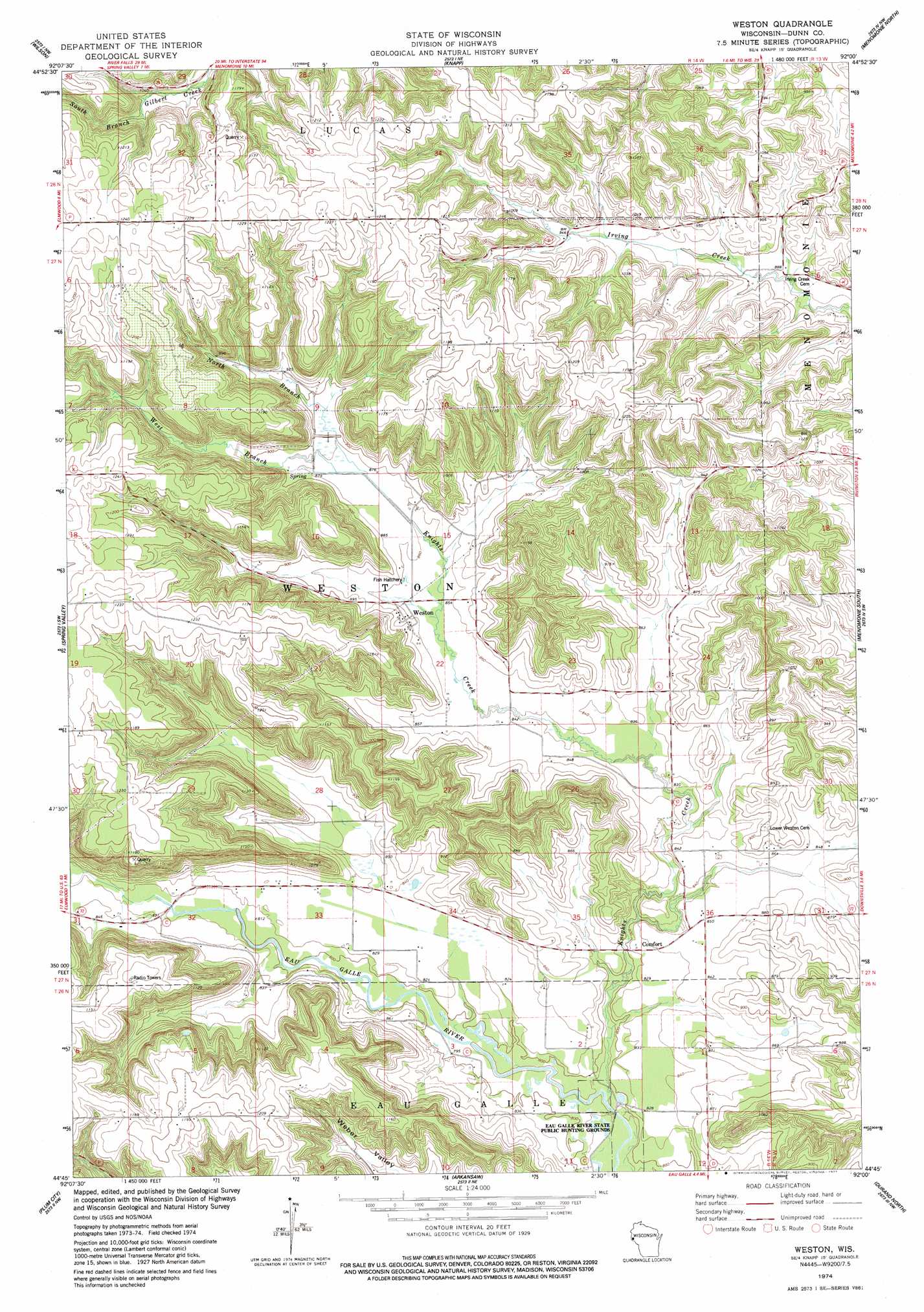
USGS Topo Quad 44092g1 - 1:24,000 scale
| Topo Map Name: | Weston |
| USGS Topo Quad ID: | 44092g1 |
| Print Size: | ca. 21 1/4" wide x 27" high |
| Southeast Coordinates: | 44.75° N latitude / 92° W longitude |
| Map Center Coordinates: | 44.8125° N latitude / 92.0625° W longitude |
| U.S. State: | WI |
| Filename: | o44092g1.jpg |
| Download Map JPG Image: | Weston topo map 1:24,000 scale |
| Map Type: | Topographic |
| Topo Series: | 7.5´ |
| Map Scale: | 1:24,000 |
| Source of Map Images: | United States Geological Survey (USGS) |
| Alternate Map Versions: |
Weston WI 1974, updated 1977 Download PDF Buy paper map Weston WI 2010 Download PDF Buy paper map Weston WI 2013 Download PDF Buy paper map Weston WI 2015 Download PDF Buy paper map |
1:24,000 Topo Quads surrounding Weston
Emerald |
Glenwood City |
Boyceville |
Wheeler |
Norton |
Baldwin East |
Wilson |
Knapp |
Menomonie North |
Rusk |
El Paso |
Spring Valley |
Weston |
Menomonie South |
Falls City |
Waverly |
Plum City |
Arkansaw |
Durand North |
Meridean |
Maiden Rock |
Nerike Hill |
Ella |
Durand South |
Tarrant |
> Back to 44092e1 at 1:100,000 scale
> Back to 44092a1 at 1:250,000 scale
> Back to U.S. Topo Maps home
Weston topo map: Gazetteer
Weston: Dams
Knights Creek 1 E4242 Dam elevation 276m 905′Knights Creek 4 E4242 Dam elevation 275m 902′
Knights Creek 5 E4242 Dam elevation 312m 1023′
Weston: Parks
Eau Galle River State Public Hunting Grounds elevation 234m 767′Weston: Populated Places
Comfort elevation 251m 823′Weston elevation 267m 875′
Weston: Reservoirs
0.60 Reservoir elevation 312m 1023′3.0 Reservoir elevation 275m 902′
3.00 Reservoir elevation 276m 905′
Weston: Streams
Knights Creek elevation 238m 780′North Branch Knights Creek elevation 266m 872′
West Branch Knights Creek elevation 265m 869′
Weston digital topo map on disk
Buy this Weston topo map showing relief, roads, GPS coordinates and other geographical features, as a high-resolution digital map file on DVD: