Baldwin East Topo Map Wisconsin
To zoom in, hover over the map of Baldwin East
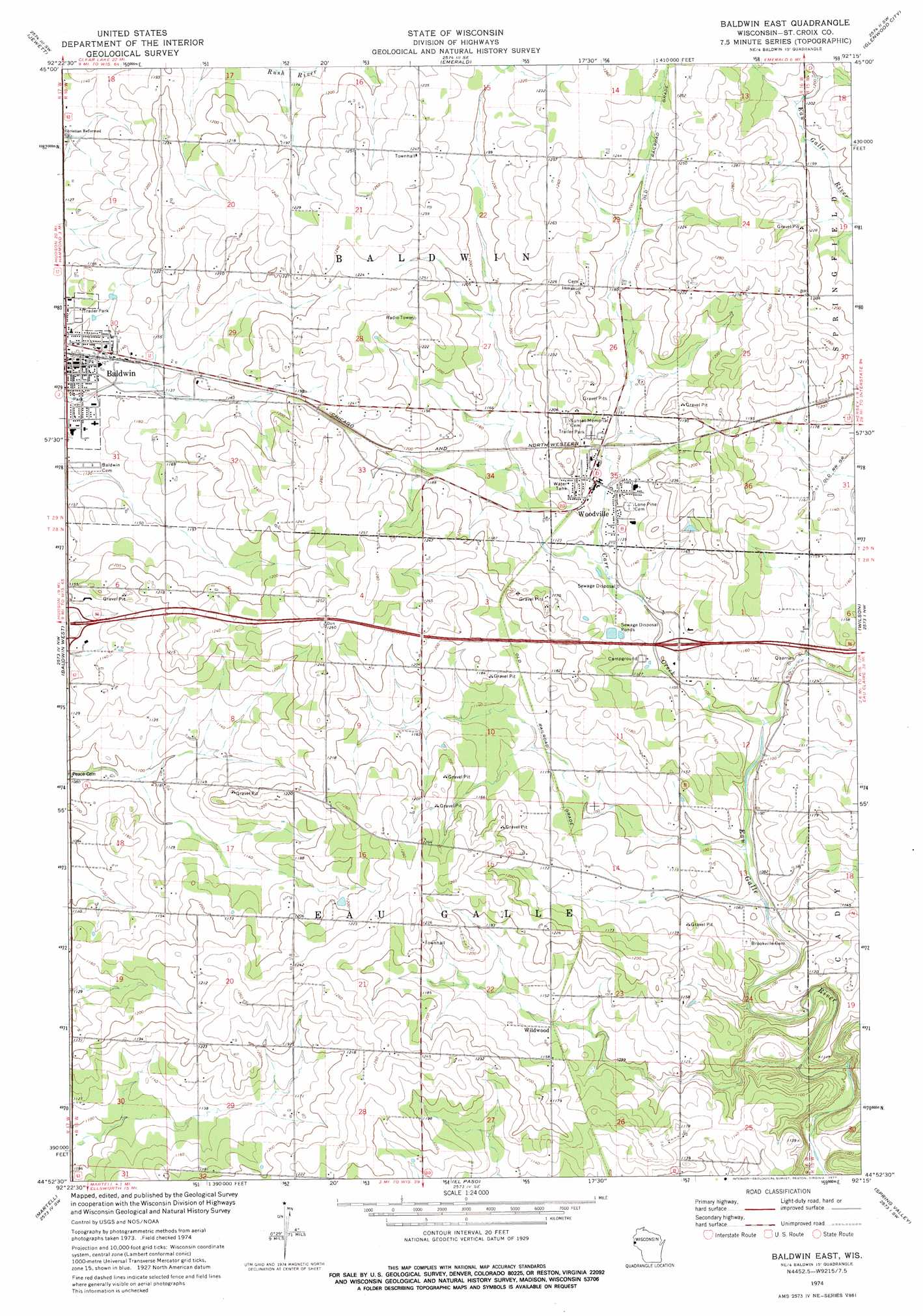
USGS Topo Quad 44092h3 - 1:24,000 scale
| Topo Map Name: | Baldwin East |
| USGS Topo Quad ID: | 44092h3 |
| Print Size: | ca. 21 1/4" wide x 27" high |
| Southeast Coordinates: | 44.875° N latitude / 92.25° W longitude |
| Map Center Coordinates: | 44.9375° N latitude / 92.3125° W longitude |
| U.S. State: | WI |
| Filename: | o44092h3.jpg |
| Download Map JPG Image: | Baldwin East topo map 1:24,000 scale |
| Map Type: | Topographic |
| Topo Series: | 7.5´ |
| Map Scale: | 1:24,000 |
| Source of Map Images: | United States Geological Survey (USGS) |
| Alternate Map Versions: |
Baldwin East WI 1974, updated 1977 Download PDF Buy paper map Baldwin East WI 2010 Download PDF Buy paper map Baldwin East WI 2013 Download PDF Buy paper map Baldwin East WI 2015 Download PDF Buy paper map |
1:24,000 Topo Quads surrounding Baldwin East
New Richmond North |
Deer Park |
Forest |
Graytown |
Connorsville |
New Richmond South |
Jewett |
Emerald |
Glenwood City |
Boyceville |
Roberts |
Baldwin West |
Baldwin East |
Wilson |
Knapp |
River Falls East |
Martell |
El Paso |
Spring Valley |
Weston |
Diamond Bluff East |
Ellsworth |
Waverly |
Plum City |
Arkansaw |
> Back to 44092e1 at 1:100,000 scale
> Back to 44092a1 at 1:250,000 scale
> Back to U.S. Topo Maps home
Baldwin East topo map: Gazetteer
Baldwin East: Airports
Triple D Airport elevation 384m 1259′Baldwin East: Populated Places
Baldwin elevation 343m 1125′Dahl elevation 379m 1243′
Deringer Mobile Home Park elevation 352m 1154′
Wildwood elevation 342m 1122′
Woodville elevation 348m 1141′
Woodville Municipal Mobile Home Park elevation 357m 1171′
Baldwin East: Streams
Carr Creek elevation 329m 1079′Baldwin East digital topo map on disk
Buy this Baldwin East topo map showing relief, roads, GPS coordinates and other geographical features, as a high-resolution digital map file on DVD: