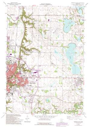
Mankato East Topo Map Minnesota
To zoom in, hover over the map of Mankato East
USGS Topo Quad 44093b8 - 1:24,000 scale
| Topo Map Name: | Mankato East |
| USGS Topo Quad ID: | 44093b8 |
| Print Size: | ca. 21 1/4" wide x 27" high |
| Southeast Coordinates: | 44.125° N latitude / 93.875° W longitude |
| Map Center Coordinates: | 44.1875° N latitude / 93.9375° W longitude |
| U.S. State: | MN |
| Filename: | o44093b8.jpg |
| Download Map JPG Image: | Mankato East topo map 1:24,000 scale |
| Map Type: | Topographic |
| Topo Series: | 7.5´ |
| Map Scale: | 1:24,000 |
| Source of Map Images: | United States Geological Survey (USGS) |
| Alternate Map Versions: |
Mankato East MN 1974, updated 1976 Download PDF Buy paper map Mankato East MN 1974, updated 1993 Download PDF Buy paper map Mankato East MN 2010 Download PDF Buy paper map Mankato East MN 2013 Download PDF Buy paper map Mankato East MN 2016 Download PDF Buy paper map |
1:24,000 Topo Quads surrounding Mankato East
> Back to 44093a1 at 1:100,000 scale
> Back to 44092a1 at 1:250,000 scale
> Back to U.S. Topo Maps home
Mankato East topo map: Gazetteer
Mankato East: Airports
Mankato Municipal Airport elevation 308m 1010′Mankato East: Dams
Eagle Lake Dam elevation 306m 1003′Mankato East: Lakes
Albert Lake elevation 302m 990′Eagle Lake elevation 301m 987′
Kearney Pond elevation 305m 1000′
Lake Dorothy elevation 304m 997′
Wita Lake elevation 304m 997′
Mankato East: Parks
Alexander Park elevation 303m 994′Anderson Park elevation 305m 1000′
Chesley Skate Park elevation 306m 1003′
Columbia Park elevation 257m 843′
Erlandson Park elevation 304m 997′
F Buscher Park elevation 301m 987′
Franklin Rogers Field elevation 307m 1007′
Highland Park elevation 302m 990′
Hilltop Park elevation 303m 994′
Jaycees Park elevation 306m 1003′
Kenwood Heights Park elevation 306m 1003′
Key Park elevation 307m 1007′
Lake Dorothy Park elevation 304m 997′
Lions Park elevation 305m 1000′
Spruce Park elevation 257m 843′
Thomas Park elevation 304m 997′
Tourtelotte Park elevation 260m 853′
Viking Park elevation 296m 971′
Washington Park elevation 248m 813′
Mankato East: Populated Places
Belle Haven elevation 306m 1003′Benning elevation 250m 820′
Eagle Lake elevation 308m 1010′
Eagle Lake Regency elevation 306m 1003′
Eastwood Manor Mobile Home Park elevation 304m 997′
High Ciara Mobile Home Park elevation 306m 1003′
Lime Valley Mobile Home Park elevation 262m 859′
Mankato elevation 253m 830′
Southhaven Mobile Home Park elevation 304m 997′
University Park of Mankato elevation 305m 1000′
Mankato East: Post Offices
Eagle Lake Post Office elevation 308m 1010′Mankato East: Reservoirs
Eagle Lake 0 839 elevation 307m 1007′Fern Lake elevation 308m 1010′
Glenwood Pond elevation 293m 961′
Lions Lake elevation 305m 1000′
Premier Pond elevation 306m 1003′
Mankato East: Valleys
Thompson Ravine elevation 265m 869′Mankato East digital topo map on disk
Buy this Mankato East topo map showing relief, roads, GPS coordinates and other geographical features, as a high-resolution digital map file on DVD:


