Nerstrand Topo Map Minnesota
To zoom in, hover over the map of Nerstrand
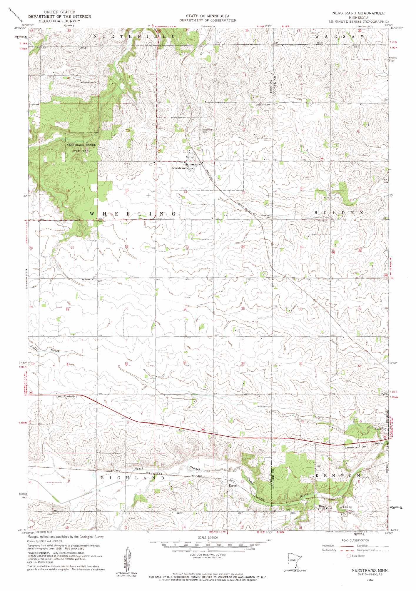
USGS Topo Quad 44093c1 - 1:24,000 scale
| Topo Map Name: | Nerstrand |
| USGS Topo Quad ID: | 44093c1 |
| Print Size: | ca. 21 1/4" wide x 27" high |
| Southeast Coordinates: | 44.25° N latitude / 93° W longitude |
| Map Center Coordinates: | 44.3125° N latitude / 93.0625° W longitude |
| U.S. State: | MN |
| Filename: | o44093c1.jpg |
| Download Map JPG Image: | Nerstrand topo map 1:24,000 scale |
| Map Type: | Topographic |
| Topo Series: | 7.5´ |
| Map Scale: | 1:24,000 |
| Source of Map Images: | United States Geological Survey (USGS) |
| Alternate Map Versions: |
Nerstrand MN 1960, updated 1961 Download PDF Buy paper map Nerstrand MN 1960, updated 1961 Download PDF Buy paper map Nerstrand MN 2010 Download PDF Buy paper map Nerstrand MN 2013 Download PDF Buy paper map Nerstrand MN 2016 Download PDF Buy paper map |
1:24,000 Topo Quads surrounding Nerstrand
New Market |
Castle Rock |
Randolph |
Cannon Falls |
Miesville |
Little Chicago |
Northfield |
Dennison |
Sogn |
White Rock |
Faribault |
Cannon City |
Nerstrand |
Kenyon |
Wanamingo |
Medford West |
Medford East |
Moland |
West Concord |
Concord |
Saco |
Owatonna |
Owatonna Se |
Claremont |
Dodge Center |
> Back to 44093a1 at 1:100,000 scale
> Back to 44092a1 at 1:250,000 scale
> Back to U.S. Topo Maps home
Nerstrand topo map: Gazetteer
Nerstrand: Parks
Kenyon Wayside Park elevation 341m 1118′Nerstrand Big Woods State Park elevation 331m 1085′
Nerstrand: Populated Places
Epsom elevation 341m 1118′Nerstrand elevation 363m 1190′
Nerstrand digital topo map on disk
Buy this Nerstrand topo map showing relief, roads, GPS coordinates and other geographical features, as a high-resolution digital map file on DVD: